Mr Bean JOGs to LA - Progress Report
Return to JOG to LA page
 East England Hospices for life limited children. |
 |
 |
 1st Swanton Morley Scout & Guide HQ fund |
|

If you would like to sponsor me please click here
If you visit this progress report please leave a message in the guestbook
Total Distance to Date = 1161 Miles
| Progress Report | Current Location (click for map) | Distance | Picture (click for larger image) |
Saturday, December 14, 2002
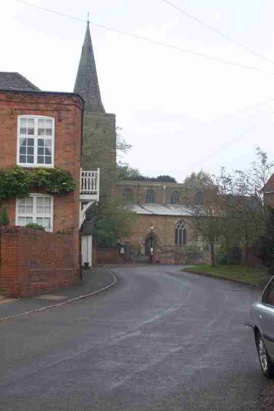
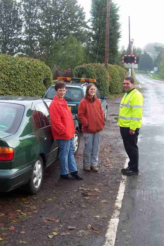
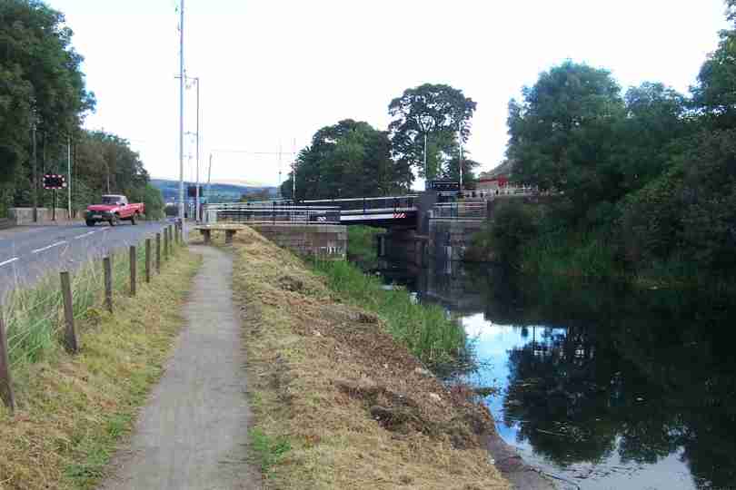
| Rite & I are now home, arrived 16.15 on 26th Nov to be greeted with banners and messages of support. I will publish my total amount raised here once it is all collected in. It looks like it will be in the region of Ł3000, Ł300+ was collected on route and over Ł200 pledged on-line. Many thanks to you all for your support and interest. - Phil Bean | TF993136 | 0 | Mr Bean JOGs to LA |
Sunday, November 24, 2002
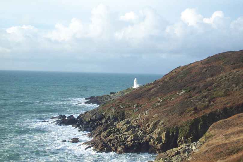
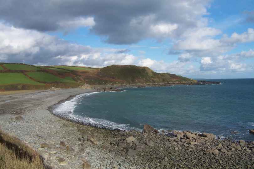
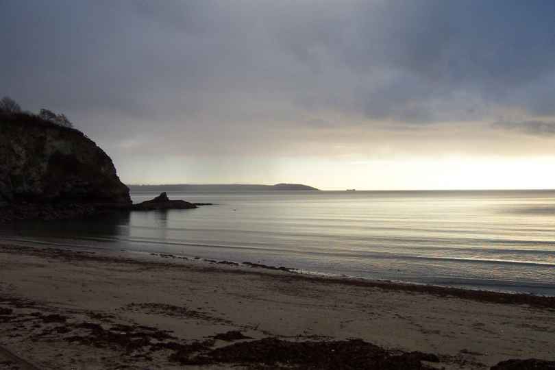
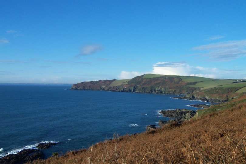
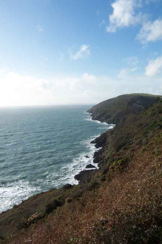
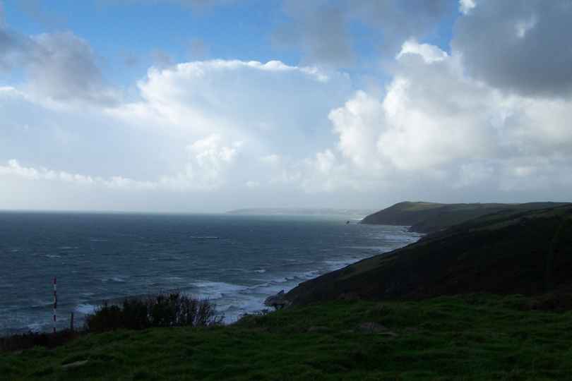
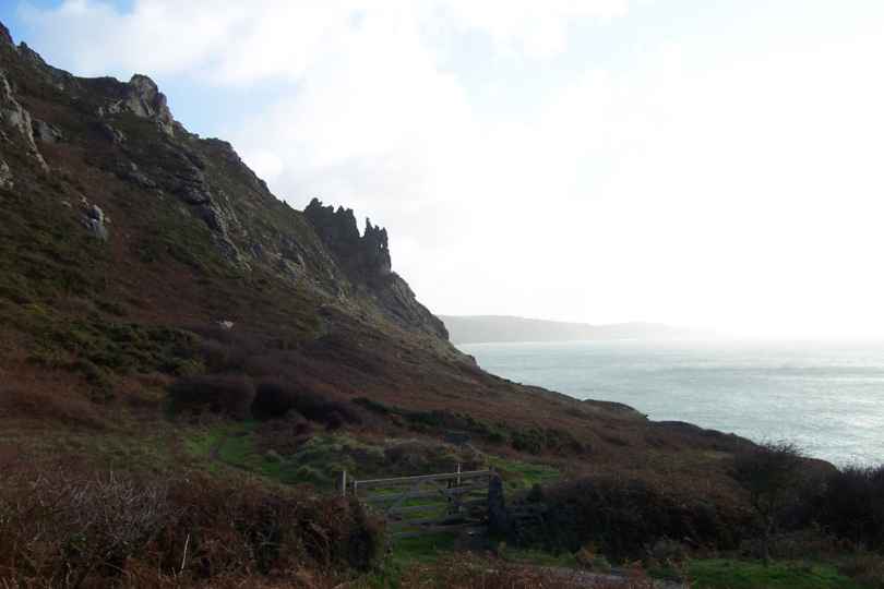
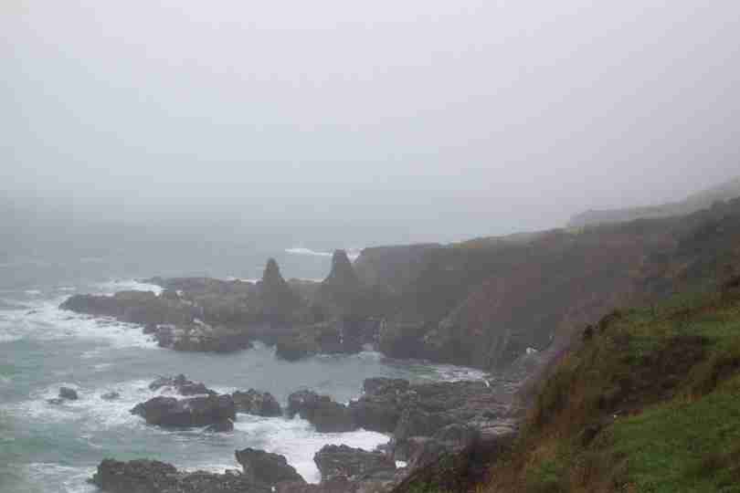
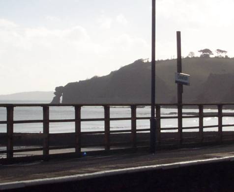
| The final day started bright and sunny, this was not to last and soon I was into full waterproofs. Shortly after leaving Lamorna CoveI encountered the lighthouse & Coastguard Station at Tater-du. | SW440230 | 1 | Tater-du Lighthouse |
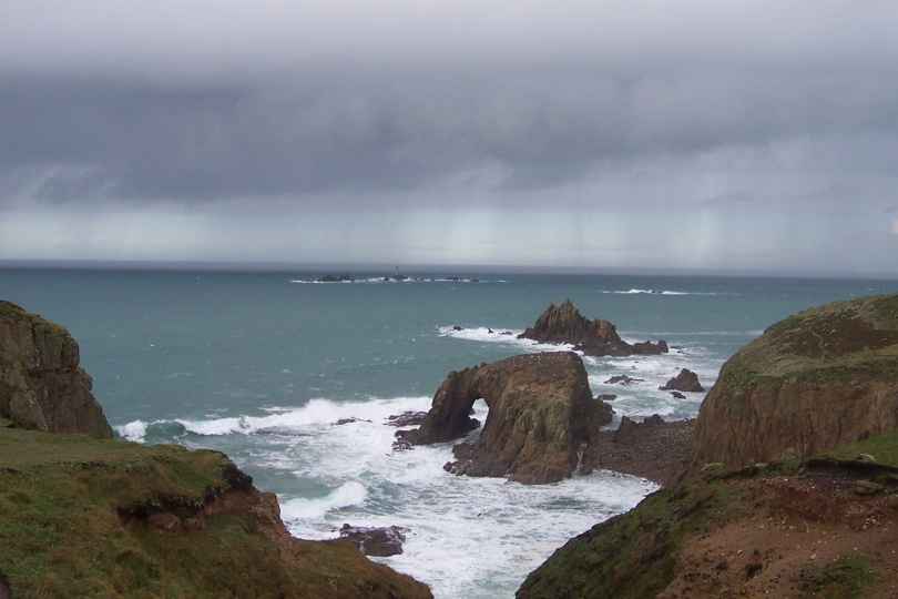
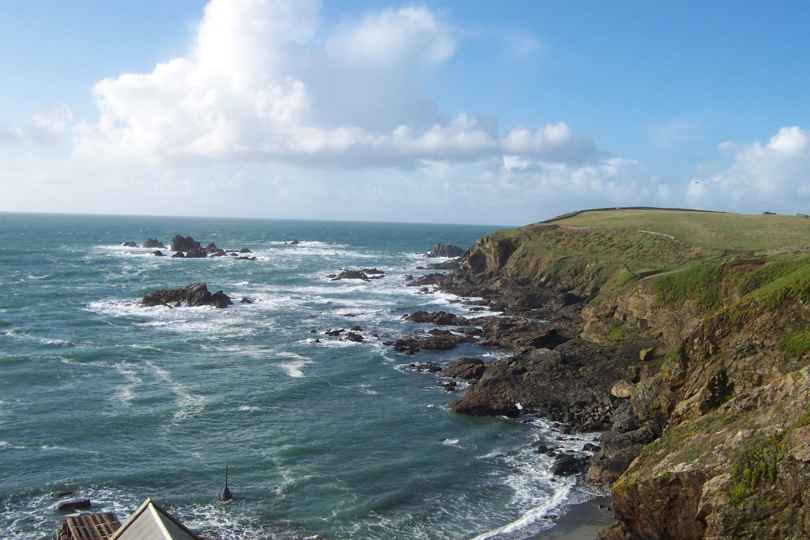
| I had started walking late today but with 10 miles to do I was soon in sight of Lands End. Shortly before Lands end I took this photo of the Longships Lighthouse with Enys Dodnan (the arch) and Armed Knight (the rocky island) in the foreground. By now the rain had cleared, but as you can see on the photo it was not far away! | SW342248 | 7.5 | Longships Lighthouse |
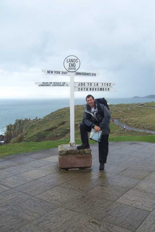
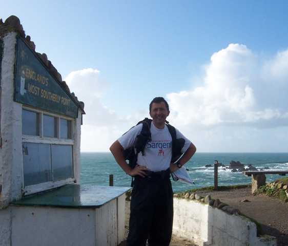
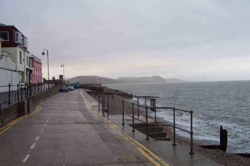
| This walk has been a fantastic experience and finishing is a great relief but not without some sadness. I will miss getting up day after day, packing my kit and setting out into unknown country. I will miss the freedom to walk for as long or as little as I like, having the wind and rain in my hair and enjoying the outdoors. Being my own boss (with help from my Wife!) has been great. At the same time I look forward to my future and planning my next adventure(s). Did I finish - you bet I did and I was greeted by an unexpected welcoming party, my family (in no specific order); Mum, Dad, Gillian (Little Sis!), Bill (Bruv in Law), David (Uncle) and friends Jacs, Philip, Trish, Derek, Justy & Will. Also Nigel (Little Bro) who took 2 months leave, 1 of them unpaid, to run all over the country picking me up and dropping me off. I must also say a massive thank you to Rite, my wife, for her undying support, assistance, cooking, washing, tolerance and TLC. Finally thanks to all who have left messages of support, offered Sponsorship, given me encouragement on-route (and offered sponsorship) and to Steve and Joyce for kicking off the sponsorship and the former for joining me for 2 days of the walk. I expect my total sponsorship figure to be in the order of Ł3000 - I should have it all in by mid to late Jan. Why did I do it? - I have no idea but it was worth it, every minute! | SW342250 | 0.5 | Me at Lands End |
Saturday, November 23, 2002
| Again it rained heavily overnight, but all stopped before I started walking and stayed that way, despite a couple of attempts to get me! | SW571277 | 1 | Looking toward Lizard and approaching shower |
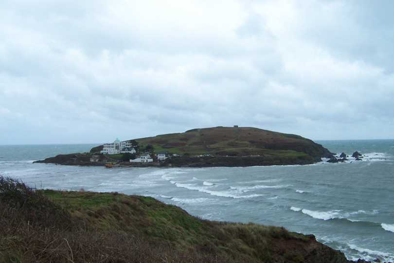
| After rounding Cudden Point I got my first view of St Michaels Mount, indeed I got my first clear view of Mounts Bay. The sunshine made it all look even better - is it really November? | SW548275 | 2 | St Michaels Mount |
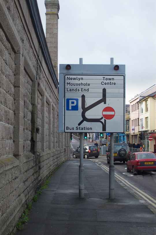
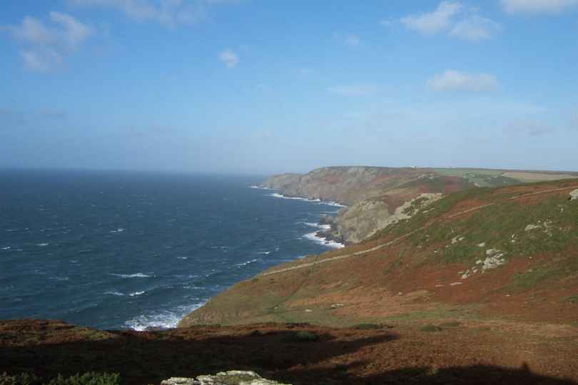
| By the time I reached Penzance I saw my first indication that Lands End was getting close, but will my legs, feet and equipment survive the final push - We will know tomorrow. | SW475305 | 6 | Which way to Lands End! |
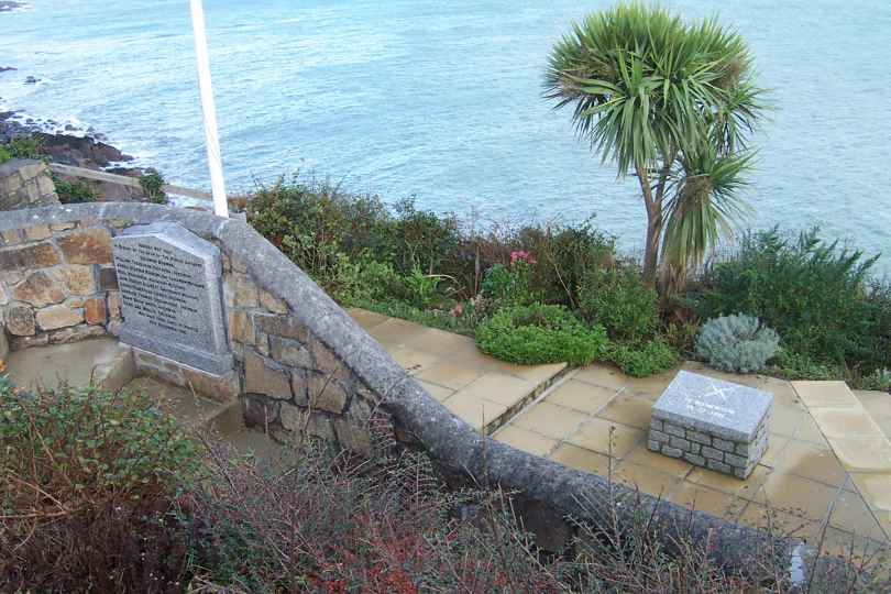
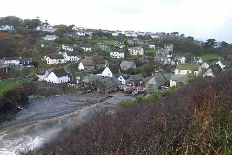
| I had planned to finish at Mousehole but extended to Lamorna Cove, leaving less to do tomorrow. On the way into Mousehole I passed the memorial Garden to the Penlee Lifeboat crew that dien in Dec 81. | SW450241 | 5 | Penlee Memorial |
Friday, November 22, 2002
| We left the accomodation in pouring rain, we returned in pouring rain, but look at the photos - I walked my whole route in sunshine! With strong winds the sea was at its most impressive. | SW663197 | 3 | Poldhu Cove nr Mullion |
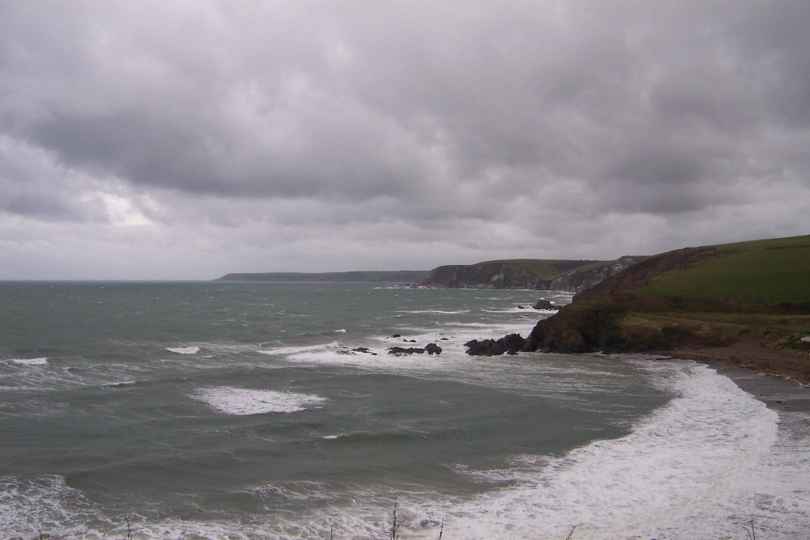
| Water, water everywhere-There has been an awful lot of water in the past few days and with the wind the cliff paths are trecherous in places, again I headed inland, but I stayed in sight of the cliffs | SW628258 | 5 | Porthleven |
| I saw the rain approaching from over the sea, I could also see todays pick up point. I made it with minutes to spare, another 12 miles, the final map and good views of Lands End and Mounts Bay. | SW576281 | 4 | Trewavas Head |
Thursday, November 21, 2002
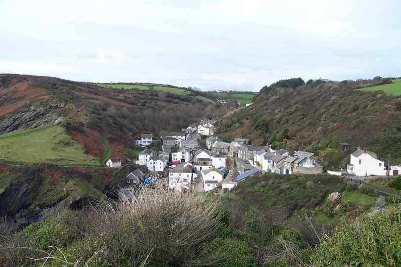
| The forecast for today was not good, once againI found it better than expected. The Coastline has slowly become more rugged. Cadgwith, nr the Lizard is very Twee! | SW721143 | 5 | Cadgwith Fishing Village |
| My aim was to walk from JOG to Lands End via Dunnet Head and Lizard point. I arrived at 12:35 completing the North-South leg, only one more to go - Great feeling. | SW701115 | 3 | Me at Lizard |
| The camera does not do the views and beauty of the sea justice but this view of the sea crashing against the Actual Lizard Point gives an impression. Everything from here is North! | SW695115 | 0 | The Lizard Point |
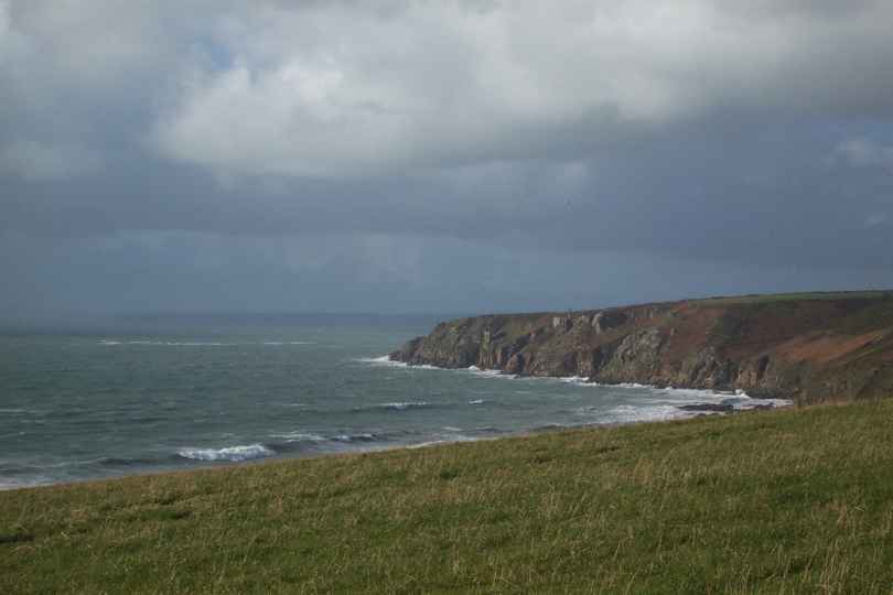
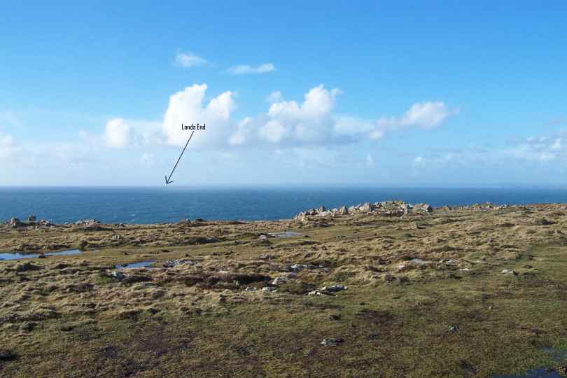
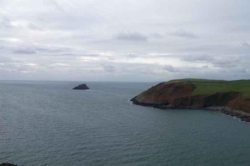
| Soon after rounding the Lizard I got my first view of my target destination, Lands End. Looks a long way but it is only about 35 miles via the coast or 20 as the seagull flies! | SW667158 | 7 | Looking to Lands End |
Wednesday, November 20, 2002
| Started my 1st day on the Lizard Peninsular. Starting at Falmouth I headed almost due South and soon joined the cliff path. The sign in the Photo was about 7 miles out, the price was not indicated! | SW796232 | 7 | Porthollow |
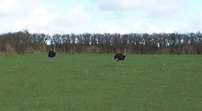
| Soon after Porthollow I wondered if I had moved too far South, these 2 birds looked none too friendly! Immediatley before the Ostriches I walked through a vinyard - I did not touch a drop! | SW800223 | 1 | 2 Ostriches Nr Porthoustock |
| It was such a nice day I decided to extend my walking to Coverack. The walking around Lowland Point was very pleasent and almost flat! Great day and great Weather. | SW782185 | 6 | Godrevy Cove |
Monday, November 18, 2002
| The ride continues but we must be mid way, the ups and downs are smaller but still in large numbers! Small fishing ports are still the order of the day, Portloe is another example. | SW937393 | 2 | Portloe |
| My estimated distance for today was 11miles, my pedometer had measured 14 miles before Portscatho, with 3 miles to do! Nare Head and Gull Island hid the Lizard from view. | SW928380 | 2 | Nare head and Gull Island |
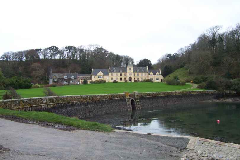
| I was now heading for another ferry, St Anthony to St Mawes, which I knew would not be running, yippee for the car! Place House at St Anthony is my new summer home. | SW854324 | 9 | Place House, St Anthony |
Sunday, November 17, 2002
| Only 1 week to go and still the weather is kind. Some of the view are excellent but not so easy to catch in photographs. Try this photo of Gribbin Head taken about 9am. | SX032506 | 1 | Gribbin Head from Lower Porthpean |
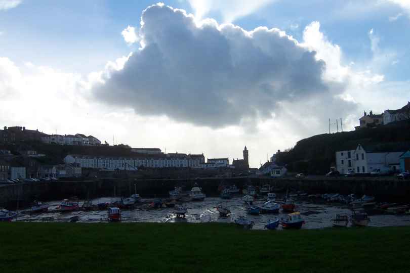
| As Roller Coasters go this coast path must be one of the best - it is definitely a test for boots, feet, ankles, knees.... Glad I cut the miles down! Mevigissey was was at the end of the ride. | SX015446 | 5.5 | Mevigissey Harbour |
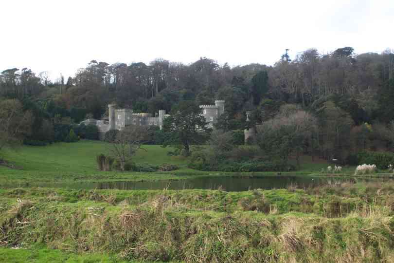
| I decided to head inland a little and after some pleasent footpaths and country lanes I returned to the coast at Caehays Castle - Or had I gone East to Windsor? | SW975414 | 3 | Caehays Castle |
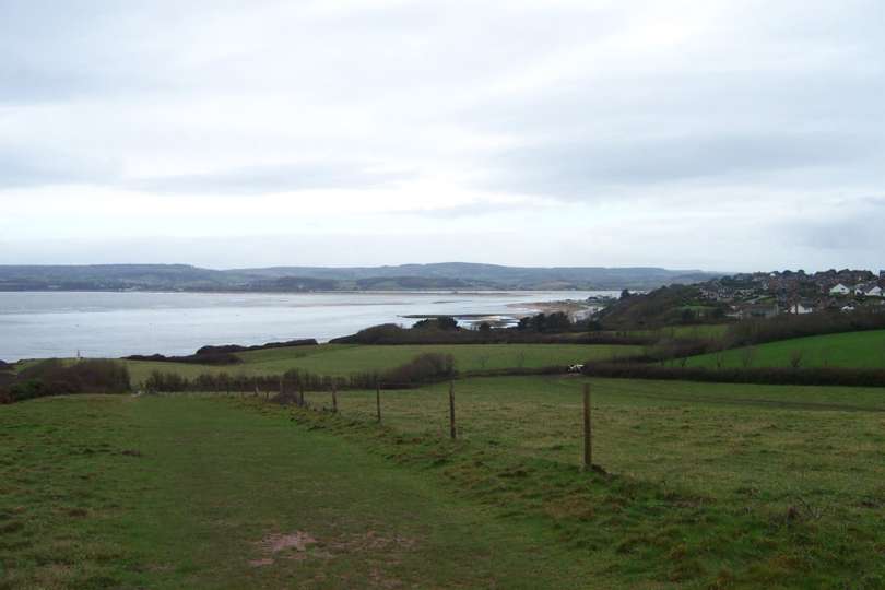
| At last I could see the Lizard! For those that dont understand the Grid References shown are used to identify points in the UK. Today I entered my last 100km Grid Square identified by the letters SW | SW960412 | 1 | The Lizard |
Saturday, November 16, 2002
| Once more the weather is excellent, as is the walking. Pencarrow head is one of the many headlands I have, or will, pass. This one looked great in the morning sun. | SX151502 | 4 | Pencarrow Head |
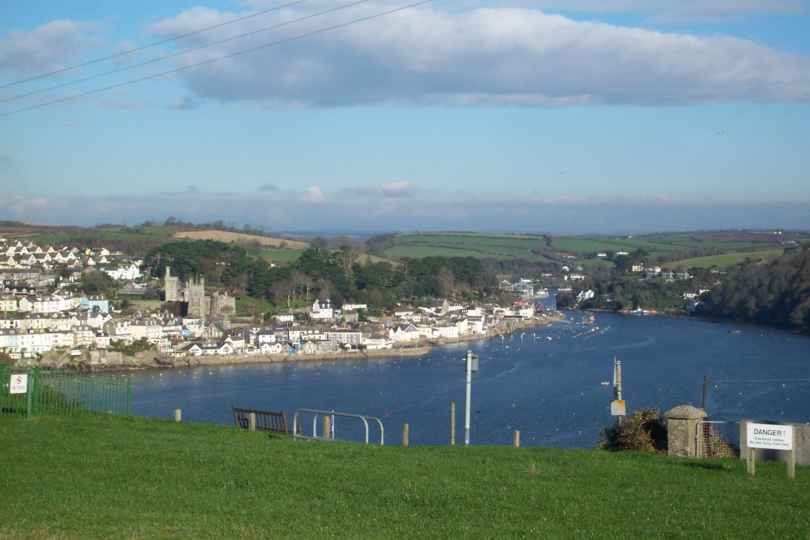
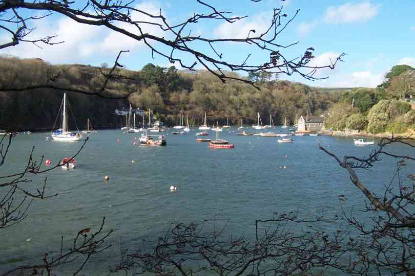
| Fowey is one of the gems on the Cornish coast. Arriving by ferry makes it all the more interesting. I remember spending many days of my childhood here - Some would say that was last week! | SX124515 | 2 | Fowey from Polruan |
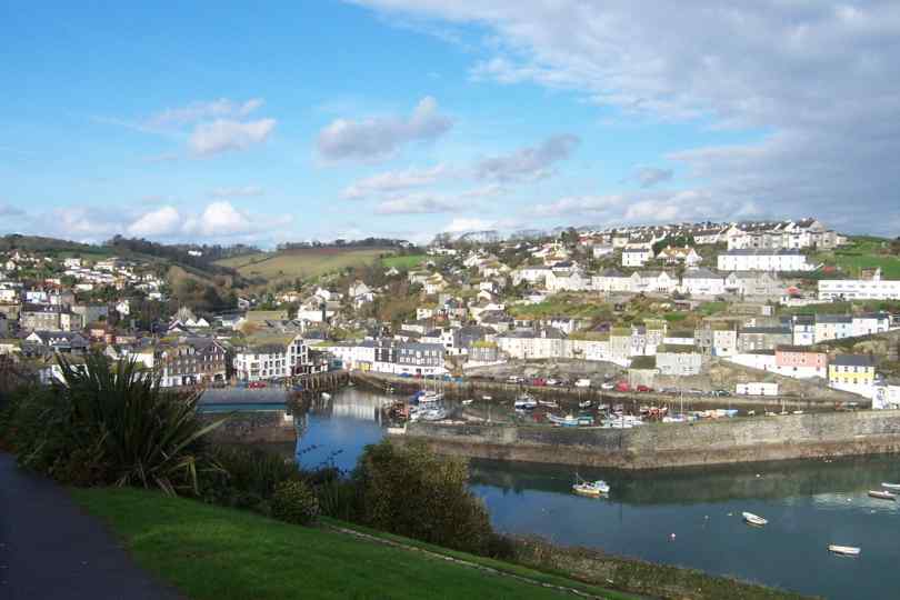
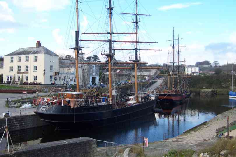
| Today I chose to join the Saints Way for a few miles, saving me 2 miles or so, but I also extended todays finish point by 4 miles to finish at Charlestown. | SX039516 | 8.5 | Ships in port at Charlestown |
Friday, November 15, 2002
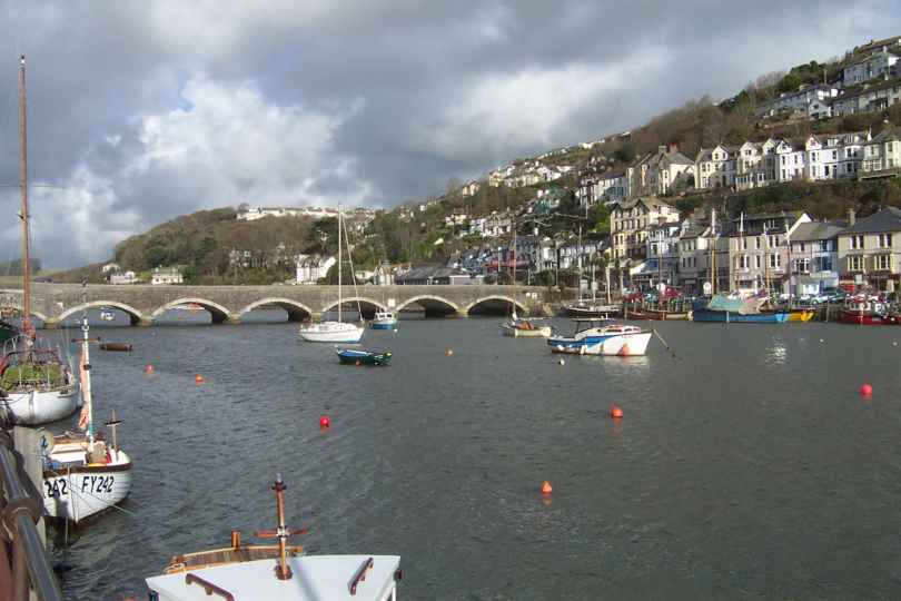
| It is a long time since we had fantastic weather, today we did. From Portwinkle to Looe was like a roller coaster ride but with a small distance to do this was no problem. Looe looked great in the sun | SX254534 | 7 | Looe in the sun |
| From Looe it was a steep climb out followed by more ups and downs. The weather continued to be excellent and the views matched. Look closely at the photo - Is that the Lizard in the distance? | SX218509 | 2 | The Cornish Coastline |
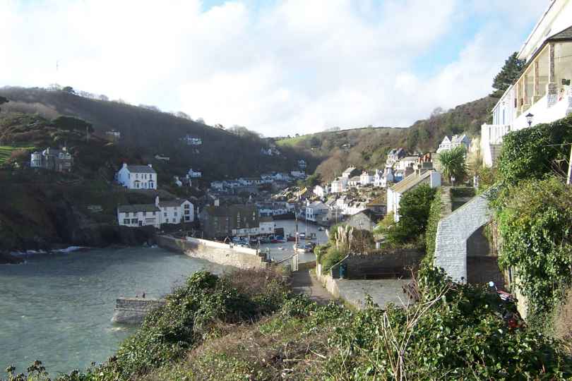
| Looking along the coast line, previous photo, there is no indication of Polperos existance. The village is totally unexpected and understandably popular with visitors. | SX210509 | 2 | Polpero |
Thursday, November 14, 2002
| Ferries so far have proved unreliable, lack of custom in winter is the cause. It was great to find both ferries planned for today were running. The first ferry was from Mount Batten Point to Plymouth | SX484535 | 4 | Mount Batten from the ferry |
| After the second ferry I walked to Millbrook from Cremyll. The view to Devonport and Torpoint looked very busy - give me my cliffs back! | SX445530 | 3 | Looking out to Devonport |
| After several miles of quiet lanes I returned to the cliffs - fantastic and the weather was kind also, despite the strong wind. Finished at Portwrinkle | SX358537 | 6 | Coastline from Trethill Cliffs |
Tuesday, November 12, 2002
| The early rain cleared to leave a dry start to my walk but the wind was not so kind. For my own safety I headed inland and out of the wind. Burgh Island nr Bigbury on Sea has a Hotel and a unique Taxi | SX649442 | 0.5 | Burgh Island |
| The River Erme can be crossed 1hr either side of low tide - I could not wait that long so made use of the car! By now the weather was getting better but the wind was still very gusty. | SX620478 | 3 | Views of the route West |
| I continued along quiet country lanes and footpaths to avoid the wind and my destination was reached at about 12pm. I had also reduced my daily tally by a couple of miles when I arrived at Noss Mayo | SX540477 | 7 | River Yealm Nr Noss Mayo |
Monday, November 11, 2002
| From the moment I looked out the window the weather looked set for a great day - I was not disappointed. Salcombe was soon left behind and Sharp Tor was the first photo. | SX730366 | 1.5 | Sharp Tor with Prawle Point in the distance |
| As I walked around the headland of Bolt Head the scenery and weather just got better and better. The coastline to Bolt Tail was very pleasing to the eye and gentle on the legs and feet. | SX699375 | 2 | Bolt Tail from above Soar Mill Cove |
| The higher cliffs gave way to small coves at regular intervals many of them populated. Hope Cove with fairly high seas was great fun to watch. | SX675398 | 3 | Hope Cove |
| As I started the final leg of the days walk to Bantham I passed South Milton Sands with The Books rocks and the background dominated by Bolt Tail. Excellent day - Highly recommended! | SX667437 | 5 | The Books and Bolt Tail |
Sunday, November 10, 2002
| Overcast but dry was my greeting for the day - it did not last. By 10am it was back into full waterproofs. The memorial at Torcross was very photogenic. | SX823423 | 0 | Torcross Memorial |
| The walking around Start Point was very good and relatively easy. The photo shows the imaginatively name Two Stones surrounded by an impressive sea. I would be very happy to return here in the future. | SX814368 | 4 | Two Stones |
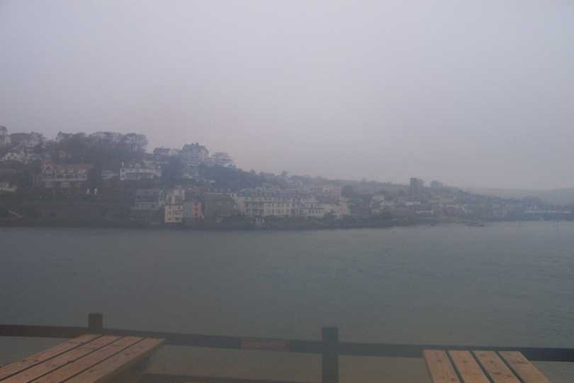
| As the weather deteriorated I chose to finish the last bit of my walk on quiet, very quiet, country lanes. Very soon I was at Salcombe and the ferry was operating. For me this was the end for today. | SX743386 | 6 | Salcombe in the rain |
Saturday, November 09, 2002
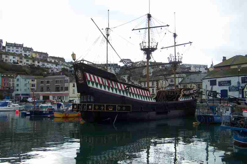
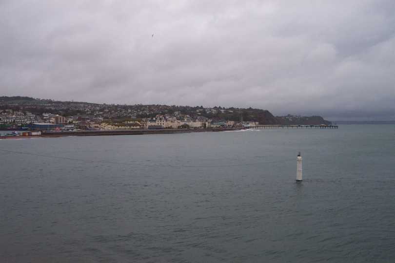
| No waterproofs required - there was even some sunshine! Brixham is home to the Golden Hind and it did not look out of place. After the last few days rain progress was much more pleasent. | SX925562 | 2 | The Golden Hind |
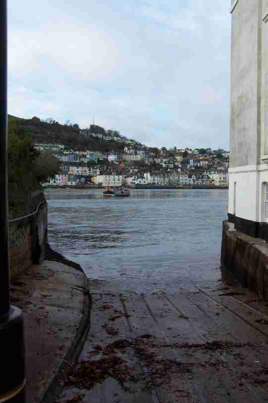
| From Brixham to Dartmouth the going was up and down and very muddy although I did get a reprieve by following a little country lane rather than the official path. Once a gain a ferry was necessary. | SX881510 | 4 | The Kingswear Ferry to Dartmouth |
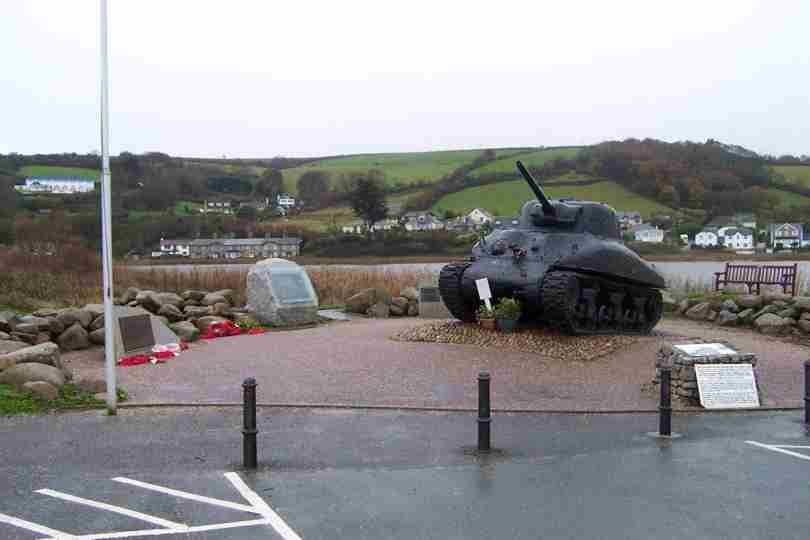
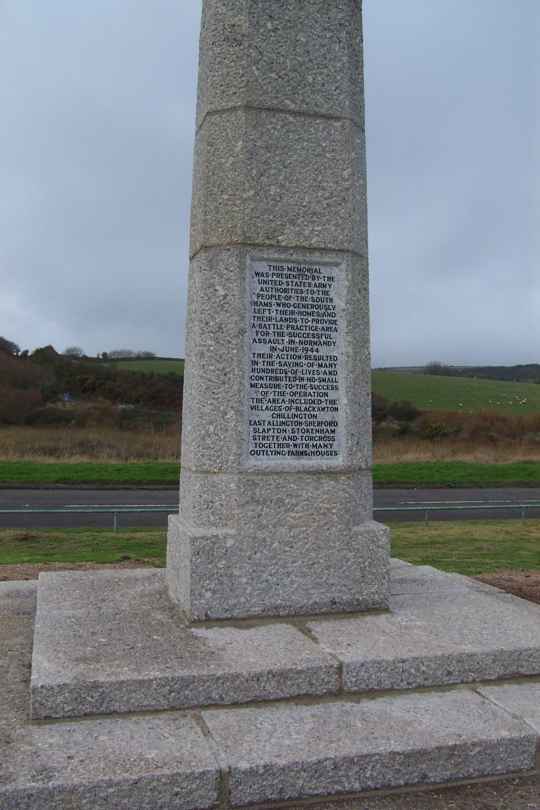
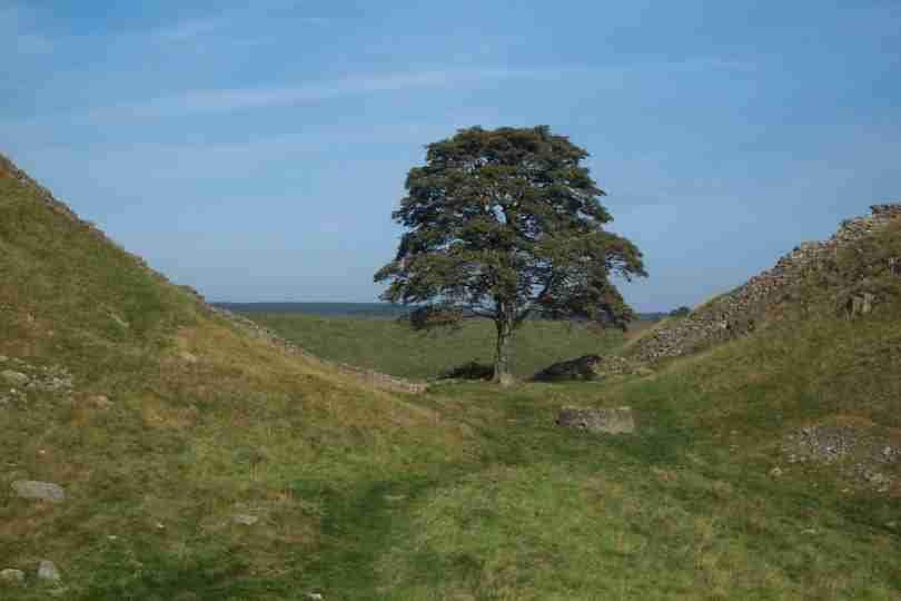
| The remaining few miles was a mixture of cliff path and country lanes, very pleasent despite a short shower. This area was used for training during WWII. Also a major milestone, over 1000 miles done. | SX822420 | 10 | Slapton Sands Monument |
Friday, November 08, 2002
| Rain appears to be the flavour of the week. Once again I started and finished in waterproofs. Teignmouth was the first place I visited - probably very nice in the sun! | SX938720 | 3 | Teignmouth in the rain |
| The coastline to Babacombe looks spectacular but the walking is up and down and up and down and up and down ..... Also very muddy. Much relief when I arrived at Torquay and Paignton. | SX895605 | 8 | What is missing? |
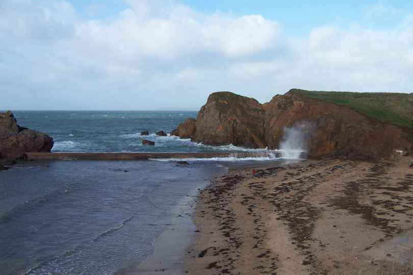
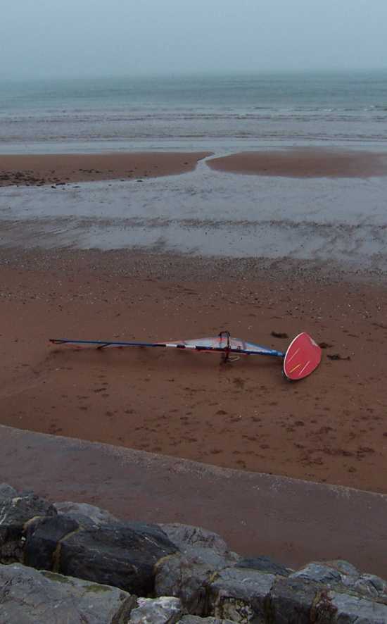
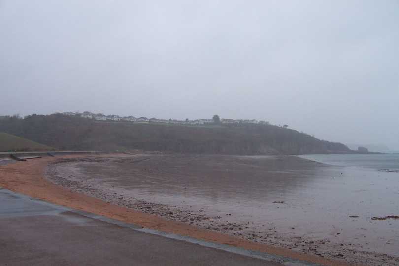
| The weather was getting wetter but the finish point closer. The beach is wonderful at this time of the year - but I think sunbathing is out of the question! | SX896573 | 3 | A nice empty beach |
Wednesday, November 06, 2002
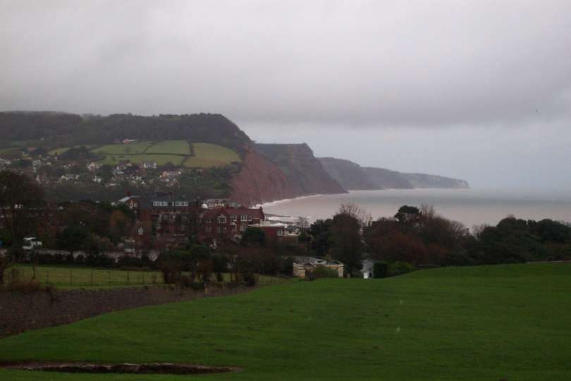
| Heavy rain and waterproofs started the day. After a short climb the waterproofs came off before going back on 2 minutes later! The walking was much easier and soon I was in to Budleigh Salterton. | SY069818 | 5 | Sidmouth and Yesterdays walk. |
| After a short detour due to a cliff fall I was soon dropping down to Exmouth and my first ferry (closed in winter!!). Exmouth looked very welcoming in the now strengthening sunshine. | SX999805 | 4 | Exmouth |
| After finding my way across the Exe I relished the sunshine and easy walking extending my finish point to Dawlish. A nice easy day and early finish. | SX964766 | 6 | The Parson and Clerk rock near Dawlish |
Tuesday, November 05, 2002
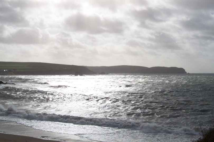
| Today was my first full day on the South West Coastal Path, my last long distance route. Lyme Regis looked miserable in the early light rain, but it was not as bad as it looks in the photo. | SY340919 | 0 | Lyme Regis at 8:15am |
| The walking to Seaton went through the results of a major Landslip, Circa 1839, when a .75mile stretch of cliff dropped away from the land. Very warm and humid. After Seaton Beer was on the menu! | SY230890 | 9 | The Village of Beer |
| Walking from Beer was very slippery and steep, both up and down. Although the highest climb was only about 200m (650ft) I must have climbed in excess of 2500ft. I completed the day at Sidmouth. | SY120870 | 7 | A Visitor Attracation in Sidmouth |
Monday, November 04, 2002
| No waterproofs today just a teeshirt and still too warm! Encounted a problem - how to cross a ford with no bridge and keep feet dry - problem solved I found a bridge! | ST407040 | 4 | A ford too far! |
| The path I chose took in valleys and higher ridges many of the views across Dorset were great. I even did my good deed for the day - I rescued a sheep caught up in brambles! | ST375003 | 4 | Dorset Countryside |
| I discovered that the planned route from Charmouth to Lyme Regis was closed due to a landslide. I revised my route to intercept the coast at Lyme Regis, I did not see the sea until I got there. | SY343920 | 6.5 | Lyme Regis and the South Coast |
Sunday, November 03, 2002
| Apart from a few showers todays weather was great. Yesterdays rain had raised the river levels although they had fallen back since last night. The picture shows The river Yeo nr RNAS Yeovilton. | ST544226 | 4 | River Yeo - I want my Canoe! |
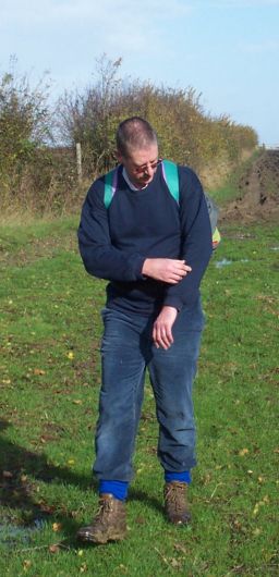
| Steve joined me again today. My pace yesterday had taken its toll and Steve was demonstrating the effects of 18 miles and little preparation - I know how he felt I was there 8 weeks ago! | ST513203 | 3 | Steve Nr Yeovil |
| Montecute House is one of the finest examples of an Elizabethan House. The village also has a couple of pubs - we took a rest! Today I made it to Misterton. Many thanx to Steve. | ST454083 | 10 | Montecute House |
Saturday, November 02, 2002
| Early indications suggested that the weather forecasters could be wrong. The sky was clear but everything changed once we reached the start point and on went the waterproofs which stayed until the end | ST673340 | 6 | Temporary Walking Partner sheltering under bridge |
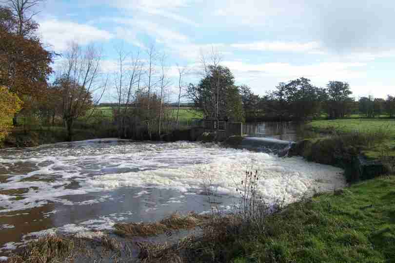
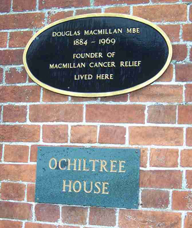
| The weather did not improve, even the villages looked bedraggled. We chose not to follow Donald Macmillans route to school as part of the Macmillan way! | ST643324 | 4 | Donald Woz Ere! |
| The A303 will be my route home - was I tempted? No Way, over 900 miles down now and I aim to finish. Although with the weather I did think about it! | ST631262 | 5 | Another Route Home (A303) |
| The final leg of the journey was very pleasent, if not wet. But what happened to these sheep? I thought they shrank in the rain! Todays finish was at Queen Camel nr Yeovil. | ST597249 | 2 | Funny shaped sheep! |
Thursday, October 31, 2002
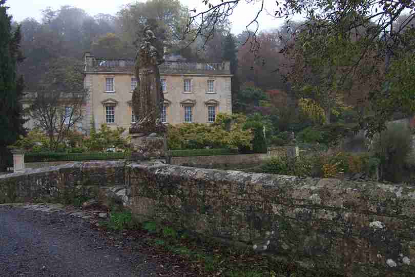
| Miserable weather but dry. However, the walking along the River Frome, in and out of Wiltshire and Somerset, was pleasent. Iford Manor was very early in the day - about 8am | ST802589 | 0.5 | Iford Manor |
| Eventually settled for Somerset. Crabb House was just into Somerset and after being welcomed by 2 Jack Russells I persuaded their owner to sign as having seen me - Thank you. | ST805556 | 2 | Crabb House, Tellisford |
| The weather slowly became less and less inspiring and after several miles on road around Trudoxhill I climbed up to Withem Park along a long grassy and muddy track before finishing at Druly Hill Farm. | ST755370 | 16.5 | Nunnery Castle at start of road section. |
Wednesday, October 30, 2002
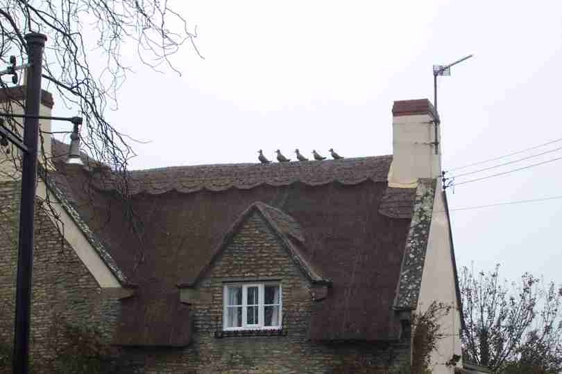
| Waterproofs were required from the outset. Some very nice places today but the ducks in the photo were looking for shelter from the rain! | ST831801 | 4 | Duck Tiles! |
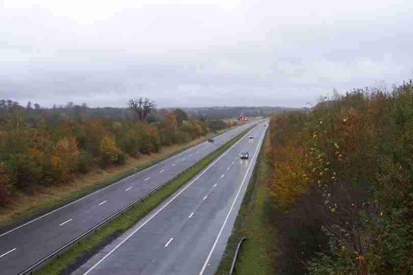
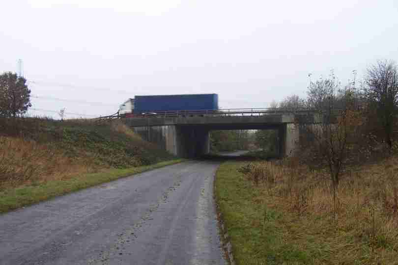
| Miles stones seem thin on the ground at present, but the M4 - in the photo- is my last motorway as I trek to Lands End, not very exciting. | ST832795 | 1 | The exciting M4 bridge |
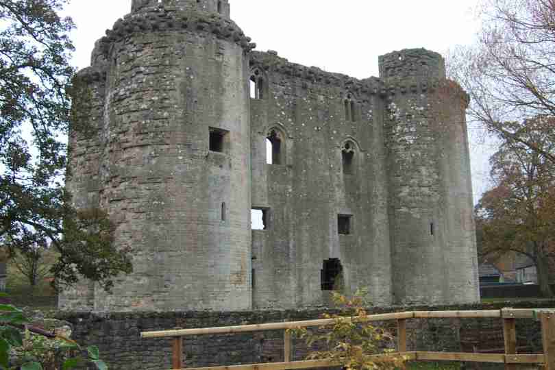
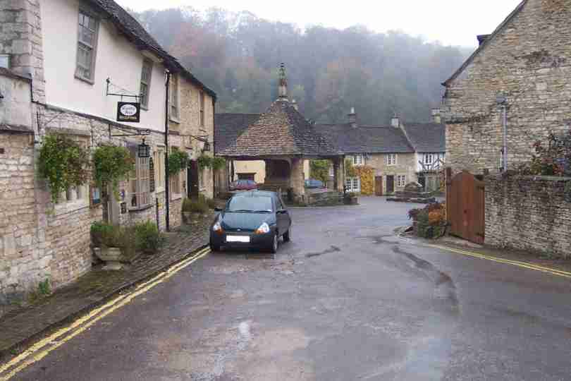
| Castle Combe is very pretty, but so are many of the villages around. My route today took me to Box and Bradford on Avon before finishing at Westwood and another 22 miles down. | ST804589 | 17 | Castle Combe |
Tuesday, October 29, 2002
| Dry and overcast was the order of the day. After skirting around Cirencester Great Park, I recovered a few miles by using some green lanes. Sapperton is very pretty, especially the house in the hedge. | SO947032 | 5 | A House In The Hedge |
| The walking was very varied; fields, woods, small hills, tracks and quiet lanes. Gatcomb Park and High Grove were close by. The tree in the Photo suffered on Sunday! Todays finish was Sherston. | ST855863 | 15 | One Of Many After Sundays Gales! |
Monday, October 28, 2002
| After yesterday anything is easy! Today the weather was excellent, complementing the views and walking. Lower Slaughter is well worth a visit | SP165225 | 3 | Lower Slaughter |
| Now in the heart of Gloustershire but did I cross the English Channel? The stable block at Rencomb is modelled on a French Chateau. A Stable block!! | SP005088 | 15 | A Flavour of France |
Sunday, October 27, 2002
| Day 57 was to be a pleasant stroll through the Cotswolds. However, I did not plan on gale force headwinds - felt just like walking up hill for 17 miles! Long Compton Church, Lych Gate with it's thatched roof was very unusual. | SP287330 | 8 | Long Compton Church |
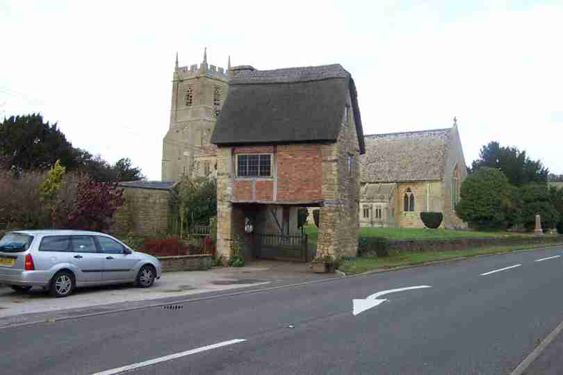
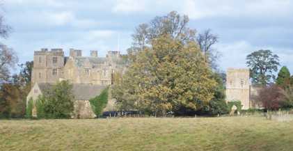
| Although the wind speed abated, it was still very strong. Several trees in the Chasleton Estate showed signs of damage, but not the house! | SP249290 | 4 | Chasleton House |
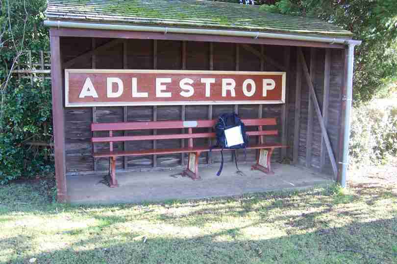
| By 13:00 it was time for lunch, but where had the walker gone! I finally finished near Stow On The Wold at 14:55. | SP200251 | 5 | Adlestrop Bus Stop |
Friday, October 25, 2002
| Another fine start, but the weather did not hold, 2 soakings in 5hrs. Thank goodness for waterproofs! The walking was easy but navigation again testing. Another Canal, County, Motorway, Map..... | SP466500 | 5 | The Oxford Canal at Claydon |
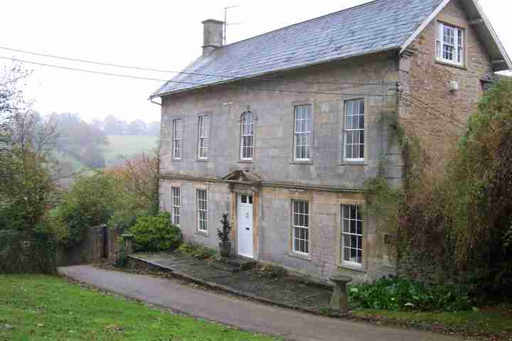
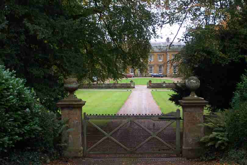
| I think I finished in Oxfordshire after moving into and out off Warwickshire, but who cares? I dont I am still heading South and West. Todays finish was at Alkerton nr Banbury. | SP377428 | 10 | Farnborough Hall, Warwickshire? |
Thursday, October 24, 2002
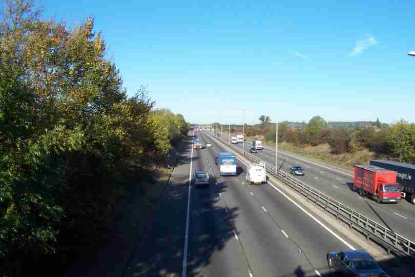
| Yet another fine and frosty start. The early walking was easy and pleasent but navigation was sometimes testing. Soon after Althorp Park I arrived at the M1 for the 2nd (and last!) time in a week. | SP650606 | 7 | The M1 Northbound nr Flore |
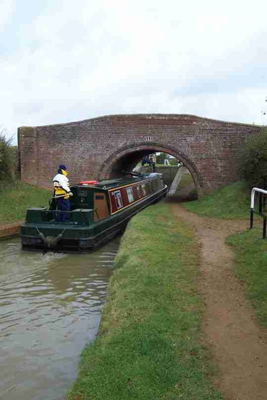
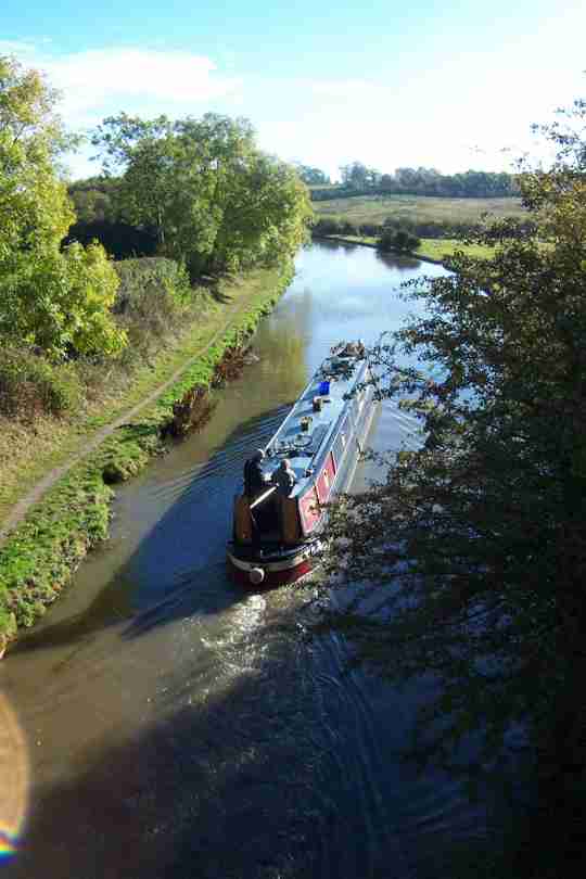
| Flore is in the Nene valley and the M1 is not the only transportation around. Nearby is the Grand Union Canal, the A5 and a mainline railway. | SP635589 | 2 | The Grand Union Canal |
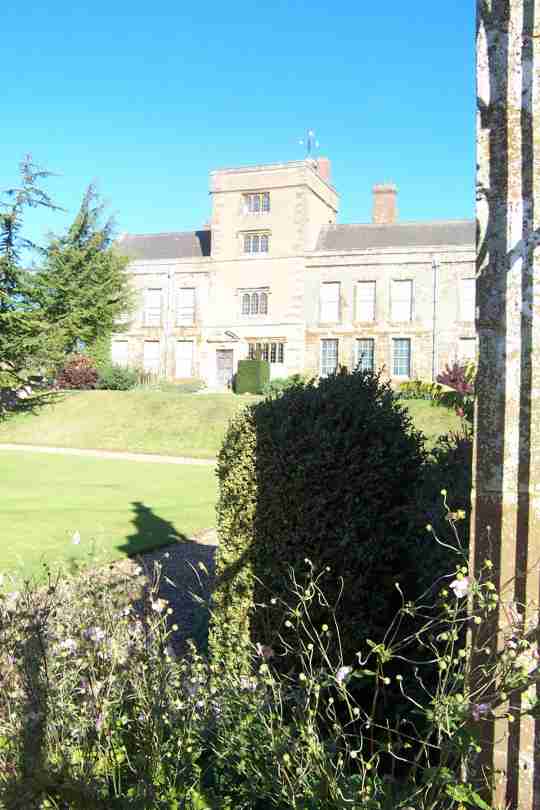
| Not only are main routes in evidence but this part of England is full of magnificent buildings, Canons Ashby is one example. | SP577505 | 6 | Canon Ashby House |
| The final 3 miles to the quaint village of Eydon was pleasent if not a little on the muddy side. Another day done, another map down and nearly another County. | SP542500 | 3 | Eydon Village Green |
Wednesday, October 23, 2002
| The rain has cleared and a beautiful Autumn morning greeted me at Weston By Welland. The gentle rolling countryside, only interupted by the odd stile or 50, meant I was soon at Brampton Ash. | SP786873 | 2 | Brampton Ash Church |
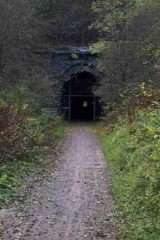
| The weather tried to break but the sunshine won. Before long I arrived at the Brampton Valley Way, an old railway line and the first of 2 tunnels. | SP738836 | 4 | Great Oxendon Tunnel |
| After about 4 miles of flat railway the footpath into Maidwell was a welcome break. The gateway in the photo (according to the guide book!) is 17th Centuary - it wood look nice on my driveway. | SP748769 | 5 | Gateway in Maidwell |
| The final miles to Teeton were very pleasent, Cottesbrook Hall looked a comfortable abode and the village of Creaton was very pretty. Today was entirely on the Macmillan Way, my 9th Long Distance Way | SP695702 | 7 | Cottesbrooke Hall |
Tuesday, October 22, 2002
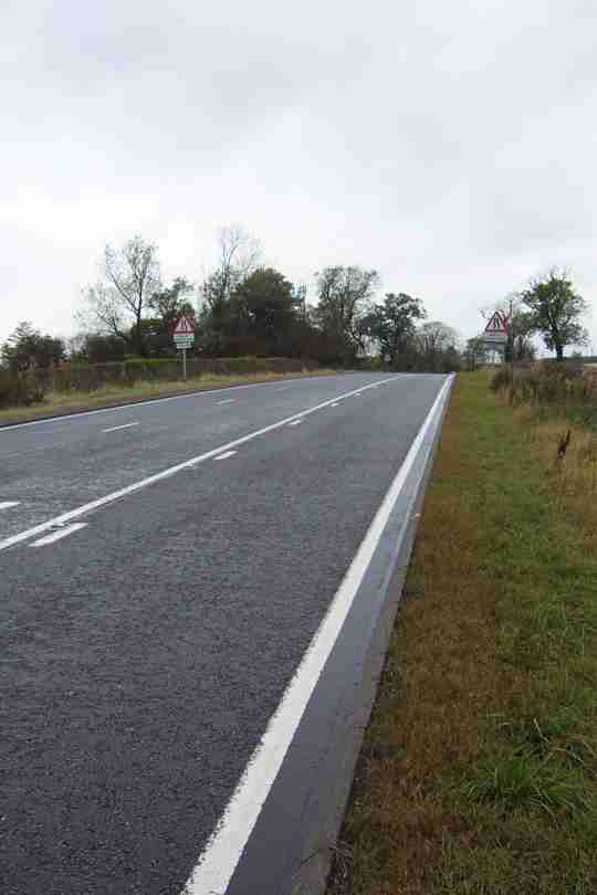
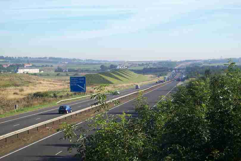
| Like yesterday today started wet and the rain stayed until after 10.30. Despite the rain the going and progress was good. By lunchtime I had crossed a major route home - the A47! | SK755018 | 9 | A47 Westbound! |
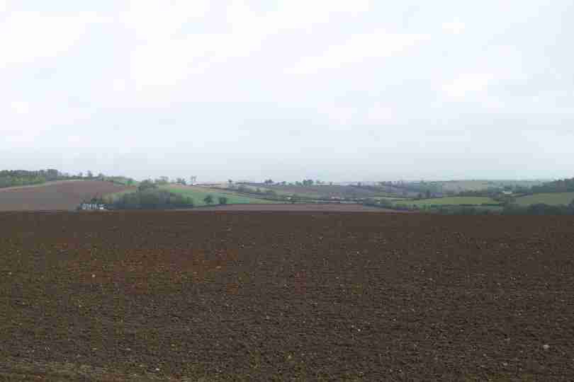
| After the A47 thoughts turned back to Lands End, only 4 weeks away. Leicestershire in the rain showed little of interest so here is a photo of typical Liecs landscape - farmland and rolling hills. | SP765985 | 2 | Liecs Landscape looking toward Rutland |
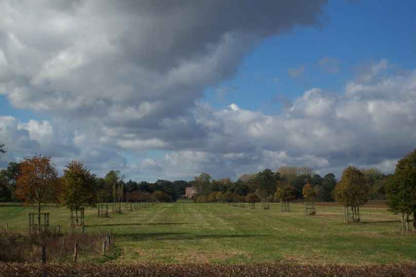
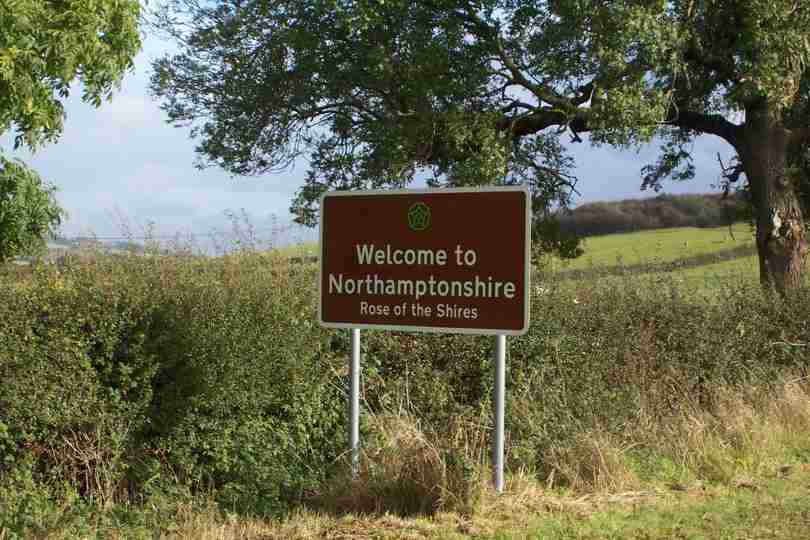
| The final few mileshid a bridleway so a short adjustment took me to Cranoe and on to Weston by Welland and the county of Northamptonshire. | SP776914 | 7 | Entry to Northants |
Monday, October 21, 2002
| A very late start today after driving across from Norfolk 10.20am! Rain cleared by 11 and was replaced with mist. Not a lot to see but the village of Hoby just before the end was pleasent. | SK668174 | 16 | Hoby Village Church |
| The advantage of roads is that progress is much quicker, especially when wet. Even with a late start I managed 17 miles and finished some 3miles or so further than planned - less for tomorrow! | SK669162 | 1 | The welcoming party at brooksby |
Sunday, October 20, 2002
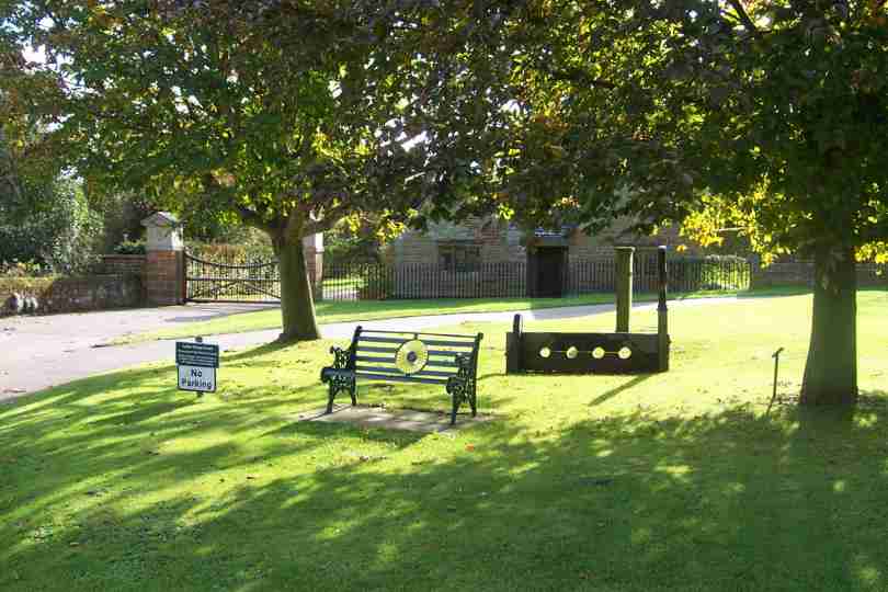
| I am now suitably rested and ready to go. I have replacement boots and indoor accommodation for the rest of the trip - roll on November. Early tomorrow I return to West Leake for a nice short 14.5 miles (shorter if I can) - it should be nice in gale and heavy rain!! | TF993136 | 0 | Mr Bean JOGs To LA |
Thursday, October 17, 2002
| Yet another fine and bright morning, albeit frosty, greeted us as we left for the days walk. The cool morning made the initial climbs easier, and faster. Before long I was walking in what was reletively flat country. By about 11.30 I had my first glimpse of Derby. I had also said farewell to the Derbyshire Peak District National Park - I wont enter any other Nataional Parks on the rest of my route. | SK443368 | 6 | Derby in the distance |
| The terrain was now getting even flater. Soon I encountered the River Derwent, which led me to the Trent and under the M1 for the first time, we'll see it again in a week or so. Before long I arrived at West Leake todays finish point and the start of a 3 day rest - which I'll take at home! | SK526264 | 14 | The M1 Crossing the River Trent |
Wednesday, October 16, 2002
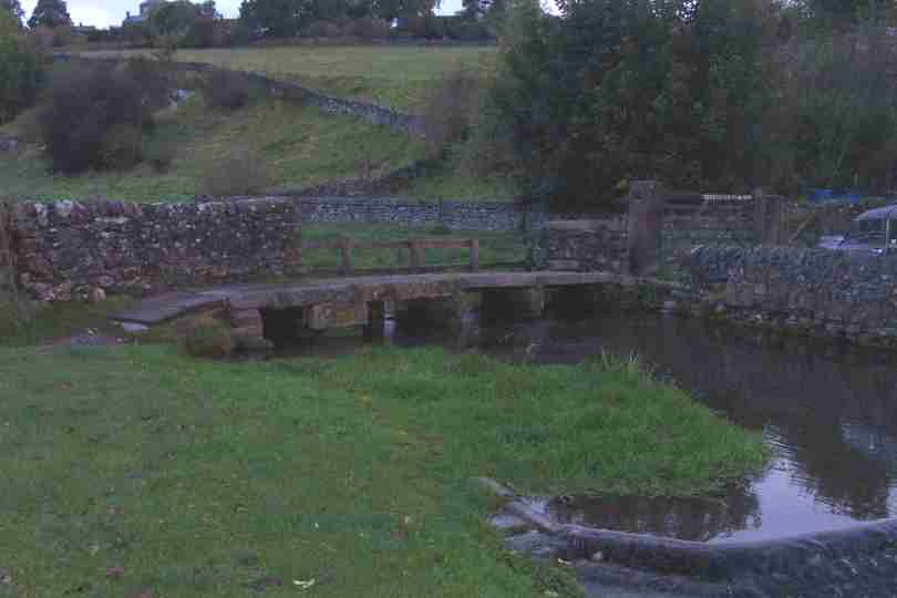
| After Yesterdays foul weather it was a pleasant surprise to wake to clear skies and sunshine, it even stayed all day. The clapper bridge was the first thing I crossed today. | SK212640 | 0 | Clapper Bridge at Youlgrave |
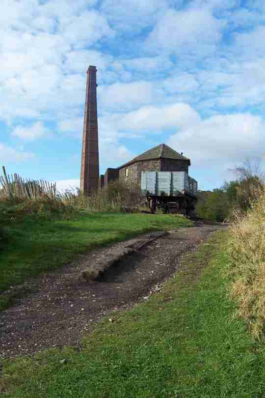
| The weather was not the only thing that was kind. The going was easier and also route finding, despite one footpath that I could not find. Middleton top used to haul steam trains onto the High Peak. | SK278552 | 9 | Middleton Top |
| I had now joined my 8th Long Distance Path, the Mid Shires Way. This route will eventually take me into Leicestershire, but for today Duffield will do. | SK351429 | 11 | Looking North to Matlock |
Tuesday, October 15, 2002
| After the riggers of the Pennine Way the Limestone Way, my next long dista nce route, should prove a doddle. I had not banked on the weather! | SK136844 | 2 | The A625 post 1970s landslide! and Mam Tor |
| I had not wished for the weather to deteriorate but it did and for the second time in 3 days I was kitted out in waterproofs. The going was wet and muddy. I cant deny I was glad to see Youlgrave. | SK213639 | 15 | Youlgrave in the rain |
Sunday, October 13, 2002
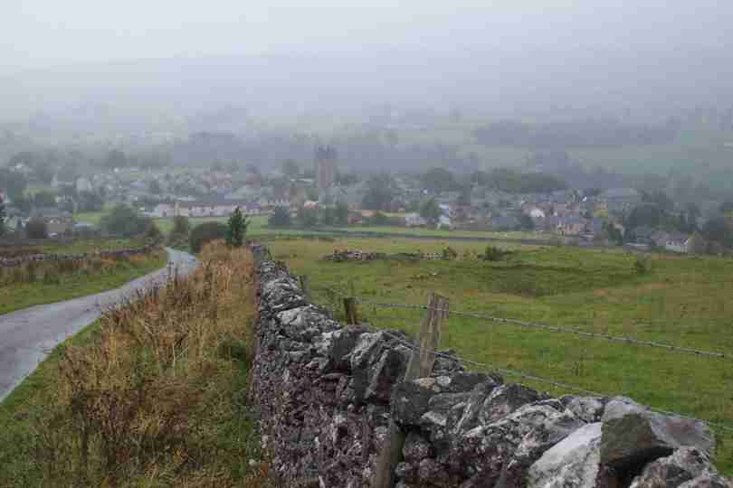
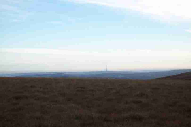
| After the rain of yesterday a fine bright morning was the reward. For Masters veterans this view from Black hill of Emley Moor mast will come as a bit of a shock - There is a view! | SE070054 | 1 | Emley Moor Mast from Black Hill |
| Not concentrating cost me an early wakeup call as my left leg sank into 2feet of water - wet foot for the day. The veiw to Crowden made up for it | SE059020 | 3 | Crowden from Black Hill Descent |
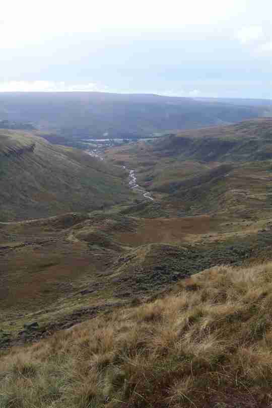
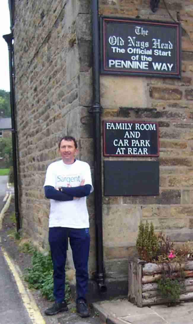
| The rest of the day was one of ups and downs. Up to Bleaklow and down, up to Mill Hill and down, up to Kinder Scout and down and the finish of the Pennine Way. | SK123860 | 17 | The End Of The Pennine Way |
Saturday, October 12, 2002
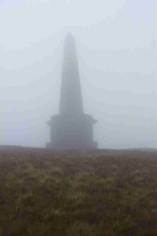
| A wet morning greeted us and stayed all day. The Stoodley Pike monument to the battle of Waterloo lookwed very bleak. Despite the weather the walking was going great. | SD973241 | 3 | Stoodley Pike above Calderdale |
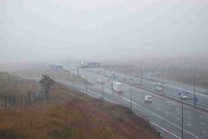
| The walking continued to be wet and misty with navigation being my prime concern, but with the advent of gravelled and paved paths this proved fairly easy. The M62 was a major Milestone. | SE050063 | 14.5 | The M62 Eastbound |
Friday, October 11, 2002
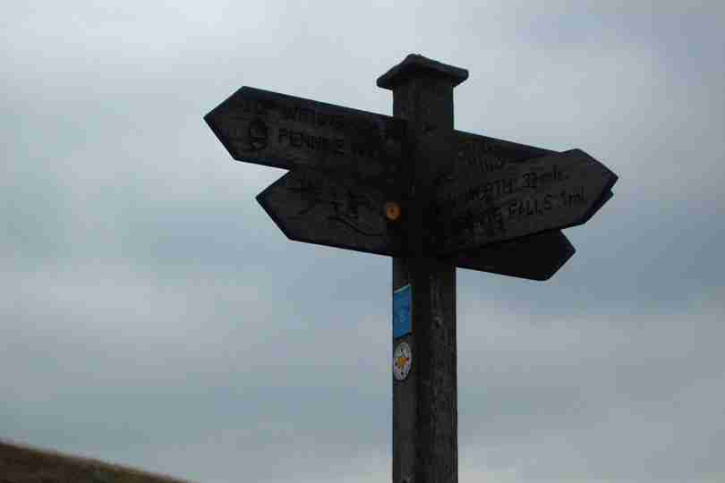
| Wel Folks another day and Ive cracked the 600 mile barrier, but only after an unscheduled detour of my own making! Any Bronte fans? Yes then see the photos.. | SD981354 | 15 | Japanese Influence |
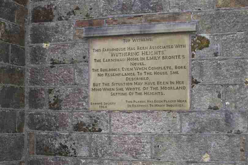
| This 2nd photo is on the ruin reputed to be the subject of Withering Heights, Top Withens. Very Barran and very wild. The trek from here to Hebden Bridge was long and hard. | SD971265 | 8 | Top Withens |
Thursday, October 10, 2002
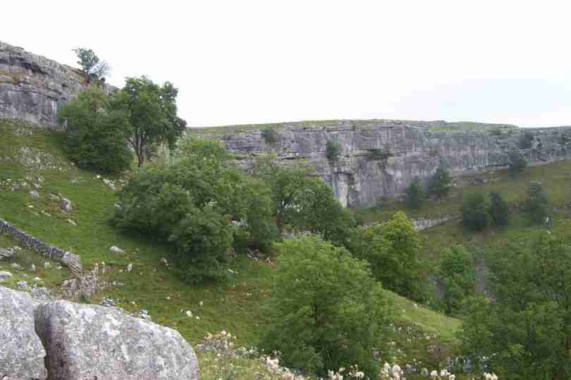
| After the ups and downs of the past few days today was relatively flat as I ventured down Aire Dale from Malham. Malham is a great little place and well worth a visit both for scenery and tea shops! | SD900630 | 7 | Malham Cove |
| At the end of Aire dale is Gargrave with the Leeds & Liverpool Canal. The trek from Gargrave to Thornton in Craven was uneventful and becoming tedious, lethargy was setting in! | SD908486 | 10.5 | Leeds Liverpool Canal at Gargrave |
Wednesday, October 09, 2002
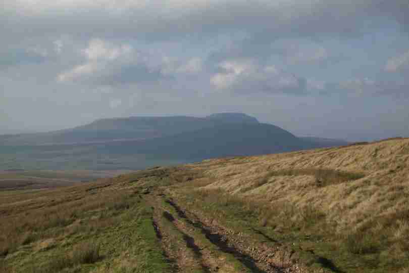
| The start today was straight from the Camp Site. It was not long before I saw the first of the Yorkshire 3 Peaks, Ingleborough. | SD801804 | 8 | Ingleborough |
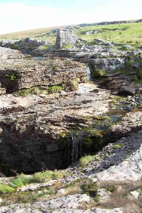
| Soon after seeing Ingleborough I could also see Wernside, closely followed by Pen Y Ghent concluding the 3 of the Yorkshire 3 peaks. On route I also saw several holes swallowing water! | SD804776 | 2 | Calf Holes Swallowing Water |
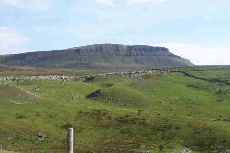
| The final assault for the day was the 694 metres (2250ft) of Pen y Ghent and a very strong and cold NE wind! The result was another 17.5 miles and over halfway. | SD852723 | 7.5 | Pen Y Ghent from the North |
Monday, October 07, 2002
| Short day today, only 12 miles to do, nice ealry knock off and rest day tomorrow. My first part of the route saw me walking from Keld to Thwaite with fantastic views of upper Swaledale. | SD903985 | 3 | Early Morning in Swaledale |
| After Thwaite a climb over Great Shunner Fell was necessary before dropping into Wensleydale and the town of Hawes. A great day and early stack. | SD880895 | 9 | Great Shunner Fell, over 2000ft |
Sunday, October 06, 2002
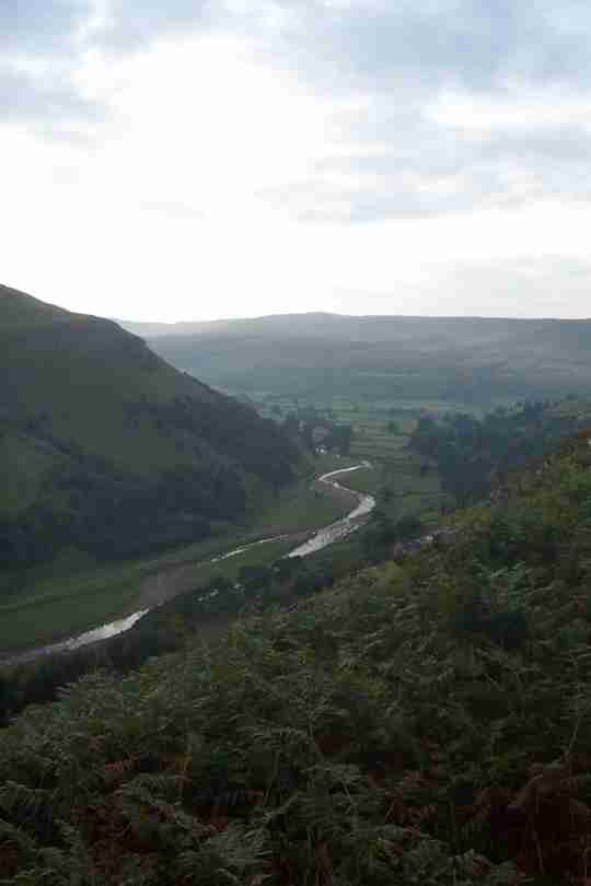
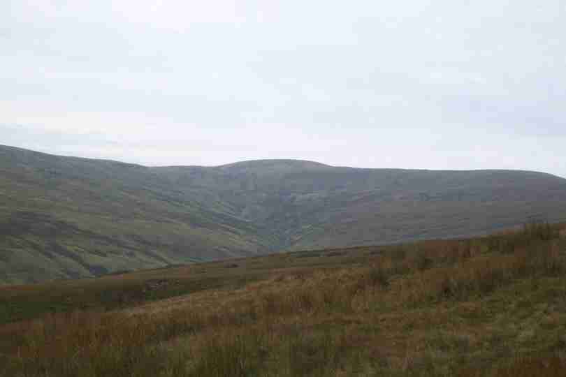
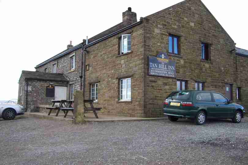
| More open moorland and the Penine Way has entered its 2nd National Park. Tan Hill is the highest place for a pint in Britain - how did I resist it? | NY896066 | 14 | The Highest Pub in Britain - Tan Hill |
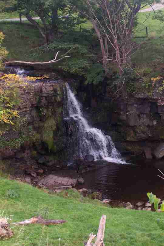
| The final 4 miles is downhill to Keld. The end arrived at 15.00hrs, with another 18 miles under the belt, another National park, another County and My Home County and complaints from my right knee. | NY893011 | 4 | Catrake Force, Keld |
Saturday, October 05, 2002
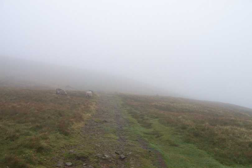
| The prospect of an excellent view of the Lakes from High Cup Nick was scuppered by more low cloud. The start also tested my Nav skills - They must have worked, Im back at camp! | NY746262 | 4 | A sample of visibility |
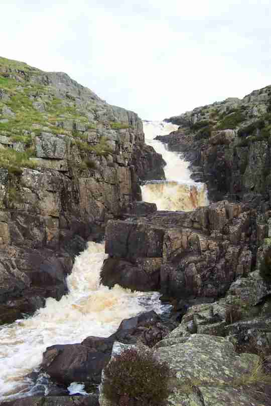
| The trek from High Cup Nick to Cowgreen Resevoir wqas reletively uneventful despite the low vis. The reward was Cauldron Snout Waterfall, manmade but impressive. | NY814286 | 5 | Cauldron Snout Waterfall |
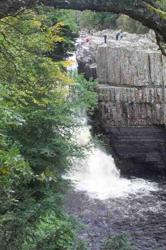
| This stretch of the River Tees is impressive, but all the more so for its waterfalls. Remember Kevin Costner inRobin Hood? The day finished at Middleton in Teesdale. | NY946251 | 9 | High Force, used by K Costner |
Friday, October 04, 2002
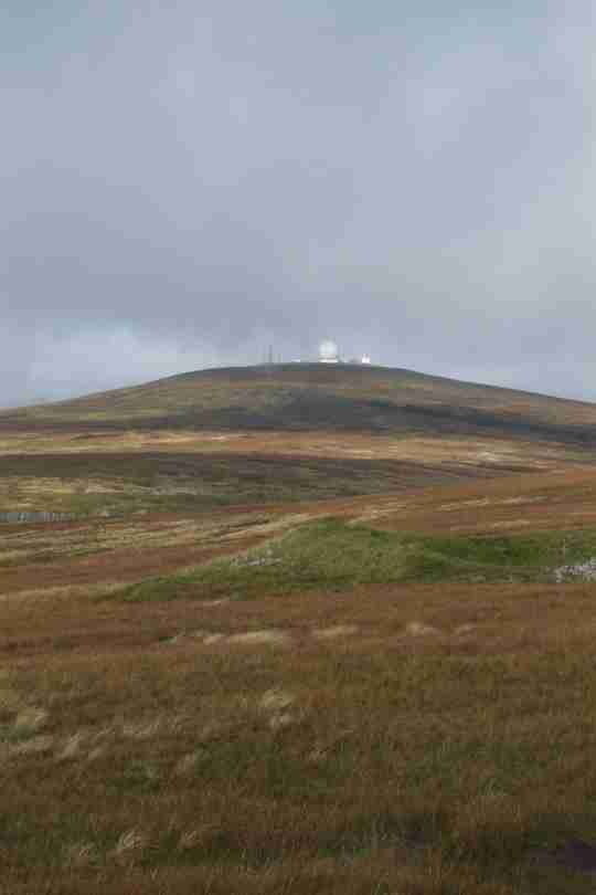
| The cloudbase today was at about 2400ft, I was to climb to over 2900ft, the highest point of my walk. Alas the cloud stayed put until well after Cross Fell, but I did get to see Great Dunn Fell. | NY710322 | 9 | Radar Stn on Great Dunn Fell |
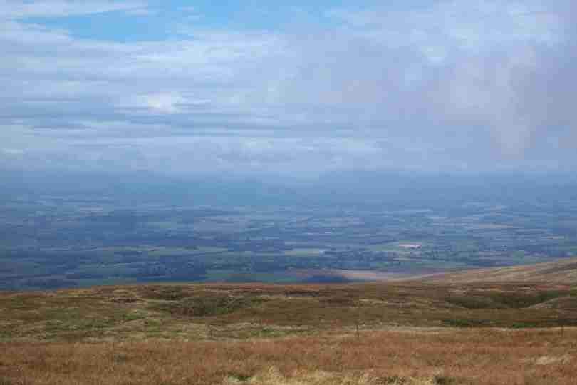
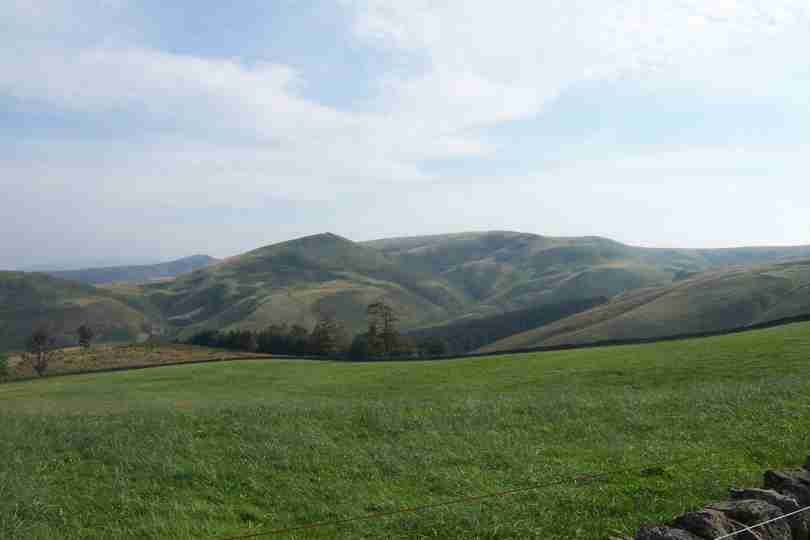
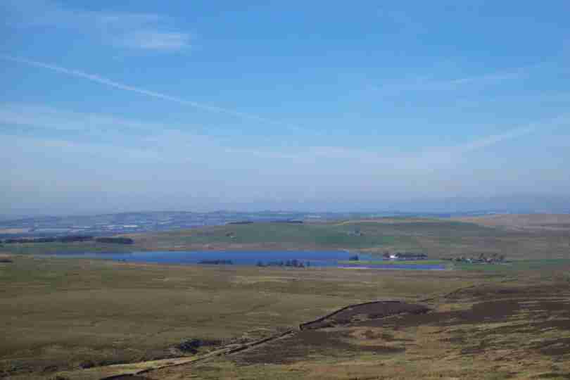
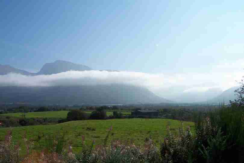
| Despite the dissapointment on Cross Fell I was awarded with a view of the Lakes before I descended into the village of Dufton, and another 15miles under my belt. | NY690250 | 6 | The Lake District from Knock Old Man |
Thursday, October 03, 2002
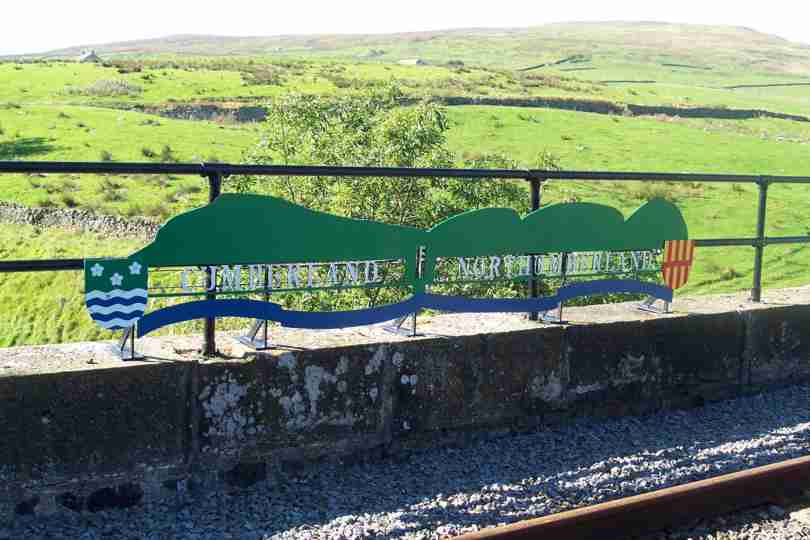
| Despite feeling slightly down the day turned out very well. I crossed into my second English county, Cumbria, at about 12:30pm. The South Tyne trail proved more friendly than the Pennine Way. | NY703485 | 14 | The Two Northern Counties |
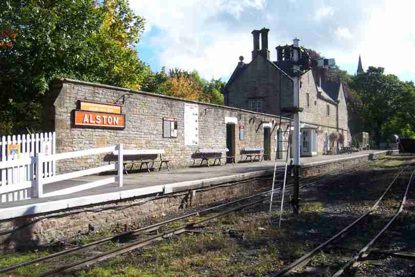
| The final 7 miles took me to Englands highest market town, Alston, and the little village of Garrigill. | NY745415 | 7 | Alston Station |
Tuesday, October 01, 2002
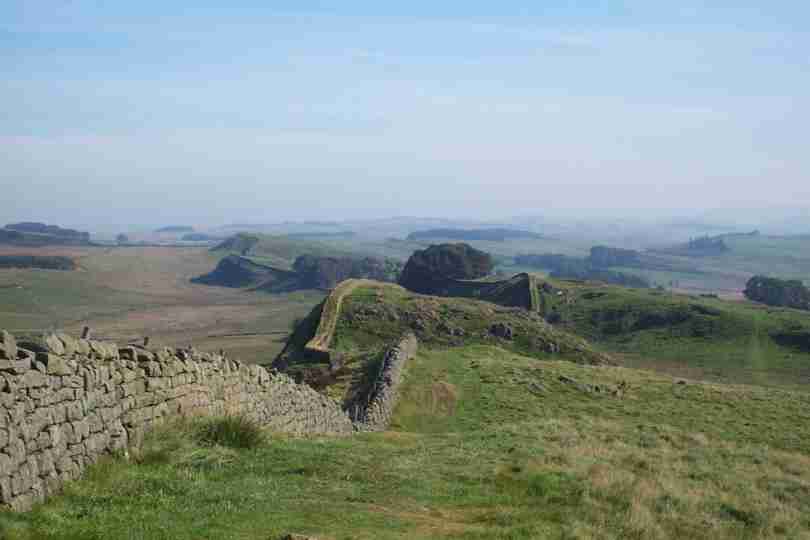
| A late start this morning 08:45! Some low level walking followed by 4 miles of forestry before intercepting Hadrians Wall. | NY781686 | 9 | Hadrians Wall |
| Robin Hood according to Kevin Costner visited this place. Remember Robin Hood Prince Of Thieves? Several more miles of up and down before arriving at Greenhead. | NY657658 | 8 | The Oak Tree |
Monday, September 30, 2002
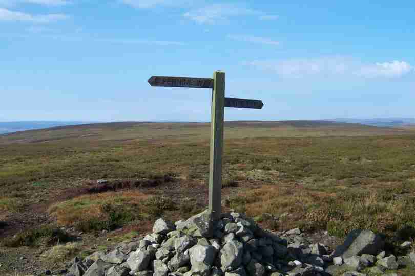
| Bright skies and warm sun were the order of the day. The first 14 miles of the Pennine Way saw me into Bellingham. | NY841902 | 9 | A Sign In The Middle Of Nowhere |
| The last 4 miles took me from Bellingham to the days finish point and was uneventful other than poor footpath signs. Fortunately the map reading was OK! | NY827792 | 8 | A View Of Bellingham Across The North Tyne |
Sunday, September 29, 2002
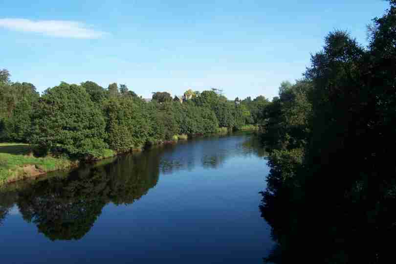
| Yet again another fine morning and a good days walk in prospect. Before 10am I said farewell to the St Cuthberts Way, now Dere Street was my route to England. At 10.50 I got my 1st view of the border | NT789105 | 10 | A Glimpse of the border and Penine Way Route |
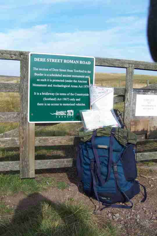
| At 11.45 I arrived at the boundry so ate my last meal in Scotland before crossing. Ahh my lungs were filling with English air! I also joined the Penine Way which will take me 250miles South. | NT770023 | 7 | My Kit at the Scottish Border |
Saturday, September 28, 2002
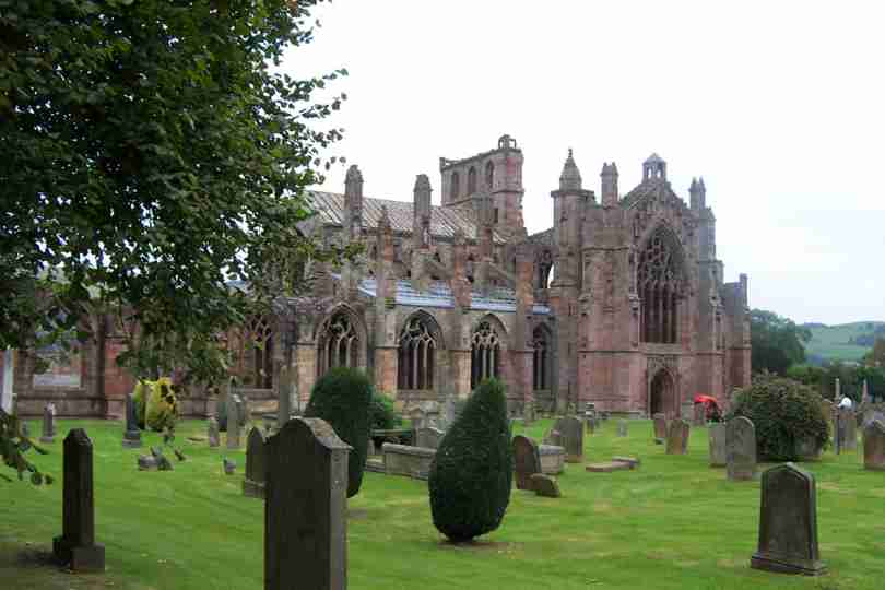
| Another Day done and the 400 mile barrier broken, celebrated with a bacon buttie in Tescos at Galashiels. Melrose was the next major place and very nice it was too. | NT549341 | 10 | Melrose Abbey |
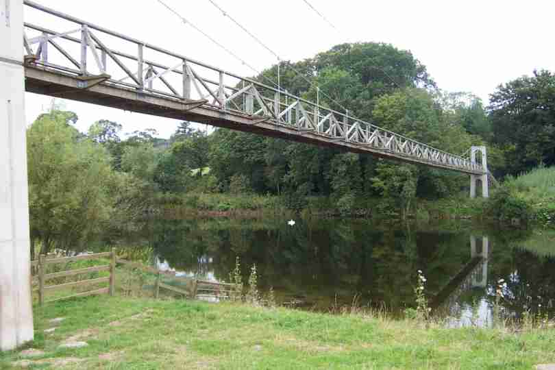
| From Melrose I left the Southern Upland way in favour of the St Cuthbert way and a more Southerly Route. After some pleasent walking, albeit up and down I made it to Jedburgh via Dere Street. | NT677227 | 12 | A Better Class Of Bridge |
| Today was also another Milestone for my support team, it halved in size! Many thanx Nigel for your efforts, look forward to seeing you in Nov, in the SW of England! Thanx Mum & Dad for joining us. | NT677227 | 0 | Mr Bean JOGs to LA |
Friday, September 27, 2002
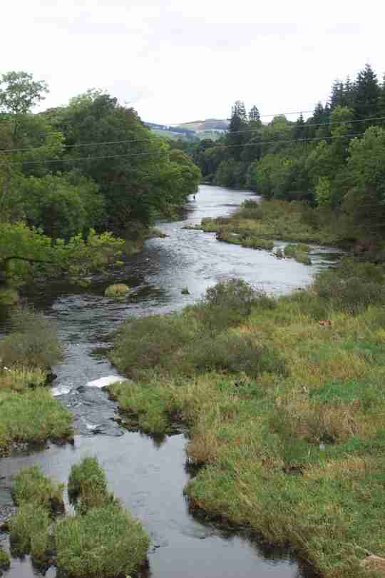
| After a nice rest for my good ladies birthday it was back to the hills. 15 miles of glorious hill tracks and paths. I am sorry to the two ladies heading from Minch Moor I still havent found you a man. | NT457325 | 17 | The River Tweed |
Wednesday, September 25, 2002
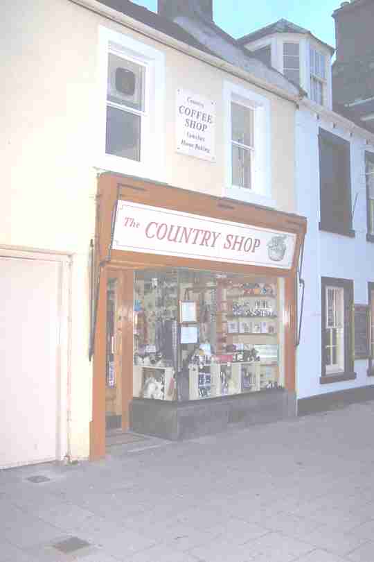
| A rather uneventful day, nothing really of note other than some nice views of Peebles and Tweedale. The day was finished with a cup of tea in The Country Shop, Peebles - Very highly recommended. | NT260392 | 17.5 | The Country Shop, Peebles |
Tuesday, September 24, 2002
| Day 24 opened to the first frost so far and a light mist in the valleys. This did have its advantages - all uglyness was well hidden. If anyone ever tells me that theres something beautiful between Glasgow and Edinburgh its a lie! | NS905666 | 0.5 | Early Mist At Blackridge |
| Milestones on this walk usually include East to West motorways and the M8 is no exception although the 3.5 mile detour necessary to navigate round it to cover less than 2 miles was less than welcome. | NS995672 | 6 | East Along The M8 |
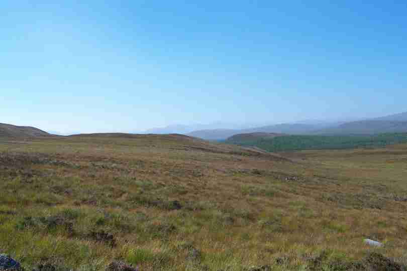
| Eventually tarmac has to give way to open country and after 30+ miles this was very very welcome! The Pentland Hills provided my very last view of the distant Highlands. | NT101627 | 14 | A Last (Hazy) View Of The Highlands |
| The Pentland Hills also shielded me from the last two days of hell and provided me with my first glimpse of the Cheviots and my route to England. | NT126550 | 4 | The Distant Cheviots |
Sunday, September 22, 2002
| Sunshine was the greeting for the day as I trekked ever further along the Forth And Clyde canal before leaving at Twechar. The route from here would comprise of mainly tarmac. | NS699759 | 5 | The End Of The Canal For Me |
| Not only was my path blocked but my road as well! The reason; a huge hole in the form of an open cast mine - not welcome after 10 miles of road. The final 8 or so miles were spent on cycle way 75 also covered in tarmac! | NS899668 | 18 | They Build Em Big Round Here! |
Saturday, September 21, 2002
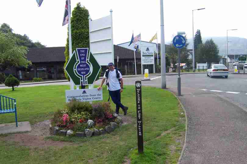
| Another bright morning and 9 miles left to complete the West Highland Way. The walking was easy and Milngavie arrived by 11am. | NS555744 | 9 | The End Of The West Highland Way |
| The next 7 miles saw a mixture of river walk, road and canal. The end was eventually reached at 1.30pm a nice early finish. A well earned rest for tired legs and feet, only a week to England! | NS634730 | 7 | Return To Milngavie |
Friday, September 20, 2002
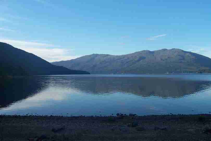
| Once again blue skies, warm sun and wonderful views this time of Loch Lomond in the early morning. The walking from Inversnaid started as it finished but quickly became an easy track. | NN342062 | 2 | Early Morning Over Loch Lomond |
| As the track improved, the sun warmed and the walking warmed also. By lunchtime I had arrived at our camp site where I had a well deserved cuppa before setting out for Balmaha. | NS417908 | 14 | A Fond Farewell To Loch Lomond |
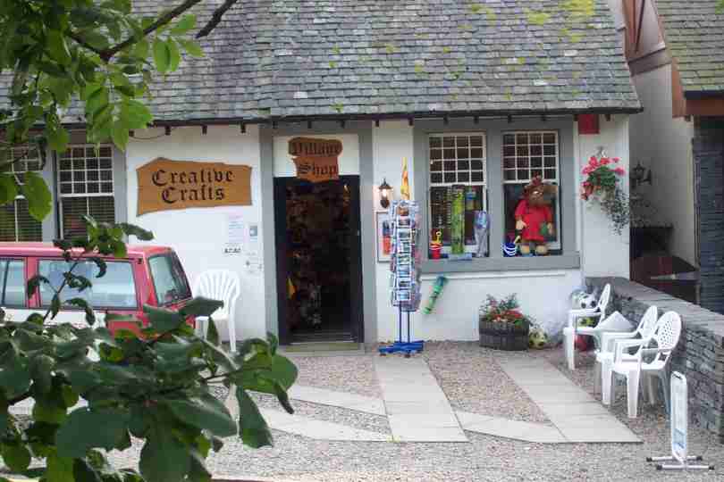
| The end of the day saw me adding a few unplanned miles to reduce tomorrows tally. Final destination Gartness but a mention of the oasis of Balmaha - the Village Store - cannot be missed. | NS504867 | 6 | Village Store, Balmaha |
Thursday, September 19, 2002
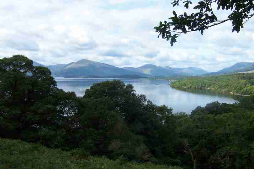
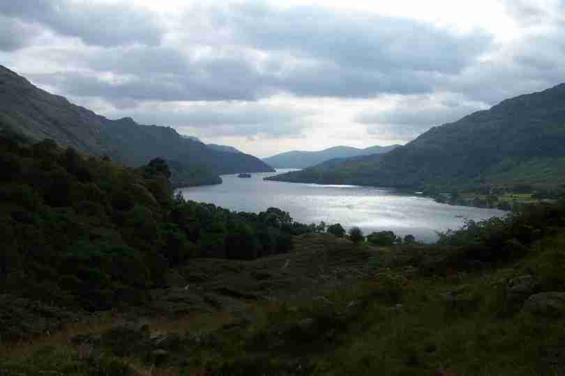
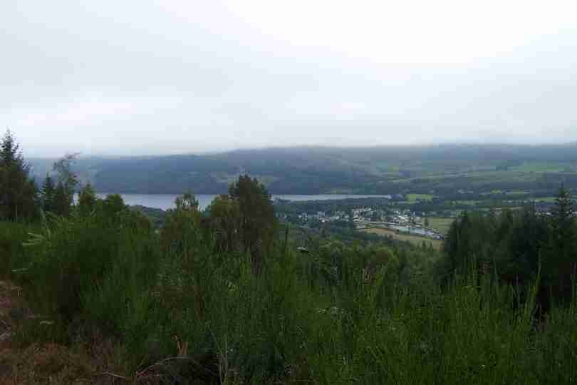
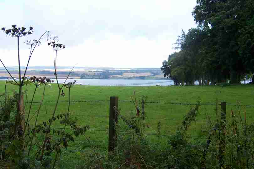
| Once more the trek Southward continues. Todays route primarily through woodland was very pleasant with the target of Loch Lomond ever present. Eventually at 13.30 I caught the first glimpse. | NN324173 | 12 | First View Of Loch Lomond |
| The route down the side of Loch Lomond is both rocky and undulating not condusive to tired legs! The views and prospect of a pint at the Inversnaid Hotel keep me moving. A great day but hard work. | NN337088 | 7 | A Closer View Of Loch Lomond |
Wednesday, September 18, 2002
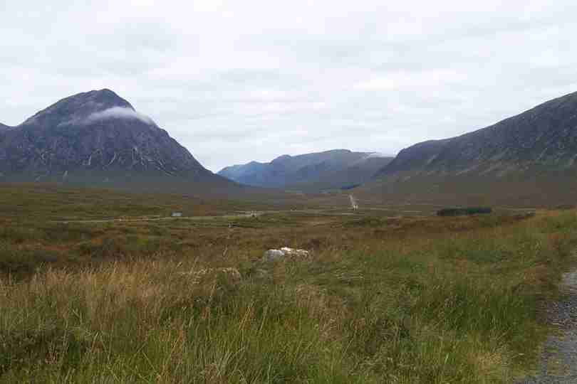
| An early 8 oclock kick off greeted me with more favourable weather. The photo shows the view back to Glencoe. The trek from here was a well defined road (path) making navigation unnecessary. | NN265539 | 3 | Looking Back To Glencoe |
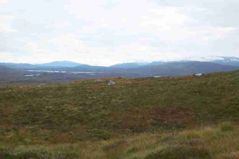
| The going didnt get easier, the tracks were long and hard underfoot but the legs and feet are still willing. A long day today with little interest except perhaps the deer and high peaks, although Rannoch Moor offers a strange, albeit barren, beauty. A welcome end came at Tyndrum. | NN327301 | 19 | Can You See Me Deer! |
Monday, September 16, 2002
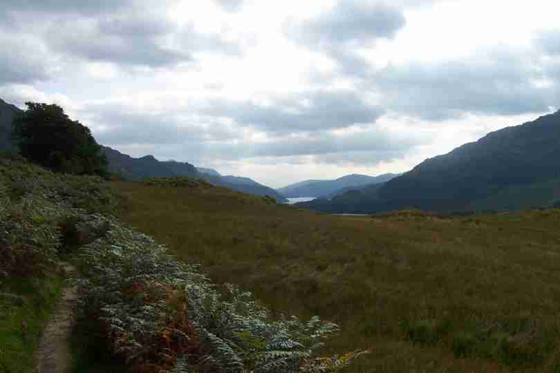
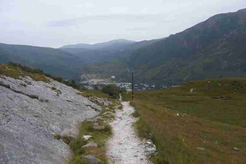
| After going so far West I now need to head East. Today saw the start of this Eastward treck. The walk was probably the 2nd best day so far, the 1st being Morven to Helmsdale. Finishing at the top of Glen Coe provided fantastic views. | NN221563 | 18 | Descent To Kinlochleven |
Sunday, September 15, 2002
| Another misty start followed by clear skies and warm sun. It was a long drag from Laggon Locks through forest and along tarmac. Greeted with this fantastic view of Ben Nevis from near Neptunes Staircase, just outside Fort William. | NN125776 | 17 | Ben Nevis With Halo! |
| With improving weather and end of Westward journey for now I found my next route South and East - The West Highland Way finish point (my Start point!). | NN123727 | 4 | The start of the West Highland Way |
Saturday, September 14, 2002
| Set out into low cloud high hills and another serious navigation excercise. On route I saw a sleeping tree eating monster before I climbed over the moor that would lead me to the descent into the Great Glen. | NH314123 | 2 | Sleeping Tree Eater |
| Got the first views of Loch Ness and the Great Glen before dropping into Fort Augustus and then commencing a 30 mile canal/lochside walk over two days. | NN286963 | 14.5 | Loch Ness And Fort Augustus |
Friday, September 13, 2002
| Another short 12 miles through soaring temperatures and following more pilons means I am fighting fit for tomorrow. Looking forward to Fort Augustus and the Great Glen. | NH309129 | 12 | Hazy Mountains In The Sunshine |
Thursday, September 12, 2002
| Day 10 and 11 saw Jonno resting in sympathy with my left leg! The rest days were enforced by severe stabbing pains in my lower left leg when walking. I've tied my foot on with a bandage after using plenty of Nurofen - it seems to have done the trick and my foot is still attached! | NH477512 | 0 | Jonno Resting In Sympathy |
| The rest seems to have done the trick and I am off again complete with bandages. A hard day but brilliant views and weather. The photo shows a bridge described in my guide book as derelict but useable - I found two rotten posts and some stands of very old wire (lying in the river) - hardly a bridge and way beyond derelict, fortunatley I was able to cross the river by more traditional means.. | NH320294 | 21 | A Bridge Too Far |
Monday, September 09, 2002
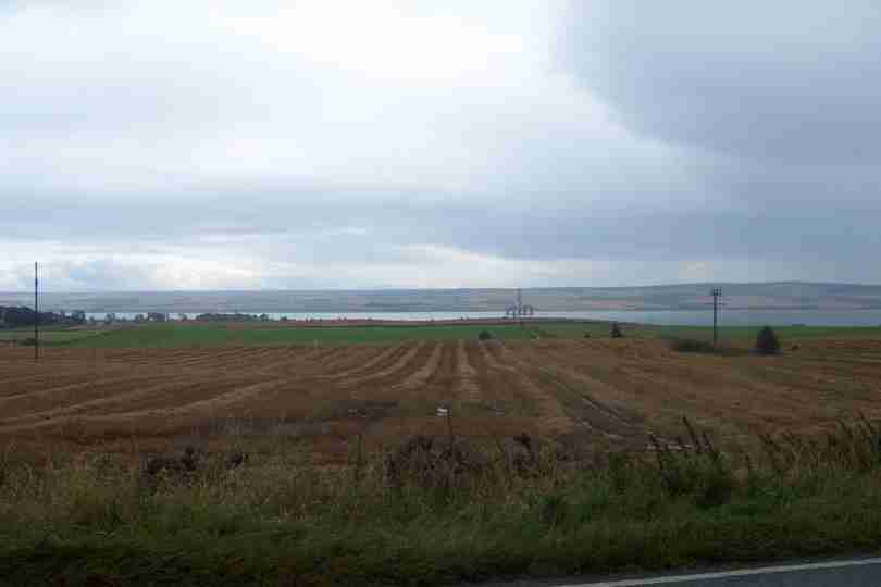
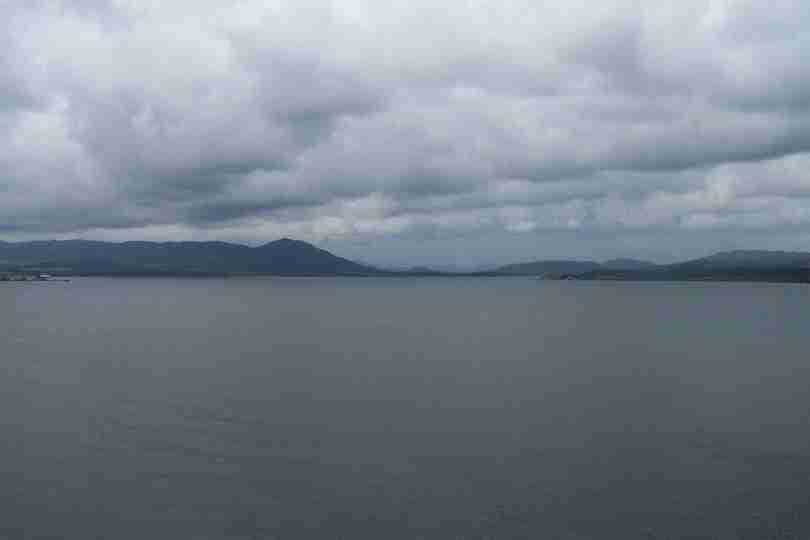
| Todays start was painful in both legs but the view across the Cromarty Firth provided some respite. | NH565590 | 2 | Cromarty Firth |
| Having only done 11 miles today it should have been a rest but my left leg don't agree! However the walking on quiet lanes was quite relaxing and the views breathtaking. | NH477511 | 9 | Tomorrows Walking Country |
Sunday, September 08, 2002
| After 21 miles of tarmac, only 4 off road, and one good soaking the mist cleared to reveal a rig in the Cromarty Firth. | NH633685 | 15 | Cromarty Firth Rig |
| Added a few extra miles so I can use tomorrow as a part rest day, Only 12 miles! Finished in sight of the A9 bridge, and 3 miles from Dingwall. | NH576623 | 6.5 | A9 Cromarty Firth Bridge |
Saturday, September 07, 2002
| After leaving Rogart Station it was a hard slog through the forest, over the moor and through the glen, eventually arriving at Loch Laoigh - Open moorland is losing it's appeal. | NH736962 | 6 | The last view of NE coast |
| Finally arrived at Meikle Ferrry Inn after 6 mile slog down A9 - How do people do JOG to LE along roads it's so tedious. | NH750843 | 9.5 | The Dornoch Firth |
Friday, September 06, 2002
| Another glorious day and great views of Loch Brora. Long slog following pylons over open moor before arriving at Rogart Station. Nice finish point with a nice bar and pint! | NC725020 | 18 | Mr Bean JOGs to LA |
Thursday, September 05, 2002
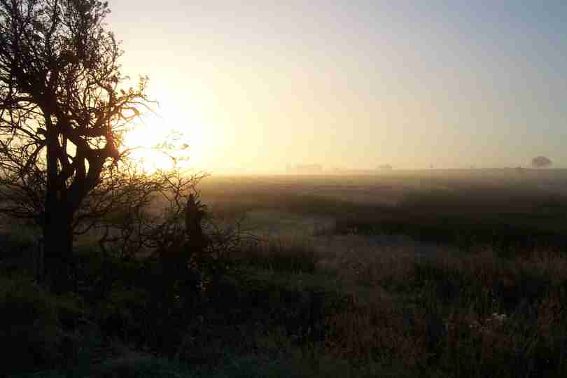
| Back on the road after a days rest due to blisters, now covered in compeeds (must by shares sometime!). Greeted with heavy rain. Terrain all open country, tested navigation skills - the GPS makes life easier and all worked. | NC983225 | 0 | Looking North |
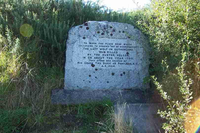
| Arrived at Brora after a 7 mile slog along the A9. Encountered a monument to the last wolf. Fantastic views and excellent weather after this mornings rain | NC913064 | 24 | The Last Wolf |
Tuesday, September 03, 2002
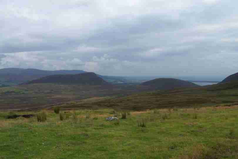
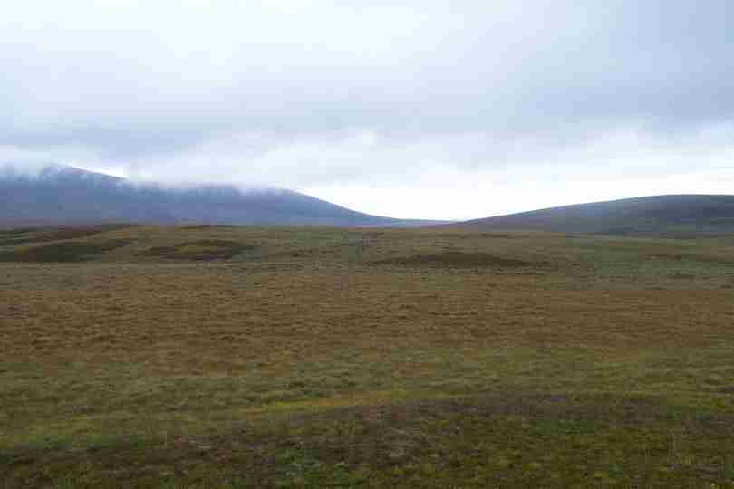
| Plodded through more flat lands, but finally hit a barrier of hills and blisters and only three days down! I'm not sorry to be out of the Flow Country and into hills. Braemore, nr Helmsdale is a welcome sight. | ND073304 | 16 | The Long And Winding Road |
Monday, September 02, 2002
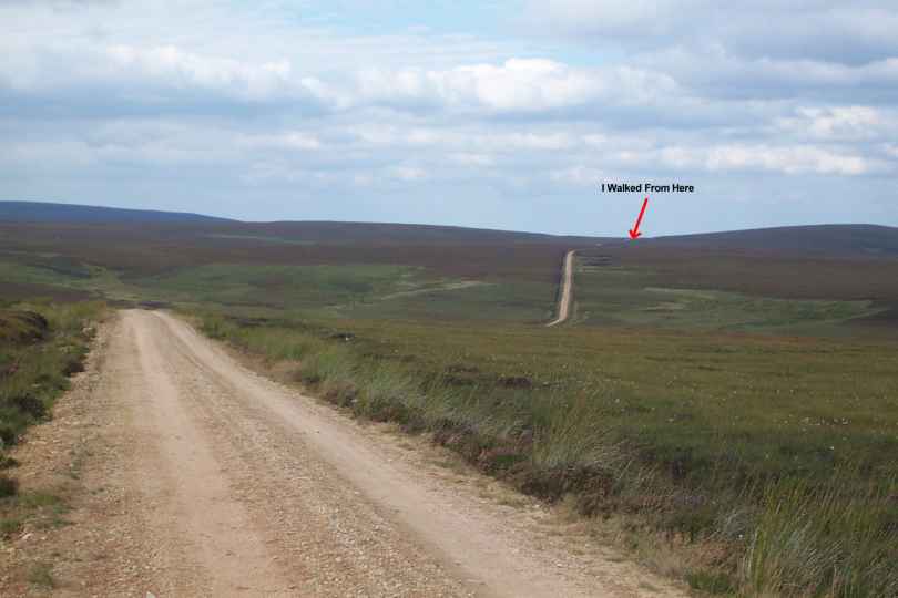
| Spoke Broadland 102, then off for glorious beach, road, path, road, road, road, road, road.... hard day, great weather, sore feet! Hopefully will never walk from Halkirk ( called it Helkirk!) again. | ND090471 | 19.5 | Mr Bean JOGs To LA |
Sunday, September 01, 2002
| Woke up to brilliant sunshine, clear skies and excellent weather. Made the journey North and greeted with fantastic views of the Orkneys and N and NE Coast line. An excellent start to the walk. | ND405734 | 0 | Mr Bean JOGs To LA |
| Having been to the most North Easterly point arrived at the most Northerly, Dunnet Head, and greeted with views to the Western peaks and far NW coast. | ND203766 | 17 | Mr Bean JOGs To LA |
| Arrived at todays destination, Dunnet village plus one mile, tired but fit and 26 miles down. | ND218705 | 9 | Mr Bean JOGs To LA |
Saturday, August 31, 2002
| Arrived at Blair Atholl last night after 250 mile drive, great night, great food, great preparation | NN877651 | 0 | Mr Bean JOGs To LA |
| Another 150 miles North, now esconsed for two weeks at Brora. Set off tomorrow for John O Groats and 06:30 start. | NC889050 | 0 | Mr Bean JOGs To LA |
Thursday, August 29, 2002
| Moved North, now 30% of the way towards home for the next 2 weeks. The start is imminent. | NZ599253 | 0 | Mr Bean JOGs To LA |
| The wine has flowed and the food has been fed - tomorrow we move north - Blair Atholl is the destination. Jonno has been drinking! | NZ599253 | 0 | Mr Bean JOGs To LA |
Wednesday, August 28, 2002
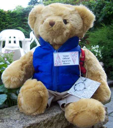
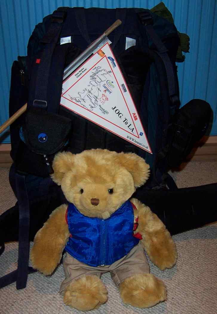
| Packing is in progress. Jonno (short for Jonno Groats) has been christened 'Official Mascot' and is ready for the off…. | TF993136 | 0 | 'Jonno' kitted up and ready to go |
Tuesday, August 27, 2002
| The start date is getting closer. If the training isn't enough -tough, it'll have to do. The kit is being packed, lists checked and car loaded - How do you fit 40 tonnes in a Nissan Primera and still leave room for 3 people (answers on a postcard please). | TF993136 | 0 | Mr Bean JOGs To LA |
Wednesday, August 21, 2002
| All ready to go, finished work, kit lists are done and route is planned. Sponsorship now in the region of GBP(Ł)2000. Training miles is now over 200. | TF993136 | 0 | Packed & Ready to Go! |
Saturday, May 18, 2002
| Training is proving difficult, but distance now seems no object. No great progress on sponsorship although donations of prizes have been received from Greens health and Fitness & Peter Beales Roses. | TF993136 | 0 | Mr Bean JOGs To LA |
Saturday, April 13, 2002
| Route Plan Finalised. Revised distance is 1146 miles. Started training in earnest, after finding 23 miles slightly uncomfortable a couple of weeks ago. | TF993136 | 0 | Mr Bean JOGs To LA |
Tuesday, March 12, 2002
| Planning continues. Recieved sponsorship from Trident Map Services. | TF993136 | 0 | Mr Bean JOGs To LA |
Friday, March 01, 2002
| Planning continues. Recieved sponsorship from TFD Services, Norwich. | TF993136 | 0 | Mr Bean JOGs To LA |
Friday, February 01, 2002
| Planning continues. Recieved sponsorship from Janssen-Cliag Ltd. | TF993136 | 0 | Mr Bean JOGs To LA |
Tuesday, January 01, 2002
| Preparing Route Plans, Equipment and embarking on obtaining Sponsorship. Approval from all Benefactors has been received. | TF993136 | 0 | Mr Bean JOGs To LA |