--------------------------------------------------------------------
I have kept the diary very plain and basic - no frills!! Please feel free to copy it, but not for commercial
gain. If you would like a more paper friendly version I have one that you can have on CDROM for a small fee to cover expenses. All the Photo's are available, if you would like copies
(by e-mail) of the originals or would like to contact me for other reasons please use the
contact form.
I will be adding to this over time to include my route plans and articles from the papers, other than that it is here until I decide to remove it - I hope someone out there finds it useful.
--------------------------------------------------------------------
 .
.
Mr Bean Did JOG to LA!
PREAMBLE
I fear that anyone attempting to read this may find it more of a cure for insomnia than a riveting and
enlightening narrative. This was not my intention. Those involved will probably recall moments of panic, stress, relief and confusion.
I hadn’t intended to go on for so long, but as I progressed so did the story but then I suppose a long walk needs a long story. So, dear readers,
I present to you ‘a walkers tale’, a story of, nay, a diary; a diary of an expedition from childhood to adulthood. North to South
and the realisation of a dream………..
INTRODUCTION
 This is the tale of how Phil Bean planned and walked from the most North Easterly point of the British Mainland to Lands End, the most South Westerly point, via Dunnet Head and Lizard Point. The walk was used to help raise funds for 5 charities.
The expedition took 85 days to complete, 68 walking and the report below gives a resume of each day. I have also included several appendices which detail, amongst other things, my route, statistics and my planned and actual budget.
I didn’t set out to do the walk on a shoestring, as you will see from my budget, I wanted to be comfortable but at the same time be able to do whatever was necessary to reach my planned destination.
If anyone is considering doing this walk I am more than willing to assist where I can. I will apologise now for my poor use of English, as mistakes are found I will correct them, but being a Yorkshire man, English is not my first language!!
Would I attempt it again, read on and you may find out. If nothing else I hope it inspires you to attempt something that is equally challenging for you.
Readers should note that in many cases Grid References of places have been given, these are in brackets and take the form of a full national Ordnance Survey form, ie two letters and 4 or 6 numbers.
If the reader wishes to determine the exact location these grid refs can be entered into websites such as the Ordnance Survey (http://www.ordsvy.gov.uk/)
or Streetmap.co.uk (http://www.streetmap.co.uk).
This is the tale of how Phil Bean planned and walked from the most North Easterly point of the British Mainland to Lands End, the most South Westerly point, via Dunnet Head and Lizard Point. The walk was used to help raise funds for 5 charities.
The expedition took 85 days to complete, 68 walking and the report below gives a resume of each day. I have also included several appendices which detail, amongst other things, my route, statistics and my planned and actual budget.
I didn’t set out to do the walk on a shoestring, as you will see from my budget, I wanted to be comfortable but at the same time be able to do whatever was necessary to reach my planned destination.
If anyone is considering doing this walk I am more than willing to assist where I can. I will apologise now for my poor use of English, as mistakes are found I will correct them, but being a Yorkshire man, English is not my first language!!
Would I attempt it again, read on and you may find out. If nothing else I hope it inspires you to attempt something that is equally challenging for you.
Readers should note that in many cases Grid References of places have been given, these are in brackets and take the form of a full national Ordnance Survey form, ie two letters and 4 or 6 numbers.
If the reader wishes to determine the exact location these grid refs can be entered into websites such as the Ordnance Survey (http://www.ordsvy.gov.uk/)
or Streetmap.co.uk (http://www.streetmap.co.uk).
IN THE BEGINNING
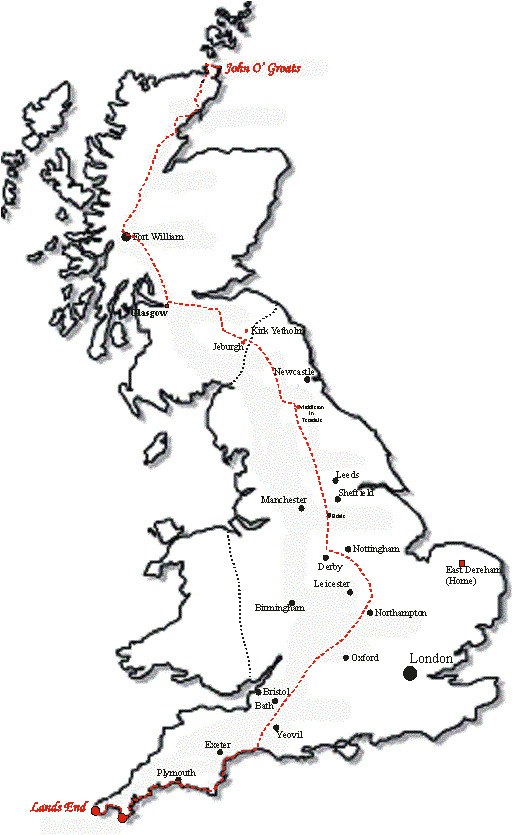
In 1980, at the ripe old age of 18, I got my first rucksack and ventured forth into the great outdoors.
I soon realized that there was more to walking than just having a map and rucksack.
Over the next few years I taught myself how to use a map and compass,
this was a process of trial and error, more error than trial! By mid 85 I was planning my first major
expedition, a 2 week trek along part of the Pennine Way (avoiding many of the
more remote parts, they frightened me!).
I enjoyed this so much that by late 86 I was attempting a 2 week walk
from Robin Hoods Bay on the N Yorks coast to St Bees on the Cumbrian coast, a
total distance of 211 miles. The
expedition also included several miles of the Pennine Way and a few of the
Lakeland Mountains and, more importantly, some remote bits.
This expedition was to be my first serious
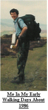
venture into the higher ground of the Lakes, rather daunting at the time. My
good friend, John Ritchie, now a member of an RAF Mountain Rescue team, joined
me and together we completed the expedition raising some Ł500 to boot.
In 87 I took the opportunity to walk the ‘Official
Coast to Coast’ route as part of an expedition involving 7 other work
colleagues, this we completed in 7.5 days. By now I was beginning to realize
that I enjoyed this long distance walking lark and also tried some of the other
long distance routes, Cleveland Way (several times), Coast to Coast (again!),
Pennine Way, Macmillan Way, Pembrokeshire coast Path all interspersed with many
days spent in the Lakeland Fells, Peak District and North Pennines.
I also took up the challenge of some
endurance type walks such as the Lyke Wake Walk and the Derbyshire
Masters. This style of event requires
participants to see how far they can go in a limited time, for example the Lyke
Wake Walk is 43 miles across primarily open moorland, the idea being to
complete it in under 24hrs and usually involves night walking.
To date I 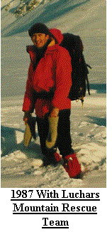 have completed the Lyke Wake at
least a dozen times, and started it several times more.
Likewise I have completed the Derbyshire
Masters, 45miles in 24hrs, three times. I have to confess I prefer the long
distance walking to the endurance style of event.
have completed the Lyke Wake at
least a dozen times, and started it several times more.
Likewise I have completed the Derbyshire
Masters, 45miles in 24hrs, three times. I have to confess I prefer the long
distance walking to the endurance style of event.
During my first few tentative
steps into the great outdoors an idea was forming that I may like to attempt a
longer, more challenging walk – why? I
have no idea! As my age increased and
my experience and skills improved the idea of walking from the most NE point of
the UK mainland to the most SW point seemed more realistic. But when could I do
it? How long would it take? How would I fund it? Would I make it?
The only way to answer the latter would be
to try it, as for the other questions, I mulled them over for several years,
and slowly, one by one, I answered them…..
PREPARATION
The hardest part about doing a walk of this nature is convincing yourself that not only can you do it, but
that you really do want to do it. It is
not in my nature to set out to do something with the intention of giving up, if
I start I usually finish. As I started
to consider the implication of doing this walk I had to consider many things,
the most important being:
When would I find the time to do it?
What route would I take?
What equipment would I need?
How long would it take?
How would I fund it?
By the early 90’s I had decided
that should I still wish to attempt this walk I would do it during my terminal
leave from the RAF, which would be in 2002 if I stuck with my decision to
leave. This solved 2 problems, firstly
I would have at least 3 months to play with and secondly I would still be
paid. The other advantages were that as
I would still be under 40 I should still be young enough and fit enough.
My route was coming together also; I would
start at John O' Groats (Most NE), go to Dunnet Head (Most N) on to Lizard Point
(most S) and finish at Lands End (Most SW), taking in the West Highland Way,
Pennine Way, Offas Dyke and South West Coast Peninsular Path. By 1997 I knew
pretty much how I would do the walk and all that was left was the detail.
Then Bang!
Out of the blue I found myself
Married, don’t get me wrong this was no mistake, but my plans for John O' Groats
to Lands End were now as open as ever they had been, I had never considered
such an event, I’d always thought I’d be the eternal bachelor.
I now couldn’t just go and walk, I had to
consider my Wife! After many
discussions it was decided, I could still do my epic walk, I would still do it
when I left the RAF but now one of my main problems was solved.
Can you imagine being away from home for
several weeks with only a couple of pairs of underwear and socks?
I had considered posting ‘used’ clothing
home and replacing it, or simply disposing of it and replacing it.
I couldn’t carry a weeks supply, I’d need 2
rucksacks to carry it all! In one fell
swoop this difficult problem was solved; My Wife offered to come with me in a
support role. This also had more
advantages, but I won’t go into them here!
On the down side it would mean my wife taking unpaid leave, using the
car for several weeks and doubling the accommodation and food costs.
By late 2001 I was into serious
planning, I was buying shares in the Ordnance Survey, if I hadn’t already.
I purchased guide books, the Scottish Rights
Of Way Society ‘Scottish Hill Tracks’ being one of my most useful.
I read ‘The Cape Wrath Trail’, an extension
of the West Highland Way, and ‘The Lands End to John O' Groats Walk’.
By far the most useful item was the Ordnance
Survey Map index. Not only was it free
but it showed every recognised way marked route in England and Wales. My route
was slowly being finalised, now only subject to review when I was actually out
there on the ground searching for the hidden signs of long lost paths (more
about that later).
Another consideration was why was
I doing this walk, yes it was a challenge, yes it was for personal pride, yes
it was to prove that I could, but I needed more, something else to give me
encouragement and a real sense of purpose.
I decided to get sponsorship, my target Ł5000, but hopefully at least
Ł2000, to be split between - between who? After much deliberation I chose:
Macmillan Cancer Relief
Sargent Cancer Care
East England Hospices
Swanton Morley Scout & Guide HQ fund
RAF Wyton Station Charities (St Johns Ambulance)
I had no specific reason for
these charities, like so many they are all worthy causes but they are all UK
and a mix of local and National.
My choice of charities had an
impact on my route. In 1999, two weeks
after I married, I joined a team who were walking the Macmillan Way.
This 250mile way marked path joins Boston in Lincolnshire to Abbotsbury in Dorset, via Oakham in Rutland.
When I first walked it we averaged over 25 miles a day, it was hard and I nearly didn’t finish.
Would I find it as hard a second time round?
With fewer miles per day it should be easy;
no high hills, no open country like Scotland or the Lakes, just gentle rolling
countryside. I decided I would include
it in my route.
So, my route was now
decided. I would start at Duncansby
Head, about 2 miles from John O' Groats and the official North Easterly point of
mainland Britain. From here I would follow
the coastline, probably on road, to Dunnet Head, mainland Britain’s most
Northerly point. From here I would use
roads, paths and Hill tracks to intercept the Great Glen Way at Fort Augustus,
which would lead me to Fort William and the West Highland Way. The Forth-Clyde Canal
would take me away from Glasgow and Sustrans route 75 toward Edinburgh before
entering the Pentland Hills. The
Southern Upland way would provide a few days upland walking before intercepting
the St Cuthbert’s Way and then Dere Street, an old Roman Road.
The Pennine Way would lead me south from
Scotland and onto the Limestone Way, then the Midshires Way. Now in the
Midlands I could intercept the Macmillan way before using several paths to get
me onto the Southern side of the Southwest Coast Peninsular path.
This final path would guide me to Lizard
Point, Mainland Britain’s most Southerly point and onto Lands End, the most
South Westerly point and my destination.
After several weeks of planning I
had costed the event, an estimated Ł10,800.
The details of accommodation had been set, we were to spend 2 weeks in a
self catering cottage, 45 days under canvas and 25 days in B & B before
finishing in a hotel for the final night and my 40th Birthday.
The budget covered lost wages, equipment
requirements, accommodation, food, fuel and other miscellaneous costs, all to
be funded from my pocket, as all sponsorship would be passed directly to my
chosen charities.
We only had two other headaches;
one was persuading people to sponsor me.
I wrote in excess of 250 letters to businesses throughout the UK,
newspapers, Radio and TV. Most came up
blank and this was by far the most demoralising part.
Of 250 letters fewer than 80 got replies.
Of these only a handful offered any form of
support (see sponsors at the back of this report).
But slowly the total increased and by the time I started my walk
I had cracked the Ł2000. The second
headache was what to do about the cat and our house.
We were going to be away for at least 3 months, with a possible
fleeting visit in October. Our initial
idea had been to have a friend house and cat sit for the full 3 months but this
proved unreliable. So, after much head
scratching we came up with a plan, our neighbours, friends and families would
take it in turn to cat sit and house sit and soon we had it finalised.
By late August 2002 everything
was in place, Rite and I were on leave, the funds were in place, the route was
planned, some accommodation was booked, equipment was packed and the car was
ready to go. I had also set up my
website (www.beanari.co.uk) so that
friends and supporters could look in at my progress.
I could have set up in business selling chargers:
Chargers for phones, laptops, camera,
camping lights… – this was definitely not a light weight expedition, even the
car was complaining and still there was more to go!
Finally the day arrived when we
started the journey North, it was the 28th August 2002.
With everything in place there was no
turning back. I already had Ł600+ of
sponsorship collected in. Even the
local radio station had suddenly shown an interest, but we were off.
The ride from Dereham to John O' Groats is some 700+ miles, mostly on good roads but in one go a daunting
challenge in itself. We chose to break
the journey, firstly at my parents in Redcar, especially as they were to join
us for the first 2 weeks and it is only 220 miles North.
Then at Blair Atholl, about another 280
miles north, here we spent the night in a B & B before the final push, some
150 miles or so to Brora which was to be our base for the first 2 weeks.
Brora is still over 70 miles South of John O' Groats but there we were, the day before I started my walk and so far
everything had gone to plan. One event
that amused me en-route to Blair Athol was a telephone conversation taking
place in the passenger seat whilst in a queue of traffic on the outskirts of
Edinburgh. Prior to setting out for the
Northward journey I had sent another letter to each of the local Radio and TV
stations as well as the local papers.
Radio Norfolk was now on the phone and talking to my wife.
The person in Norfolk obviously had no idea
how far John O' Groats was from Norwich, as 2 days before I was due to start
walking she was enquiring as to my availability for an interview, and asked
‘could I pop into Norwich?’ This was
greeted with amusement as my wife explained we were presently entering
Edinburgh, a mere 400 or so miles North! I later did the interview over the phone from a service station on the
M9!
THE WALK
Day 1 (Sun 1st Sep)
 The
day to start had now arrived and the first thing I heard was the alarm clock
announcing it was 6am. Very soon we
were all up and about, washing, breakfasting and packing supplies for the
forthcoming expedition. We set out for
the final 70 miles or so North
The
day to start had now arrived and the first thing I heard was the alarm clock
announcing it was 6am. Very soon we
were all up and about, washing, breakfasting and packing supplies for the
forthcoming expedition. We set out for
the final 70 miles or so North
 to John O' Groats at a little past 6.55am, I
expected it to take about 2hrs. Being a
Sunday, the already generally quiet roads, were almost deserted and so it was
that at about 8:30am I got my 1st sighting of this the most North
Easterly point of mainland Britain, and what a view.
We had been greeted by clear skies and bright early morning
sun. My first surprise was how close the Orkneys were to the mainland, the second was how flat and barren the far NE
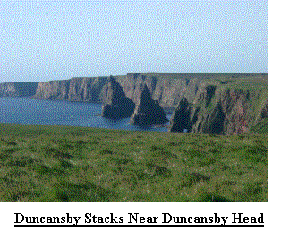
is! We headed for the Lighthouse at Duncansby Head.
After posing for some photo’s I donned my rucksack for the first
time and with just a little trepidation, apprehension, expectation and relief
set out on my journey South, walking in a Westerly direction!
to John O' Groats at a little past 6.55am, I
expected it to take about 2hrs. Being a
Sunday, the already generally quiet roads, were almost deserted and so it was
that at about 8:30am I got my 1st sighting of this the most North
Easterly point of mainland Britain, and what a view.
We had been greeted by clear skies and bright early morning
sun. My first surprise was how close the Orkneys were to the mainland, the second was how flat and barren the far NE
is! We headed for the Lighthouse at Duncansby Head.
After posing for some photo’s I donned my rucksack for the first
time and with just a little trepidation, apprehension, expectation and relief
set out on my journey South, walking in a Westerly direction!
The first 2 miles were absolutely glorious and, as my Dad and I headed West to John
O' Groats, we absorbed the
views North tothe Orkneys, South with glimpses of Duncansby Stacks, East across the Northern
reaches of the North Sea and West towards Dunnet head some 15 or so miles away
and today’s destination.
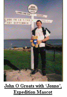
 I do not know what I expected at John O' Groats, it looked quite picturesque in the early morning sun.
I soon realised it comprised: One hotel (closed down), one large car park with two cars on it, one campsite, a small
complex of tourist trap shops and an ‘official’ Photographer, not forgetting the quay and small harbour. I decided
to use the photographer and so Jonno and I posed for our photos once more. Jonno was my Jog to LA mascot, presented to
Rite when she left work for the expedition.
I do not know what I expected at John O' Groats, it looked quite picturesque in the early morning sun.
I soon realised it comprised: One hotel (closed down), one large car park with two cars on it, one campsite, a small
complex of tourist trap shops and an ‘official’ Photographer, not forgetting the quay and small harbour. I decided
to use the photographer and so Jonno and I posed for our photos once more. Jonno was my Jog to LA mascot, presented to
Rite when she left work for the expedition.
It was now about 9.30am and the day was warming up, I had already removed my fleece and even in a t-shirt was
still quite warm. The journey South, now started in earnest and I set out on my Westerly track along the side of the
A9, before picking up an undefined route along the edge of the cliffs about 4 miles from JOG. As I approached
Scotland Haven (ND316745) I heard what sounded like wind wailing as it blow through a hole. As I got closer I
discovered the source of this noise was a colony of seals in the
 small bay below so I stopped for my mid morning snack, it was about 10.30am, and
watched these lumbering animals basking in the sun. I couldn’t help wondering if the noise was normal or a sign that
they were unwell, after all there were reports of an outbreak of distemper, like that of the late eighties which wiped out large numbers of the seal
population, just across the North Sea.
small bay below so I stopped for my mid morning snack, it was about 10.30am, and
watched these lumbering animals basking in the sun. I couldn’t help wondering if the noise was normal or a sign that
they were unwell, after all there were reports of an outbreak of distemper, like that of the late eighties which wiped out large numbers of the seal
population, just across the North Sea.
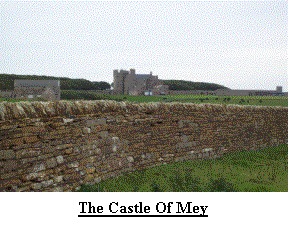 As I left the Seals behind I rejoined the road before walking around the Northerly
perimeter of the Castle of Mey, the former home of the Queen Mother who had
died earlier this year. Within 3 hrs it would be opening its doors to the
Public and my wife would be one of the first in the queue! By 2pm I was at the bottom of Dunnet Head in
the little hamlet of Brough. The former post office is now a tea shop and I headed inside for a well earned cuppa and
piece of cake. I was amazed, after walking about 14 miles I had seen barely a soul, I now knew why.
There must have been 20+ people packed into this oasis, which is no bigger than the average garage.
Included in this mass of humanity were my Wife, Mum and Dad, Uncle and Brother all tucking into large pieces of
cake. It did have its advantages, I not only got my tea and cake, I also didn’t have to pay and got some sponsorship as
well!
As I left the Seals behind I rejoined the road before walking around the Northerly
perimeter of the Castle of Mey, the former home of the Queen Mother who had
died earlier this year. Within 3 hrs it would be opening its doors to the
Public and my wife would be one of the first in the queue! By 2pm I was at the bottom of Dunnet Head in
the little hamlet of Brough. The former post office is now a tea shop and I headed inside for a well earned cuppa and
piece of cake. I was amazed, after walking about 14 miles I had seen barely a soul, I now knew why.
There must have been 20+ people packed into this oasis, which is no bigger than the average garage.
Included in this mass of humanity were my Wife, Mum and Dad, Uncle and Brother all tucking into large pieces of
cake. It did have its advantages, I not only got my tea and cake, I also didn’t have to pay and got some sponsorship as
well!
And so my Southerly journey continued. I left the café feeling refreshed and raring to go, after all I only had about 8 miles left to do for
today, or so I thought and I set out facing due North! It was about now that I realised my feet
were feeling a little sore, and I have to admit my legs ached a little, as did
my knees, ankles, back, shoulders and almost every other joint! Eventually I
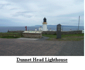
arrived at Dunnet Head, with it’s towering cliffs, lighthouse and abandoned
military buildings. Not only is Dunnet head about the most beautiful thing in these north easterly parts it is also
home to thousands of Sea birds, but the views from here in all directions are also fantastic: To the north the Orkneys and the Old Man of
 Hoy, to the east, Duncansby Head, to the west Cape Wrath and the northwest coastline
and to the south Morven (the highest point in Caithness and my destination a
few days hence) and views of some of the most spectacular mountains in
Britain. From here I really would be
heading south and I set out with new purpose, expectations and less
trepidation. I had nearly completed my
first day as I rounded the western side of Dunnet Head.
I continued around the western side of
Dunnet Head, I still proceeded around Dunnet Head, and proceeded and proceeded,
and proceeded…… Now I must admit I do
make the occasional mistake and I had, don’t ask me how, estimated the distance
from Dunnet Head to Dunnet village as a little over 3 miles.
Some 5 miles or so later and more than an
hour later than estimated I eventually stepped foot in Dunnet village. Oops!
What worried me was I might have done this for every day meaning that my
estimated 1147 miles would be nearer 1300!
Fortunately this proved not to be the case but I did make a point of
checking some of my later days when I returned to our accommodation.
Hoy, to the east, Duncansby Head, to the west Cape Wrath and the northwest coastline
and to the south Morven (the highest point in Caithness and my destination a
few days hence) and views of some of the most spectacular mountains in
Britain. From here I really would be
heading south and I set out with new purpose, expectations and less
trepidation. I had nearly completed my
first day as I rounded the western side of Dunnet Head.
I continued around the western side of
Dunnet Head, I still proceeded around Dunnet Head, and proceeded and proceeded,
and proceeded…… Now I must admit I do
make the occasional mistake and I had, don’t ask me how, estimated the distance
from Dunnet Head to Dunnet village as a little over 3 miles.
Some 5 miles or so later and more than an
hour later than estimated I eventually stepped foot in Dunnet village. Oops!
What worried me was I might have done this for every day meaning that my
estimated 1147 miles would be nearer 1300!
Fortunately this proved not to be the case but I did make a point of
checking some of my later days when I returned to our accommodation.
 Not to show any signs of
weakness, despite the now very uncomfortable soreness in my feet and aches in
my joints, I opted to walk an extra mile, after all this would be less to do
tomorrow! I arrived at Dunnet Bay
visitor centre at 5.40pm feeling relieved and satisfied with my days effort.
Not to show any signs of
weakness, despite the now very uncomfortable soreness in my feet and aches in
my joints, I opted to walk an extra mile, after all this would be less to do
tomorrow! I arrived at Dunnet Bay
visitor centre at 5.40pm feeling relieved and satisfied with my days effort.
I can’t leave Dunnet Head behind without elaborating on the wildlife. One of the reasons I took a little longer than expected going round
Dunnet Head was because I spent sometime trying to see the Puffins, which were plainly described on many of the information leaflets we had obtained.
Now I don’t wish to seem ungrateful, but they could hang around a little longer, I didn’t read the bit that indicated they migrate in August!!
And so the first day was finished and after 26 miles I wondered would I even reach the Caithness border.
By the time we reached our cottage I had seized up completely, perhaps my training should have been harder? Perhaps I
would never reach the fitness level I needed; perhaps I would sneak quietly home and hide in shame! Would I get up in time tomorrow? Would I be able to
walk tomorrow? These and many other questions were pondered whilst I relaxed in a hot bath and examined my injuries.
Day 2 to Day 7 (Mon 2nd Sep to Sat 7th Sep)
Day 2 (Mon 2nd Sep) greeted us with overcast but dry skies and a 6am alarm call.
We were now better organised, and ready to go by 6:30am but despite covering 26 miles we now had further to drive than
yesterday as I had walked primarily west and a little north, somewhat perverse for a south westerly walk! I also breathed a sigh of relief as I carefully carried out a functional check of my
legs and other joints finding that all passed. If you are thinking of doing something similar to this walk I have one
word for you ‘Compeeds’. They might be expensive, but they are worth their weight in gold.
It turned out the source of my feet’s soreness was the beginnings of some blisters; in fact some had gone further than just beginnings!
Today was also to be a first, Broadland 102, the local radio station in Norwich, would be contacting me to see how I had got on and
would continue to contact me each Monday I was walking. Now I have a confession here to anyone who
listened. When asked where I was I would always state the point from which I was walking, but in most cases I was
not actually anywhere near. Today was a good example; my start point was just out of Dunnet village some 80 miles North
of our accommodation. The Radio station would ring me about 7:30 to 7:45am, I needed to have a reasonable signal on my
phone and I didn’t expect to start walking before 8:30am. So during my first moment of stardom I told Norfolk I was just south of Dunnet Head, this meant
nothing to most listeners anyway! I was actually about 2 miles north of Helmsdale, parked up in someone’s driveway!
 I did arrive at Dunnet and set off to walk at about 8:50am. Now having travelled from Dereham in Norfolk
to Huntingdon every working day for 8 years taught me that the Fens are flat, indeed the Cambridgeshire Fens make NE Norfolk look positively hilly.
Why do I mention this? Well I hate the Fenland landscape, it is
flat for miles, I love hills. Everyone thinks of hills and mountains when they think of Scotland but Caithness is more
like the Fens but bigger, although not quite so flat, but definitely more boggy, more remote and more boring. I
must apologise to anyone who lives in Caithness for this opinion, but Caithness does not appeal to me.
I did arrive at Dunnet and set off to walk at about 8:50am. Now having travelled from Dereham in Norfolk
to Huntingdon every working day for 8 years taught me that the Fens are flat, indeed the Cambridgeshire Fens make NE Norfolk look positively hilly.
Why do I mention this? Well I hate the Fenland landscape, it is
flat for miles, I love hills. Everyone thinks of hills and mountains when they think of Scotland but Caithness is more
like the Fens but bigger, although not quite so flat, but definitely more boggy, more remote and more boring. I
must apologise to anyone who lives in Caithness for this opinion, but Caithness does not appeal to me.
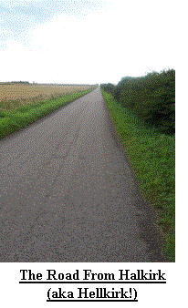
Being boggy means open country is not a sensible option for anyone like myself heading south and so it was that
day 2 saw the onslaught of tarmac, mile after mile after mile of it. My intention was to intercept a Scottish Hill Track, no 331, at Halkirk (we referred
to it as Hellkirk!), which I did. A little respite was had by using a track from Olrig House (ND185663) over Olrig
Hill (ND 1765), some 130m (400ft) above Sea Level. From here it was all road, mostly straight and often none to quiet.
After a 5 mile slog, 2 more Compeeds a lunch and afternoon snack stop I arrived at my planned destination; a cemetery (GR ND107479) near Strathmore
Lodge – very apt for the way I felt. I did feel good enough to opt to walk a further mile and to the end of the Tarmac
for now. With great relief, more aches and pains, I settled into the car for the return journey to our accommodation,
still about 75 miles away.
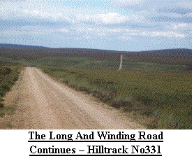 Day 3 (Tue 3rd Sep) greeted us with clear skies and a lie-in, 7am
alarm call today. After the northward
journey to Strathmore Lodge I set out into one of the most desolate landscapes
I have ever encountered along a ‘hill track’.
At least I could now see some hills on the horizon and by days end the
ground was to become much more undulating.
I don’t know what I expected from a hill track, but this one was little
better than a road only without tarmac, a ridge along the middle, ruts either
side and not any too comfortable to walk on.
Despite the tedium of the road the views were definitely improving and
as I stopped for my morning break I was greeted with a display by a Golden
Eagle, I could have watched it for hours.
With nothing more of interest I arrived at the hamlet of Braemore
(ND0730) with feet that were now very sore, despite several layers of
Compeeds. It was nice to find the car
and sit down whilst I looked south to the next days walk and my first real
challenge; some hills and open country. I had also finished my first map, only
33 to go!
Day 3 (Tue 3rd Sep) greeted us with clear skies and a lie-in, 7am
alarm call today. After the northward
journey to Strathmore Lodge I set out into one of the most desolate landscapes
I have ever encountered along a ‘hill track’.
At least I could now see some hills on the horizon and by days end the
ground was to become much more undulating.
I don’t know what I expected from a hill track, but this one was little
better than a road only without tarmac, a ridge along the middle, ruts either
side and not any too comfortable to walk on.
Despite the tedium of the road the views were definitely improving and
as I stopped for my morning break I was greeted with a display by a Golden
Eagle, I could have watched it for hours.
With nothing more of interest I arrived at the hamlet of Braemore
(ND0730) with feet that were now very sore, despite several layers of
Compeeds. It was nice to find the car
and sit down whilst I looked south to the next days walk and my first real
challenge; some hills and open country. I had also finished my first map, only
33 to go!
Day 4 (Wed 4th Sep)
was an unplanned day! From the outset I had intended to walk for 5 days then
take a rest day repeating this sequence until, hopefully, I arrived at Lands
End. This also meant that should the
unexpected happen I could re-adjust my schedule and still finish when planned
but consume one of my ‘spare’ days of which I had 6.
I had not expected to need a day off so early.
Despite numerous Compeeds the previous 3
days had taken a much greater toll on my feet than expected, the result; both
feet were blistered on the ball! I could still walk, with a little pain, but I
decided to rest up hopefully resulting in harder feet and more miles when I
resumed. This was not a good sign
though and despite my good humour it was obvious to those with me that I did
not relish in this early set back. If I
only walked 3 days out of 4 I’d be lucky to see Lands End this side of 2003!
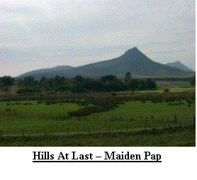
 Day 5 (Thu 5th Sep) sore! Compeeds shares rocket! A 7am alarm call
presented low cloud and heavy rain – Where I was going was higher up and into
remote country that I did not know at all.
> After much consideration I checked my map, I checked my Compass
and I programmed my GPS! I also ruled out the A9, a simpler option but harder
on the feet. By 8:45am I was on my way and soon passing Braeval (ND0630), the
gamekeepers cottage. I had to check
several times, but there in his back garden was a huge Hatracker (Stag to the
uneducated!), I could not take a photo the rain was too heavy.
I was soon climbing up to the pass between
Morven (ND0028) and Carn Mor (ND0228), until now only contours on a map.
The walking was now exceptional, despite the
rain. All around were small peaks,
nothing much above 700m (2300ft) but after days of flatness they were
fantastic. At last I was in my element,
open country, hills and miles of nothingness.
I was reliant on my own skills (and the GPS to keep life simple) and my
years of planning and experience. I
reached my highest point to date; 360m (1200ft).
Soon after I saw my first herd of red deer before I dropped down
to the Langwell Water and the derelict Wag (ND015260).
From here I regained some height climbing
over Garvery Hill before my descent to
Day 5 (Thu 5th Sep) sore! Compeeds shares rocket! A 7am alarm call
presented low cloud and heavy rain – Where I was going was higher up and into
remote country that I did not know at all.
> After much consideration I checked my map, I checked my Compass
and I programmed my GPS! I also ruled out the A9, a simpler option but harder
on the feet. By 8:45am I was on my way and soon passing Braeval (ND0630), the
gamekeepers cottage. I had to check
several times, but there in his back garden was a huge Hatracker (Stag to the
uneducated!), I could not take a photo the rain was too heavy.
I was soon climbing up to the pass between
Morven (ND0028) and Carn Mor (ND0228), until now only contours on a map.
The walking was now exceptional, despite the
rain. All around were small peaks,
nothing much above 700m (2300ft) but after days of flatness they were
fantastic. At last I was in my element,
open country, hills and miles of nothingness.
I was reliant on my own skills (and the GPS to keep life simple) and my
years of planning and experience. I
reached my highest point to date; 360m (1200ft).
Soon after I saw my first herd of red deer before I dropped down
to the Langwell Water and the derelict Wag (ND015260).
From here I regained some height climbing
over Garvery Hill before my descent to
 Kilphedir and my first road for about 10 miles. I
spent several minutes stopping and admiring the vast emptiness and lack of
human development. As I progressed I
realised my feet felt considerably better – it was like walking on a wet sponge
– it was delightful! On arriving at Kilphedir (NC989186) I had two
options: To continue almost due south
over more open country or veer east and follow the coast.
I opted for the latter as I felt another
10miles of hills and open country might prove too strenuous this early in the
walk and so I found myself surrounded by low hills and a wide open valley with
the river Helmsdale racing for the sea with fishermen in mid stream after the
Salmon heading for home. The Town of
Helmsdale (ND0215) was quite pretty, and we did return here for tea on two
occasions to ‘La Mirage’ – you have to see it to believe it, but I urge you to
go. Choosing the easier route for
heading south meant re-joining the A9 for 7 miles, not pleasant but good for
fast progress. My Dad also joined me
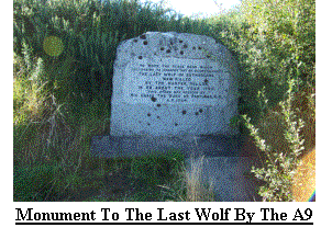
and as we rested on a lay-by we spotted a memorial stone (NC941100) to the last
Wolf killed in Britain. By 5:30pm I had
completed another 24 miles and finished less than 3 miles from our
accommodation. Also of note was the
weather, which, from about 1:30pm, had improved considerably to leave bright
sun and clear skies, great for my tan.
Kilphedir and my first road for about 10 miles. I
spent several minutes stopping and admiring the vast emptiness and lack of
human development. As I progressed I
realised my feet felt considerably better – it was like walking on a wet sponge
– it was delightful! On arriving at Kilphedir (NC989186) I had two
options: To continue almost due south
over more open country or veer east and follow the coast.
I opted for the latter as I felt another
10miles of hills and open country might prove too strenuous this early in the
walk and so I found myself surrounded by low hills and a wide open valley with
the river Helmsdale racing for the sea with fishermen in mid stream after the
Salmon heading for home. The Town of
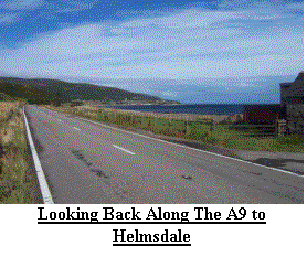
Helmsdale (ND0215) was quite pretty, and we did return here for tea on two
occasions to ‘La Mirage’ – you have to see it to believe it, but I urge you to
go. Choosing the easier route for
heading south meant re-joining the A9 for 7 miles, not pleasant but good for
fast progress. My Dad also joined me
and as we rested on a lay-by we spotted a memorial stone (NC941100) to the last
Wolf killed in Britain. By 5:30pm I had
completed another 24 miles and finished less than 3 miles from our
accommodation. Also of note was the
weather, which, from about 1:30pm, had improved considerably to leave bright
sun and clear skies, great for my tan.
Day 6 (Fri 6th Sep)
saw the latest alarm call to date, 7:15am and I was still walking by 8:30am.
The day started on quiet lanes, again heading inland and away from the A9 I was
now going to head north about 2˝ miles in payment for my walking down the road.
My chosen route climbed gently along a stalkers track before rejoining tarmac
near Gordenbush (GR NC845096), soon after I intercepted a line of pylons
heading southwest and followed them for about 3 miles.
From here I had planned to stay in open
country, but the number of fences persuaded me to stay on tarmac, walking
completely off my map until I rejoined it a couple of miles later and headed
into Rogart (GR NC725020). This was a
relatively short day and I finished at 1:55pm right next door to a pub – my
planning was getting better!
 Day 7 (Sat 7th Sep) started with a steep climb through a forest, but
at least the weather was still kind. As
I reached the top of the climb I encountered more deer, they also provided me
with my escape route from the forest in the form of a large hole in the fence.
I had opted to follow a path shown on the map – this proved to be a
cartographers joke. No obvious path was
available so I found myself bashing through heather and the occasional
bog. Finally I reached tarmac before
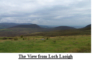
turning back southeast and uphill looking for Loch Laoigh (NH7396).
Here the GPS came into it’s own.
I could wander in any direction avoiding
man-eating bogs, head high heather and any other natural or man made trap and
still the GPS told me which way to go, no real effort trying to follow
imaginary lines, taking back bearings, checking position and the like.
Before too long I was heading downhill along
a rough but well used and ugly track before once again intercepting
tarmac. Again I found some paths I had
planned to use but I also found the cartographers laughing at me from afar – I
returned to the A9. Despite the
ugliness at least it knew where it was going and you could rely on it to be
there! A 2pm finish on the south side
of the Dornoch Firth (NH7484) meant another restful afternoon and a visit to
Dornoch (NH8089) for tea and cakes.
Day 7 (Sat 7th Sep) started with a steep climb through a forest, but
at least the weather was still kind. As
I reached the top of the climb I encountered more deer, they also provided me
with my escape route from the forest in the form of a large hole in the fence.
I had opted to follow a path shown on the map – this proved to be a
cartographers joke. No obvious path was
available so I found myself bashing through heather and the occasional
bog. Finally I reached tarmac before
turning back southeast and uphill looking for Loch Laoigh (NH7396).
Here the GPS came into it’s own.
I could wander in any direction avoiding
man-eating bogs, head high heather and any other natural or man made trap and
still the GPS told me which way to go, no real effort trying to follow
imaginary lines, taking back bearings, checking position and the like.
Before too long I was heading downhill along
a rough but well used and ugly track before once again intercepting
tarmac. Again I found some paths I had
planned to use but I also found the cartographers laughing at me from afar – I
returned to the A9. Despite the
ugliness at least it knew where it was going and you could rely on it to be
there! A 2pm finish on the south side
of the Dornoch Firth (NH7484) meant another restful afternoon and a visit to
Dornoch (NH8089) for tea and cakes.
Day 8 to Day 15 (Sun 8thSep to Sat 14th Sep)
Day 8 (Sun 8th Sep).
A week down and so far no major problems,
but my left shin was slowly getting more painful.
Today had been one of the most difficult days to plan.
I intended to head slightly inland and pick
up some forest tracks before eventually intercepting another Hill Track.
I left the A9 behind for the last time and
at 8:45am even the main roads were still quiet.
After Edderton (GR NH708847) I joined some minor roads before
entering some forestry. The forest had
an almost spooky feel to it as I was totally surrounded by trees with strange
‘barking’ from the hidden deer and a light mist enveloping the tree tops.
I expected the mad axe man to appear at any
moment! As I emerged from the forest I got my last glimpse of the hills I was
now leaving behind before I settled down to 10 miles of tarmac.
I could have gone through more forestry but
as the day went on the weather deteriorated and I was soon in full
waterproofs. Even a passing driver took
pity on me and offered a ride, which after much deliberation I declined!
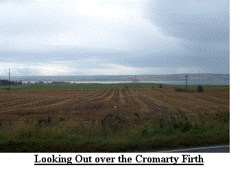
Eventually the rain eased and I got my first
sighting of 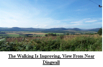 the
Cromarty Firth with its Oil and Gas rigs close to the shore.
As I was already soaking wet and tomorrow’s
target destination was fixed I opted to walk a few extra miles leaving only 11
or so for tomorrow. I also learned
later that Inverness was flooded today and several roads were closed, including
that running by Loch Ness, due to land
slides caused by the rain.
the
Cromarty Firth with its Oil and Gas rigs close to the shore.
As I was already soaking wet and tomorrow’s
target destination was fixed I opted to walk a few extra miles leaving only 11
or so for tomorrow. I also learned
later that Inverness was flooded today and several roads were closed, including
that running by Loch Ness, due to land
slides caused by the rain.
Day 9 (Mon 9th Sep).
By now my left leg was getting very painful
so after a 6:30am alarm call I dug out my FA kit and practised my
bandaging. On the plus side my feet
were recovering and it was no longer necessary to replace the 20 layers of
Compeeds. After my weekly contact with
Broadland I took my first steps at 8:46am in glorious sunshine. The 3 miles to
Dingwall quickly passed. After a minor,
unplanned, diversion in a northerly direction I retraced my steps and headed in
the right direction. I now had 2
choices; Follow the A835 or the banks of the River Connon.
My biggest problem in Scotland was knowing
where I could and where I could not walk.
As the path by the river was not clear, and involved an extra mile or so
I opted for the A835. Luckily the old
road was still in existence and this provided a very pleasant route with vistas
to the south and west of the mountains I would be entering in a couple of
days. By 12:30pm I had arrived at my
destination, my left leg was now extremely painful and I was relieved to take a
rest and climb into the car. As we had
finished so early we called in at the Glen Morangie Distillery, my leg felt
better already!
Day 10 (Tue 10thSep). Today was my first planned rest day and that is what I needed.
The pain from my left leg gave me plenty to
worry about. One of my greatest fears
when planning this walk was getting an injury early on and not being able to
proceed. I had decided that even if I
couldn’t reach Lands End I had to make every effort to reach the English
Border, but now even that looked in doubt.
Even my support team were whispering words of concern between each
other. Still I had spare days and I
could afford a couple of days rest if required.
So whilst everyone else went out I moped around at the cottage
revising my plans and planning accommodation for the next few weeks.
Day 11 (Wed 11thSep) – unplanned rest day! My leg was still painful, especially when I
walked so I found my way to a pharmacist.
After some discussion we concluded my best course of action was to keep
it strapped up but also cover it in Nurofen Gel. Having sold my shares in
Compeed I now invested heavily in crepe bandages and Nurofen.
After a visit to Dunrobin Castle we returned
to the accommodation for a B-B-Q.
Day 12 (Thu 12thSep). The alarm sounded at 6:25am
and I conducted a full functional check of legs and feet – all passed.
With bandages, gel and a single Compeed
applied I set out into the next stretch of open country following my next hill
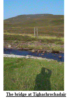
track, no 269. Once again I saw a herd
of red deer as I approached what the guide book described as ‘the remains of a
footbridge’ at Tighachrochadair. The
remains barely resembled remains and you would be hard pushed to believe they
were ever part of a bridge! Fortunately
the burn was slow and low and I was able to easily cross it.
After a short break I climbed up to over
350m (1100ft) before embarking on a long but gentle descent into Strathglass, a
wide, flat and very pretty Glen. It was
now back onto tarmac for 9 miles and with the sun high in the sky I was glad of
some tree cover to provide shelter.
Despite the 21 miles and high temperatures my leg was holding out and by
4:30pm we were heading home.
 Day 13 (Fri 13thSep). Despite the bad omens, the day, the date, low cloud and high hills I
set out with a spring in my step. The
first couple of miles was on tarmac and hard track before turning due South to
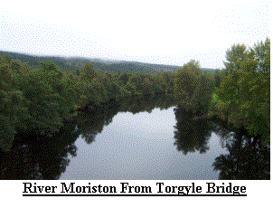
climb to my highest point to date at over 550m (1800ft) where I intercepted
hill track no 251 which would lead me to Torgoyle bridge in Glen Moriston.
The walk was uneventful and the descent to
Glen Moriston almost tedious, but the views in all directions made up for it
and the weather improved by the minute.
By the time I arrived at my destination at 2:10pm I was in full sun and
rapidly running out of water. By now
the journey back to our accommodation was over 75 miles and taking in excess of
2hrs. To cap it all the road to Inverness
was closed due to serious land slides which had occurred on Sunday.
Day 13 (Fri 13thSep). Despite the bad omens, the day, the date, low cloud and high hills I
set out with a spring in my step. The
first couple of miles was on tarmac and hard track before turning due South to
climb to my highest point to date at over 550m (1800ft) where I intercepted
hill track no 251 which would lead me to Torgoyle bridge in Glen Moriston.
The walk was uneventful and the descent to
Glen Moriston almost tedious, but the views in all directions made up for it
and the weather improved by the minute.
By the time I arrived at my destination at 2:10pm I was in full sun and
rapidly running out of water. By now
the journey back to our accommodation was over 75 miles and taking in excess of
2hrs. To cap it all the road to Inverness
was closed due to serious land slides which had occurred on Sunday.
 Day 14 (Sat 14th Sep). We had reached the end of the second week and I was now over 180 miles into my
walk. With a long run out the alarm sounded at 6:30am and after applying the bandages to my left leg we set out for
the start, saying farewell to our cottage. The next 5 weeks would be spent under canvas, or to be more precise,
Nylon. We arrived at the start point at 9:30am, my latest to date, and the
climb ahead rose sharply and into thick mist. Having no idea how well, or badly, defined the path would be I checked
the GPS, map and compass and set out. The initial climb through the forestry was uneventful but I couldn’t
help admiring the machinery parked by the track, they looked like sleeping
monsters. Soon I was into mist and startled more than one deer as I approached the open moor.
I needn’t have worried about navigation the path pretty much followed a line of pylons making route finding easy if not a
little boggy. By 12:00pm I had descended into Fort Augustus and had arrived at the head of Loch Ness in the
Great Glen. I was now to join my first long distance route. Only formally opened in April of 2002 the Great Glen Way should have been a fantastic walk
but as I set out along the Caledonian Canal tow path my opinion soon changed. Fort Augustus is like an
Oasis. After 2 weeks of virtual emptiness it was like a bustling city with the people, cars, boats and endless
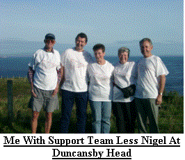
shops and cafes. I opted for a tea stop and was joined by Rite (my wife) and Nigel (my brother) who would transport,
feed and pamper me until the end of November. The weather had also improved and once more I was walking in full sun,
great for the tan, but keeping me warmer than I would have liked. With well defined paths and no inclines I
stretched out my legs and soon completed the 8 or so miles to Laggon Locks, arriving at 4:10pm. As I rested and
awaited my carriage to take me to my tent I met a chap from Australia who was into his last fortnight of walking Lands End to JOG.
After exchanging pleasantries we discussed the quality, or not, of paths between the 2 extremes, I was not encouraged.
But we did agree that the Great Glen way could be considerably better simply by raising it a few hundred feet!
Day 14 (Sat 14th Sep). We had reached the end of the second week and I was now over 180 miles into my
walk. With a long run out the alarm sounded at 6:30am and after applying the bandages to my left leg we set out for
the start, saying farewell to our cottage. The next 5 weeks would be spent under canvas, or to be more precise,
Nylon. We arrived at the start point at 9:30am, my latest to date, and the
climb ahead rose sharply and into thick mist. Having no idea how well, or badly, defined the path would be I checked
the GPS, map and compass and set out. The initial climb through the forestry was uneventful but I couldn’t
help admiring the machinery parked by the track, they looked like sleeping
monsters. Soon I was into mist and startled more than one deer as I approached the open moor.
I needn’t have worried about navigation the path pretty much followed a line of pylons making route finding easy if not a
little boggy. By 12:00pm I had descended into Fort Augustus and had arrived at the head of Loch Ness in the
Great Glen. I was now to join my first long distance route. Only formally opened in April of 2002 the Great Glen Way should have been a fantastic walk
but as I set out along the Caledonian Canal tow path my opinion soon changed. Fort Augustus is like an
Oasis. After 2 weeks of virtual emptiness it was like a bustling city with the people, cars, boats and endless
shops and cafes. I opted for a tea stop and was joined by Rite (my wife) and Nigel (my brother) who would transport,
feed and pamper me until the end of November. The weather had also improved and once more I was walking in full sun,
great for the tan, but keeping me warmer than I would have liked. With well defined paths and no inclines I
stretched out my legs and soon completed the 8 or so miles to Laggon Locks, arriving at 4:10pm. As I rested and
awaited my carriage to take me to my tent I met a chap from Australia who was into his last fortnight of walking Lands End to JOG.
After exchanging pleasantries we discussed the quality, or not, of paths between the 2 extremes, I was not encouraged.
But we did agree that the Great Glen way could be considerably better simply by raising it a few hundred feet!
Day 15 to Day 21 (Sun 15thSep to Sat 21st Sep)
Day 15 (Sun 15th Sep). After
a good night in the tent Nigel ran me out for the start.
I left Laggon Locks at 8am in warm weather
but a heavy mist. The mist didn’t
 really matter as all I could see was trees, mile after mile of trees.
Occasionally I got a glimpse of Loch Lochy.
By now I had decided I would never try the
really matter as all I could see was trees, mile after mile of trees.
Occasionally I got a glimpse of Loch Lochy.
By now I had decided I would never try the
 Great Glen way. Loch Lochy is only
about 8 miles long and was already testing my patience, I dread to think what
it would be like along Loch Ness at over 20 miles long. Eventually the trees
subsided and I was once again on the canal towpath.
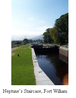
A couple of miles from Banavie and the Neptune’s Staircase, an
impressive flight of locks. Here I met
a chap from Norwich. I soon discovered
he had heard me on the radio. Before we
parted he offered a donation, which I readily accepted and we both set out to
complete our respective challenges. The
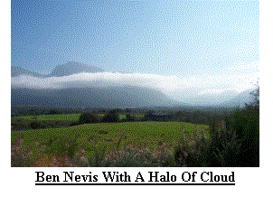
skies had now cleared and I was only a few miles from Fort William, the largest
place on route to date. For those that
don’t know Fort William is set in beautiful country at the base of Britain’s
highest mountain, Ben Nevis. Today the
whole mountain was visible and the views were breathtaking, perhaps the Great
Glen way was not so bad after all. As I
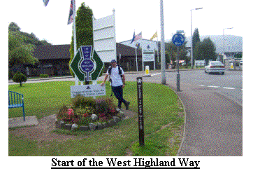
entered Fort William I passed the start, or officially the end, of the West Highland
Way, one of the UK’s most popular long distance routes.
I was quite encouraged to see people
completing the WHW looking far worse than me and they had only walked 94 miles
compared with my 200+. Knowing that I
would be meeting people for the next few days gave me a boost and I walked into
our campsite with confidence, now certain that I would at least reach the
English Border. I finished at 3:10pm
Great Glen way. Loch Lochy is only
about 8 miles long and was already testing my patience, I dread to think what
it would be like along Loch Ness at over 20 miles long. Eventually the trees
subsided and I was once again on the canal towpath.
A couple of miles from Banavie and the Neptune’s Staircase, an
impressive flight of locks. Here I met
a chap from Norwich. I soon discovered
he had heard me on the radio. Before we
parted he offered a donation, which I readily accepted and we both set out to
complete our respective challenges. The
skies had now cleared and I was only a few miles from Fort William, the largest
place on route to date. For those that
don’t know Fort William is set in beautiful country at the base of Britain’s
highest mountain, Ben Nevis. Today the
whole mountain was visible and the views were breathtaking, perhaps the Great
Glen way was not so bad after all. As I
entered Fort William I passed the start, or officially the end, of the West Highland
Way, one of the UK’s most popular long distance routes.
I was quite encouraged to see people
completing the WHW looking far worse than me and they had only walked 94 miles
compared with my 200+. Knowing that I
would be meeting people for the next few days gave me a boost and I walked into
our campsite with confidence, now certain that I would at least reach the
English Border. I finished at 3:10pm
Day 16 (Mon 16thSep) had the alarm going at 6:50am.
I planned 19 miles along the WHW with my longest climb to
 date, only 550m but from sea level! Before I set out I held my appointment with Broadland and was able to describe the view
looking up Ben Nevis, how I wish I were back there now! I set out from the campsite at 7:55am and
had soon gained a fair height. The views along Glen Nevis were breathtaking, but soon they fell behind me as I
entered yet more forestry. By 9am I had left the forest behind and found myself on an old military road heading for
Kinlochleven. A sign I passed suggested the walk to Kinlochleven was both strenuous and remote and should not be
attempted lightly. It also suggested the route
date, only 550m but from sea level! Before I set out I held my appointment with Broadland and was able to describe the view
looking up Ben Nevis, how I wish I were back there now! I set out from the campsite at 7:55am and
had soon gained a fair height. The views along Glen Nevis were breathtaking, but soon they fell behind me as I
entered yet more forestry. By 9am I had left the forest behind and found myself on an old military road heading for
Kinlochleven. A sign I passed suggested the walk to Kinlochleven was both strenuous and remote and should not be
attempted lightly. It also suggested the route
 would take in excess of 3hrs I had planned 1˝! I hoped I hadn’t made another faux pas.
About 9:15am I met my first person walking the WHW, by 9:20 I met the
next 100! There seemed to be swarms walking out of Kinlochleven, German, Dutch, Australian, Canadian and
English. Soon the flood became a trickle and then no one. I did take great relish in explaining I had walked
from JOG a mere 200+ miles North. It took me about 1Ľhrs to reach Kinlochleven and after a tea stop in the local
hostelry I started my climb, which would take me over the top to the head of Glen Coe. I now met those walking the
WHW that were heading for Kinlochleven, I also realised I would see many of them again as I would be returning to Glen Nevis campsite for another 2
nights. I arrived at Altnafeadh, at the top of Glen Coe, at 2:50pm. This had been one of my best days walking so far and whetted my appetite for more.
would take in excess of 3hrs I had planned 1˝! I hoped I hadn’t made another faux pas.
About 9:15am I met my first person walking the WHW, by 9:20 I met the
next 100! There seemed to be swarms walking out of Kinlochleven, German, Dutch, Australian, Canadian and
English. Soon the flood became a trickle and then no one. I did take great relish in explaining I had walked
from JOG a mere 200+ miles North. It took me about 1Ľhrs to reach Kinlochleven and after a tea stop in the local
hostelry I started my climb, which would take me over the top to the head of Glen Coe. I now met those walking the
WHW that were heading for Kinlochleven, I also realised I would see many of them again as I would be returning to Glen Nevis campsite for another 2
nights. I arrived at Altnafeadh, at the top of Glen Coe, at 2:50pm. This had been one of my best days walking so far and whetted my appetite for more.
 Day 17 (Tue 17th Sep) was another planned rest day.
Nigel took the opportunity to climb Ben
Nevis, I opted to climb Anoch Mor with my Wife, but we did it by means of a
chair lift! Once again the weather was
proving excellent and we had great vistas across the whole northwest of
Scotland as far as the eye could see.
Nigel was not so lucky!
Day 17 (Tue 17th Sep) was another planned rest day.
Nigel took the opportunity to climb Ben
Nevis, I opted to climb Anoch Mor with my Wife, but we did it by means of a
chair lift! Once again the weather was
proving excellent and we had great vistas across the whole northwest of
Scotland as far as the eye could see.
Nigel was not so lucky!
Day 18 (Wed 18th
Sep) found me awaking at 6:30am, but I noticed that the light at this time
of day was now not as strong, the dark mornings and evenings were definitely
upon us. After the short drive up Glen
Coe I set out for the Bridge of Ochy.
Despite starting walking at 8:25am I did meet a couple of people who had
also already set out for their days walk.
However, when I arrived at the Kingshouse Hotel, a remote hotel on the
edge of Rannoch moor, most of the campers were either still in bed or just
having breakfast – I wonder if they realised they were missing the best part of
the day. After crossing the A82 I
realised something was watching me but it wasn’t until I looked at the photos
that I was able to confirm several Deer were on a hillock less than 50yds
away. As I drew closer to the Inveroran
Hotel I was caught in the morning rush of WHW walkers moving north.
The path had now become a cobbled road,
apparently laid many years before the days of tarmac, but very uncomfortable to
walk on – I would rather be on tarmac!
I arrived in the Bridge of Ochy at about 1pm so I chose to continue to
Tyndrum. This later proved a wise move
as I discovered I had omitted about 6 miles from my route plan of the next
day. The walk to Tyndrum was uneventful
and I arrived at the Lower Station at 3:10pm.
We now returned to Glen Nevis for the last time.
I should also mention that I was now
receiving reports along the WHW grapevine that 2 gentlemen, both in their 60’s
were a few days ahead of me. There is
nothing unusual in this, several of those I met heading north on the WHW were
mature in years! What was of interest,
particularly to me, was that these 2 gents were also attempting JOG to Lands
End. I hoped that I would meet them
before they left the WHW, as the route they took beyond it was not fixed.
 Day 19 (Thu 19th Sep) saw us rise at 6:30am followed by a rush of activity to get the
camping equipment packed in the car – it fitted but only just.
By 8:25 I was walking and heading south from
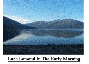
Tyndrum looking forward to seeing Loch Lomond for the first time.
I had expected much of the same from the WHW
but after an initial track that didn’t seem to know exactly where it wanted to
go I arrived in more woodland, but it could just as easily have been a roller
coaster. For about 6 miles I climbed up
a hill and down a hill, up a hill and down a hill… Some of the climbs caused me
some exertion, but I continued southward all the same. At 1:20pm I got my first
view of Loch Lomond and despite not looking forward to walking for several
miles along its edge it turned out to be a very pleasant walk.
After clambering over rocks on the very
rough path I arrived at the Inversnaid Hotel (GR NN337089) at 3:15pm.
Here we had some refreshment before the 30
mile journey to our campsite on the shore of Loch Lomond.
I should say a word about our campsite, it
was very nice, the facilities were excellent as were the views but as the light
faded so the midgies came out – time to retire!
Day 19 (Thu 19th Sep) saw us rise at 6:30am followed by a rush of activity to get the
camping equipment packed in the car – it fitted but only just.
By 8:25 I was walking and heading south from
Tyndrum looking forward to seeing Loch Lomond for the first time.
I had expected much of the same from the WHW
but after an initial track that didn’t seem to know exactly where it wanted to
go I arrived in more woodland, but it could just as easily have been a roller
coaster. For about 6 miles I climbed up
a hill and down a hill, up a hill and down a hill… Some of the climbs caused me
some exertion, but I continued southward all the same. At 1:20pm I got my first
view of Loch Lomond and despite not looking forward to walking for several
miles along its edge it turned out to be a very pleasant walk.
After clambering over rocks on the very
rough path I arrived at the Inversnaid Hotel (GR NN337089) at 3:15pm.
Here we had some refreshment before the 30
mile journey to our campsite on the shore of Loch Lomond.
I should say a word about our campsite, it
was very nice, the facilities were excellent as were the views but as the light
faded so the midgies came out – time to retire!
 Day 20 (Fri 20th Sep) was another early call, 6:30am and by 8:35am I
was walking. The path from Inversnaid
continued in the same vain for a short distance before flattening out and
becoming a very pleasant track offering excellent views over loch Lomond. After
a short stop at our campsite for a cup of tea I arrived in the village of
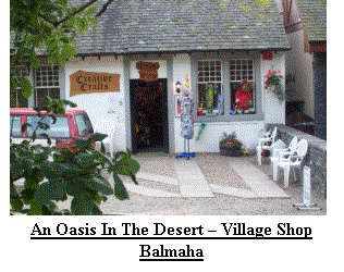
Balmaha (GR NS419908) where I treated myself to an ice cream from the Balmaha
Village Shop. As was often the case
with people I met on-route I got talking and left with more sponsorship.
After passing my planned finish point of
Drymen, I pressed on to Gartness (GR NS502869) where we called in to a very
nice teashop for a drink and sticky bun. I was now within sight of the end of
the WHW, only about 9 miles south. I had continued to receive reports of the 2
gents ahead of me also heading for Lands End, but today the reports
changed. One of the gents had incurred
an injury and had dropped out at Rowardennan Lodge Youth Hostel, leaving his
colleague to proceed alone. Alas I
believe I passed the remaining gent between Balmaha and Drymen and so never met
up, I hope he made it.
Day 20 (Fri 20th Sep) was another early call, 6:30am and by 8:35am I
was walking. The path from Inversnaid
continued in the same vain for a short distance before flattening out and
becoming a very pleasant track offering excellent views over loch Lomond. After
a short stop at our campsite for a cup of tea I arrived in the village of
Balmaha (GR NS419908) where I treated myself to an ice cream from the Balmaha
Village Shop. As was often the case
with people I met on-route I got talking and left with more sponsorship.
After passing my planned finish point of
Drymen, I pressed on to Gartness (GR NS502869) where we called in to a very
nice teashop for a drink and sticky bun. I was now within sight of the end of
the WHW, only about 9 miles south. I had continued to receive reports of the 2
gents ahead of me also heading for Lands End, but today the reports
changed. One of the gents had incurred
an injury and had dropped out at Rowardennan Lodge Youth Hostel, leaving his
colleague to proceed alone. Alas I
believe I passed the remaining gent between Balmaha and Drymen and so never met
up, I hope he made it.
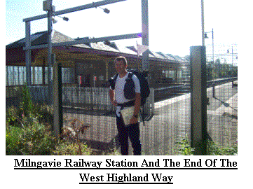
 Day 21 (Sat 21st Sep). The
end of my 3rd week and by 11am I was at the end of my first official
Long Distance Route. The last day of
the WHW, first day for most, was easy; Old railway line, quiet lanes, forest
tracks and parkland. As I descended
into Milngavie a couple of gents enjoying their breakfast of sandwiches and
Extra Strong Lager said hello, or at least I think they did.
I had arrived in the suburbs of Glasgow and I could not understand a word! I soon
left Milngavie behind and headed out following a quiet stream before emerging
on what I had expected to be a quiet road.
How wrong I was, it must have been a major thoroughfare and I spent the
next 3 miles dodging cars as I searched for a path marked on the map.
Once again the cartographers were laughing
at me from afar! I can’t leave this
area without mentioning the Antonine Wall.
This roman wall was erected much further north than the more famous
Hadrian’s wall and its course is clearly marked on the maps but there is no
sign of it on the ground. I am
surprised the Scots don’t make more of it as they seem eager to highlight
anything that may squeeze a few more pence out of the unsuspecting
tourist! I had not looked forward at
all to the stretch of my walk from Glasgow to the Pentland Hills and already my
fears were being realised. I soon
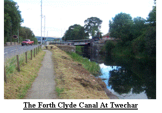
intercepted the Forth & Clyde
canal, which I would be using to carry me east for a few miles.
Day 21 (Sat 21st Sep). The
end of my 3rd week and by 11am I was at the end of my first official
Long Distance Route. The last day of
the WHW, first day for most, was easy; Old railway line, quiet lanes, forest
tracks and parkland. As I descended
into Milngavie a couple of gents enjoying their breakfast of sandwiches and
Extra Strong Lager said hello, or at least I think they did.
I had arrived in the suburbs of Glasgow and I could not understand a word! I soon
left Milngavie behind and headed out following a quiet stream before emerging
on what I had expected to be a quiet road.
How wrong I was, it must have been a major thoroughfare and I spent the
next 3 miles dodging cars as I searched for a path marked on the map.
Once again the cartographers were laughing
at me from afar! I can’t leave this
area without mentioning the Antonine Wall.
This roman wall was erected much further north than the more famous
Hadrian’s wall and its course is clearly marked on the maps but there is no
sign of it on the ground. I am
surprised the Scots don’t make more of it as they seem eager to highlight
anything that may squeeze a few more pence out of the unsuspecting
tourist! I had not looked forward at
all to the stretch of my walk from Glasgow to the Pentland Hills and already my
fears were being realised. I soon
intercepted the Forth & Clyde
canal, which I would be using to carry me east for a few miles.
 I finished the day just west of
Kirkintilloch at 1:30pm. We returned to
the peace of the countryside.
I finished the day just west of
Kirkintilloch at 1:30pm. We returned to
the peace of the countryside.
Day 22 to Day 28 (Sun 22th Sep to Sat 28st Sep)
Day 22 (Sun 22nd
Sep) had us up again at 6:30am and we were greeted with cloudless
skies. Today we were moving camp so
 after packing the car we headed out. The roads were much quieter and by 8:20am I was walking. I have nothing against the people who live
in and around Glasgow but for most of the day I felt slightly ill at ease. After walking
through Kirkintilloch I left the canal at Twechar where I turned onto some
minor roads and a couple of footpaths. By 12pm I was close to Plains (GR
NS7967) on the outskirts of Airdrie but found my planned way blocked by a hole
in the ground so large I would need climbing kit to descend!
The problem a huge open cast mine!
I eventually found the Sustran's route 75 at 1:30pm after a 2 mile detour. Plains
did nothing to reduce my unease. After plodding along the cycleway for several miles,
dodging mad cyclists, ducking under fishing rods, jumping out of the way of
kids on motor bikes and avoiding dogs with jowls so huge they made the
guardians of hell look tame I finished the day near Armadale to find Rite and
Nigel in the car with all doors securely locked!
It was 3:40pm. I then found that the campsite was no better, oh joy!
We planned to stay for 3 nights, I wasn’t sure we would survive 1, and
Rite was so impressed she was keen to go home!!
after packing the car we headed out. The roads were much quieter and by 8:20am I was walking. I have nothing against the people who live
in and around Glasgow but for most of the day I felt slightly ill at ease. After walking
through Kirkintilloch I left the canal at Twechar where I turned onto some
minor roads and a couple of footpaths. By 12pm I was close to Plains (GR
NS7967) on the outskirts of Airdrie but found my planned way blocked by a hole
in the ground so large I would need climbing kit to descend!
The problem a huge open cast mine!
I eventually found the Sustran's route 75 at 1:30pm after a 2 mile detour. Plains
did nothing to reduce my unease. After plodding along the cycleway for several miles,
dodging mad cyclists, ducking under fishing rods, jumping out of the way of
kids on motor bikes and avoiding dogs with jowls so huge they made the
guardians of hell look tame I finished the day near Armadale to find Rite and
Nigel in the car with all doors securely locked!
It was 3:40pm. I then found that the campsite was no better, oh joy!
We planned to stay for 3 nights, I wasn’t sure we would survive 1, and
Rite was so impressed she was keen to go home!!
 Day 23 (Mon 23rd
Sep) was a rest day so I rose at 7:15 to a fantastic clear, slightly misty
morning and awaited my call from Broadland.
After a leisurely breakfast we headed into Edinburgh where we had a very
pleasant day before returning to the campsite and deciding we would move in the
morning regardless of how far the journey would be. I was also becoming
concerned about a niggling pain just above my left knee.
Day 23 (Mon 23rd
Sep) was a rest day so I rose at 7:15 to a fantastic clear, slightly misty
morning and awaited my call from Broadland.
After a leisurely breakfast we headed into Edinburgh where we had a very
pleasant day before returning to the campsite and deciding we would move in the
morning regardless of how far the journey would be. I was also becoming
concerned about a niggling pain just above my left knee.
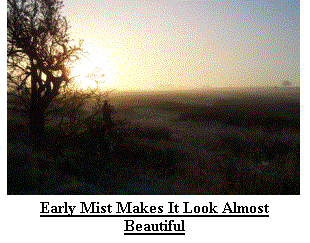 Day 24 (Tue 24thSep) welcomed us with frost. Nigel
had persuaded Rite to have a lie in and he transported me to my start point,
which looked quite pleasant in the thick early morning frost and
fog. I was walking by 7:30am.
As the sun warmed the mist lifted and I
recognised the now familiar grey housing, re-claimed industrial land and covered
land fill sites. I was continuing along
route 75 and it went on and on and on and on and on… Until eventually I turned
onto a more southerly heading at East Calder.
I should mention some of the highlights; the first was a series of
Pyramids obviously placed along the cycle way to help those using it take their
minds of the beauty around them. The
second was the M8, my first motorway since leaving JOG.
I should also mention Livingston village,
one of the very few places in this area that actually looked a nice place to
live. I had decided that morning that
if I could manage the extra 6 miles over the Pentland hills I would do it but
the miles of tarmac had upset my left knee in a very painful way and
Day 24 (Tue 24thSep) welcomed us with frost. Nigel
had persuaded Rite to have a lie in and he transported me to my start point,
which looked quite pleasant in the thick early morning frost and
fog. I was walking by 7:30am.
As the sun warmed the mist lifted and I
recognised the now familiar grey housing, re-claimed industrial land and covered
land fill sites. I was continuing along
route 75 and it went on and on and on and on and on… Until eventually I turned
onto a more southerly heading at East Calder.
I should mention some of the highlights; the first was a series of
Pyramids obviously placed along the cycle way to help those using it take their
minds of the beauty around them. The
second was the M8, my first motorway since leaving JOG.
I should also mention Livingston village,
one of the very few places in this area that actually looked a nice place to
live. I had decided that morning that
if I could manage the extra 6 miles over the Pentland hills I would do it but
the miles of tarmac had upset my left knee in a very painful way and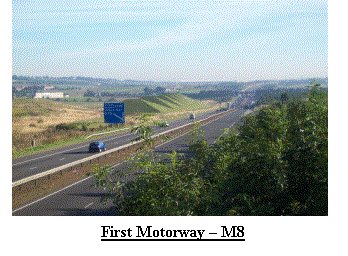 even
as I left the cycle way I was unsure of how far I could continue.
I should also mention that the reason for
contemplating this 6 mile addition was to reduce the miles in the car for my
collection and dispatch. Instead of a 40 mile each way trip it would be about
15. I made it to my planned pick up
point, a parking area on the A70 (GR NT101627). But an hour earlier I had
called Rite & Nigel to change my collection point and so I set out into the
hills once more. It was bliss, I can
only compare it with spending an hour roasting yourself by a hot fire and
even
as I left the cycle way I was unsure of how far I could continue.
I should also mention that the reason for
contemplating this 6 mile addition was to reduce the miles in the car for my
collection and dispatch. Instead of a 40 mile each way trip it would be about
15. I made it to my planned pick up
point, a parking area on the A70 (GR NT101627). But an hour earlier I had
called Rite & Nigel to change my collection point and so I set out into the
hills once more. It was bliss, I can
only compare it with spending an hour roasting yourself by a hot fire and
 then being allowed to plunge yourself into beautiful cool and refreshing water, even
my knee approved. As I climbed (hill track no 51) I got my last view of the, now distant, highlands and my first
view of the Cheviots, my route out of Scotland. I finished at 3:40pm and we
returned to a very nice campsite in Peebles.
then being allowed to plunge yourself into beautiful cool and refreshing water, even
my knee approved. As I climbed (hill track no 51) I got my last view of the, now distant, highlands and my first
view of the Cheviots, my route out of Scotland. I finished at 3:40pm and we
returned to a very nice campsite in Peebles.
Day 25 (Wed 25th Sep) allowed me a lie in and the alarm sounded at 7:05am.
For the first time in days it looked as if
it might rain but as I set out on foot at 8:30am the sky was starting to
clear. Nothing of interest today, but
it was a pleasant walk through West Linton and deeper into the Borders before I
arrived in
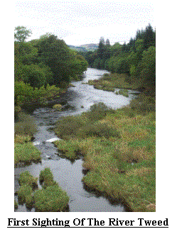 Peebles. I realised I was now close to the 400 mile point and that I was likely to actually complete my walk, within a couple of
days I would also reach the England, Scotland border.
Peebles turned out to be a little oasis with its busy High Street
and little shops. Having finished my days walk at 2:10pm we called into the
Country Shop, a very pleasant tea shop that we later returned to several times.
Peebles. I realised I was now close to the 400 mile point and that I was likely to actually complete my walk, within a couple of
days I would also reach the England, Scotland border.
Peebles turned out to be a little oasis with its busy High Street
and little shops. Having finished my days walk at 2:10pm we called into the
Country Shop, a very pleasant tea shop that we later returned to several times.
Day 26 (Thu 26th Sep). This was a very important day
and despite having only just had a rest day I rose late and cooked breakfast.
We spent the day visiting local attractions, especially Traquaire House,
reputed to be the oldest lived in house in Scotland.
The Taxi arrived at the campsite at 7pm and we departed for a
very enjoyable meal in the Peebles Tontine Hotel to celebrate my Wife’s
Birthday.
Day 27 (Fri 27th Sep) started at 6:45am with fairly clear skies and a cloud base below that
of the surrounding hills. I was walking by 7:45am and found myself climbing
along a well defined path on-route for Birkscairn Hill (GR NT273332). After
contouring around some forestry I dropped down to intercept the Southern Upland
way near Traquaire. From here I climbed
over Minch Moor and met 2 ladies, both looking for a man.
I explained that I was unavailable and
accounted for but I could probably do a deal with my Brother and Uncle, both
unattached. Having paid their
sponsorship we parted. My brother and
Uncle are still available! The Southern
Upland way was my first high level route and whetted my appetite for a return
trip sometime in the future. I arrived
at the river Tweed and my transport home at 1:50pm.
This was an excellent day, all off road and no niggles and I had
cracked the 400 mile barrier.
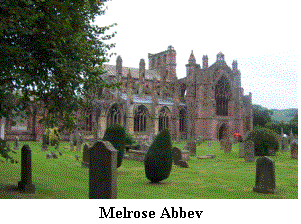 Day 28 (Sat 28th Sep) arrived with relief. It turned
out that the last weekend in Sep is the ‘Glasgow Weekend’ and the campsite had
filled to capacity. Our neighbours, who
were friendly enough at the start, then spent the night on the phone telling
all their friends where they were, what they were doing, what we were doing
Day 28 (Sat 28th Sep) arrived with relief. It turned
out that the last weekend in Sep is the ‘Glasgow Weekend’ and the campsite had
filled to capacity. Our neighbours, who
were friendly enough at the start, then spent the night on the phone telling
all their friends where they were, what they were doing, what we were doing
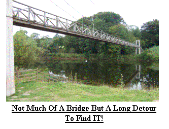 and what everyone in the Borders was doing. And, apparently, he ran a chicken farm, as there were obviously a lot of
‘hens’! We awoke at 6:30am, after next to no sleep, quickly packed the car and
set out to my start point. This would be my penultimate day in Scotland and I set out at 8:05am heading for
Galashiels. Having called into Tescos for breakfast I followed the Tweed for the next couple of miles, some of it was
exceptionally pretty and I felt reluctant to leave it behind at Melrose, another very picturesque village. By lunchtime I was passing a monument to
William Wallace and had joined the St Cuthbert Way and re-joined the Tweed. By early afternoon the St Cuthbert Way
joined Dere Street, an old roman road running parallel to the A68, a major route into and out of Scotland. After passing through the grounds of
Harestanes, near Jeburgh, I arrived at my pick up point at 3:45pm. We now said farewell to Nigel who had to
return to work, and welcomed my parents who joined us for the next few days.
and what everyone in the Borders was doing. And, apparently, he ran a chicken farm, as there were obviously a lot of
‘hens’! We awoke at 6:30am, after next to no sleep, quickly packed the car and
set out to my start point. This would be my penultimate day in Scotland and I set out at 8:05am heading for
Galashiels. Having called into Tescos for breakfast I followed the Tweed for the next couple of miles, some of it was
exceptionally pretty and I felt reluctant to leave it behind at Melrose, another very picturesque village. By lunchtime I was passing a monument to
William Wallace and had joined the St Cuthbert Way and re-joined the Tweed. By early afternoon the St Cuthbert Way
joined Dere Street, an old roman road running parallel to the A68, a major route into and out of Scotland. After passing through the grounds of
Harestanes, near Jeburgh, I arrived at my pick up point at 3:45pm. We now said farewell to Nigel who had to
return to work, and welcomed my parents who joined us for the next few days.
Day 29 to Day 35 (Sun 29th Sep to Sat 5th Oct)
Day 29 (Sun 29th Sep) was to be my last day in Scotland and despite a late rise, 7am, I was
 walking by 8am. I continued along Dere Street, saying farewell to the St Cuthbert Way after about 2 miles.
The ground round about was slowly rising and I realised how empty of human things this area was.
The last time I had walked in this area was in 1993 when I completed the Pennine way and I decided then I would like to return to this
area, the same thoughts occurred to me now. As I left my last stretch of Scottish tarmac I climbed into the high
Cheviot region and soon I could see the boundary fence on the
walking by 8am. I continued along Dere Street, saying farewell to the St Cuthbert Way after about 2 miles.
The ground round about was slowly rising and I realised how empty of human things this area was.
The last time I had walked in this area was in 1993 when I completed the Pennine way and I decided then I would like to return to this
area, the same thoughts occurred to me now. As I left my last stretch of Scottish tarmac I climbed into the high
Cheviot region and soon I could see the boundary fence on the
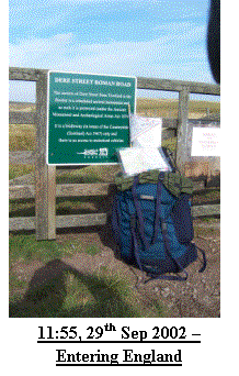 ridge ahead, England was getting closer and so was my first major milestone. At
11.45am I arrived at the border and rested for a while whilst I ate lunch and
contemplated the past 4 weeks. Since
leaving JOG I had completed 430 miles, followed some or all of 4 recognised
long distance routes, lost about a stone in weight and for the first time I was
confident of reaching my target destination. For now I needed to cross into
England, say farewell to Scotland and complete my days walk to Byrness.
I now met 2 walkers attempting the Pennine Way, my route South for the next 2 weeks.
After a short conversation we parted in opposite directions, each envious
of the other, they of my walk and I of their nearness to completion!
Apart from encountering several motor cyclists who should not have been there, a couple of bogs from hell and fantastic views
nothing else of interest happened. I arrived in Byrness at 2:20pm. After
some refreshment in a local hostelry we headed back to camp in Jedburgh.
ridge ahead, England was getting closer and so was my first major milestone. At
11.45am I arrived at the border and rested for a while whilst I ate lunch and
contemplated the past 4 weeks. Since
leaving JOG I had completed 430 miles, followed some or all of 4 recognised
long distance routes, lost about a stone in weight and for the first time I was
confident of reaching my target destination. For now I needed to cross into
England, say farewell to Scotland and complete my days walk to Byrness.
I now met 2 walkers attempting the Pennine Way, my route South for the next 2 weeks.
After a short conversation we parted in opposite directions, each envious
of the other, they of my walk and I of their nearness to completion!
Apart from encountering several motor cyclists who should not have been there, a couple of bogs from hell and fantastic views
nothing else of interest happened. I arrived in Byrness at 2:20pm. After
some refreshment in a local hostelry we headed back to camp in Jedburgh.
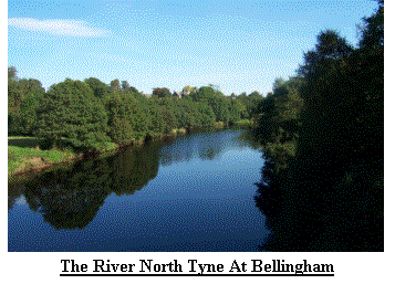 Day 30 (Mon 30th Sep). My
daily ritual started at 6:30 in virtual darkness and after packing we departed
the campsite to find a parking area where I could talk to Broadland.
By 8:10am I was walking, now along the edge
of and later in the depths of Keilder Forest, one of, if not the, largest
forested area in England. I encountered
more of the tree eating monsters, but these were alive and eating trees as if
they were matchsticks. I emerged from
the forest at about 10am and set out across open moor to the village of Bellingham
(GR NY8383) in the heart of Northumberland.
This quiet little village sits on the banks of the North Tyne and is
well worth a visit. After meeting Rite
and my Parents for a tea and sticky bun I continued southward through swarms of
little black flies enjoying the autumn sunshine.
After several minor diversions whilst I tried to follow the path
I arrived at my pick up point at 3.10pm.
As I removed my rucksack I heard an aircraft pass overhead, not unusual
in these parts, but I recognised this as one of the RAF’s newest fighters known
as the ‘EFA’, not yet in service. We
now headed south to our campsite near Haltwhistle, apparently the centre of the
United Kingdom. Having only recently joined the PW reports of those ahead of me were scarce, but already I had hints
that 2 ladies, both in their 70’s were about a week ahead. A quick calculation suggested that I may
have a good chance of catching and meeting them.
Day 30 (Mon 30th Sep). My
daily ritual started at 6:30 in virtual darkness and after packing we departed
the campsite to find a parking area where I could talk to Broadland.
By 8:10am I was walking, now along the edge
of and later in the depths of Keilder Forest, one of, if not the, largest
forested area in England. I encountered
more of the tree eating monsters, but these were alive and eating trees as if
they were matchsticks. I emerged from
the forest at about 10am and set out across open moor to the village of Bellingham
(GR NY8383) in the heart of Northumberland.
This quiet little village sits on the banks of the North Tyne and is
well worth a visit. After meeting Rite
and my Parents for a tea and sticky bun I continued southward through swarms of
little black flies enjoying the autumn sunshine.
After several minor diversions whilst I tried to follow the path
I arrived at my pick up point at 3.10pm.
As I removed my rucksack I heard an aircraft pass overhead, not unusual
in these parts, but I recognised this as one of the RAF’s newest fighters known
as the ‘EFA’, not yet in service. We
now headed south to our campsite near Haltwhistle, apparently the centre of the
United Kingdom. Having only recently joined the PW reports of those ahead of me were scarce, but already I had hints
that 2 ladies, both in their 70’s were about a week ahead. A quick calculation suggested that I may
have a good chance of catching and meeting them.
Day 31 (Tue 1st Oct) greeted me with more clear skies, a light mist and a respectable 7:10am
alarm, it was also October. As I set out at 8:40am I followed an undulating
quiet country lane before crossing some open farmland.
I then re-entered the more southerly
stretches of Keilder Forest before emerging and climbing to join Hadrian’s
Wall. Unlike its northern cousin
Hadrian’s wall is highly commercialised and very popular.
I soon heard the indication that a school
trip was approaching and readied myself for the onslaught of large groups that
had escaped the controlling environment of the classroom.
I also met several people out for a walk,
some doing the 93 miles of the Hadrian’s Wall.
I had lunch overlooking a lone Oak tree, recognisable from the early
90’s film ‘Robin Hood Prince of Thieves’.
I hadn’t realised Sherwood Forest stretched so far north! I completed my
days walk at 3:30pm in the village of Greenhead (GR NY6565) after a walk with
lots of ups and downs, each one only a few metres in height but they soon add
up and I was relieved to finish.
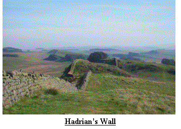 Day 32 (Wed 2ndOct) was another planned rest day and we spent it visiting some of the
attractions on Hadrian’s wall, we also said farewell to my parents who were
heading home. We finished the day with tea outside before the light faded and
replaced the sun with light rain.
Day 32 (Wed 2ndOct) was another planned rest day and we spent it visiting some of the
attractions on Hadrian’s wall, we also said farewell to my parents who were
heading home. We finished the day with tea outside before the light faded and
replaced the sun with light rain.
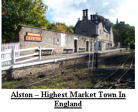 Day 33 (Thu 3rd Oct) was an early start at 6:40am.
The weather had changed it was now very
windy and cloudy, though still dry.
Soon after setting out I was onto open moorland and met one of the very
few who were attempting the entire route of the Pennine Way (in 2 weeks I met only
6). As is the case when one Long
Distance walker meets another we exchanged life histories, a potted report of
the route in each others planned directions and said our farewells before
setting out on our merry ways. Shortly
before leaving open moorland the path had become very indistinct and I had
strayed slightly from the route. I
spent several minutes following a wall in order to locate a stile and my exit
from open country. As I stepped onto
the first step my phone rang, it was my Mother in Law after her weekly update,
my loss of concentration nearly caused a major embarrassment as I lunged
backwards with my feet aiming for the sky – The step was like ice, but twice as
slippery! After several miles of open
moor and
Day 33 (Thu 3rd Oct) was an early start at 6:40am.
The weather had changed it was now very
windy and cloudy, though still dry.
Soon after setting out I was onto open moorland and met one of the very
few who were attempting the entire route of the Pennine Way (in 2 weeks I met only
6). As is the case when one Long
Distance walker meets another we exchanged life histories, a potted report of
the route in each others planned directions and said our farewells before
setting out on our merry ways. Shortly
before leaving open moorland the path had become very indistinct and I had
strayed slightly from the route. I
spent several minutes following a wall in order to locate a stile and my exit
from open country. As I stepped onto
the first step my phone rang, it was my Mother in Law after her weekly update,
my loss of concentration nearly caused a major embarrassment as I lunged
backwards with my feet aiming for the sky – The step was like ice, but twice as
slippery! After several miles of open
moor and
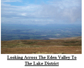 farmland I left the Pennine Way for a path following the Alston ‘South Tynedale Railway’
where I crossed from Northumberland into Cumberland, my second English county.
After meeting Rite for a cup of tea in Alston, England’s highest market town, I
returned to the Pennine Way and continued along the banks of the South
Tyne. The weather had improved and I
found myself sitting by the river soaking up the afternoon sun.
At 3:15pm I arrived in Garrigill, an old
mining village, now just a pleasant village placed around a village green.
farmland I left the Pennine Way for a path following the Alston ‘South Tynedale Railway’
where I crossed from Northumberland into Cumberland, my second English county.
After meeting Rite for a cup of tea in Alston, England’s highest market town, I
returned to the Pennine Way and continued along the banks of the South
Tyne. The weather had improved and I
found myself sitting by the river soaking up the afternoon sun.
At 3:15pm I arrived in Garrigill, an old
mining village, now just a pleasant village placed around a village green.
Day 34 (Fri 4th Oct) was to be my highest day and I had been praying for clear skies.
I poked my head out of the tent at 6:30am
and was greeted with dry weather but a cloud base lower than that of the
surrounding hills. At 8:10am I set off
for the climb from Garrigill to Cross Fell, the highest point of my entire
route. At Greg’s hut (GR NY690354), some 700m (2300ft) above sea level I
entered the cloud and all views
 disappeared. I continued the climb onto Cross Fell,
making use of the GPS to ensure I found the summit cairn. At 10:37am I reached
the summit, some 893m (2800ft) above sea level and thick hill fog.
I waited around for a while to eat in the
hope that for once I might get a tempting view of the Lakes I knew to be in the
west, but it was not to be and as the cold started to penetrate I headed away
for Little Dunn and Great Dunn Fells. Great Dunn Fell is home to a RADAR
station and on a clear day can be seen for miles.
The last time I passed here I almost walked into the stations
boundary fence the cloud was so thick and today was no different.
I still had not had a view of the Lakes and
with some disappointment I pressed on to Knock Old Man.
It was not until I started my descent into
Dufton
disappeared. I continued the climb onto Cross Fell,
making use of the GPS to ensure I found the summit cairn. At 10:37am I reached
the summit, some 893m (2800ft) above sea level and thick hill fog.
I waited around for a while to eat in the
hope that for once I might get a tempting view of the Lakes I knew to be in the
west, but it was not to be and as the cold started to penetrate I headed away
for Little Dunn and Great Dunn Fells. Great Dunn Fell is home to a RADAR
station and on a clear day can be seen for miles.
The last time I passed here I almost walked into the stations
boundary fence the cloud was so thick and today was no different.
I still had not had a view of the Lakes and
with some disappointment I pressed on to Knock Old Man.
It was not until I started my descent into
Dufton
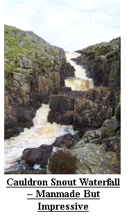 that the cloud started to lift and at last I could see the Lakes across the Eden
Valley, Cross Fell towering above the surrounding area and Little and Great
Dunn Fells, the latter with it’s RADAR station.
During my descent I also met my third Pennine Way walker heading
north and after a short conversation, during which I confirmed that there were
still 2 ladies ahead of me heading for Lands End about a week in front, I
plodded on arriving in Dufton at 1:45pm. In Dufton I met Rite and we visited
the local hostelry before heading to our new campsite in Kirkby Stephen, the
best so far.
that the cloud started to lift and at last I could see the Lakes across the Eden
Valley, Cross Fell towering above the surrounding area and Little and Great
Dunn Fells, the latter with it’s RADAR station.
During my descent I also met my third Pennine Way walker heading
north and after a short conversation, during which I confirmed that there were
still 2 ladies ahead of me heading for Lands End about a week in front, I
plodded on arriving in Dufton at 1:45pm. In Dufton I met Rite and we visited
the local hostelry before heading to our new campsite in Kirkby Stephen, the
best so far.
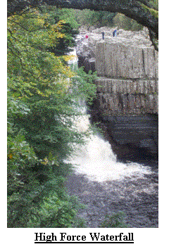 Day 35 (Sat 5th Oct) greeted us with strong winds, fortunately in the direction to assist
me, light rain and low cloud. At 8:10am
I found myself walking out of Dufton resigned to the fact that I was unlikely
to see the fantastic view from High Cup Nick, a dramatic steep sided valley
that on a good day frames a wonderful picture of the distant Lakeland
Fells. If you ever find yourself in
this area on a good day this is a view not to be missed. It was on this climb
that I was nearly trampled by a herd of wild horses; I am not sure who was the
most surprised, them or me. This whole
area feeds several of the largest rivers in the North of England, the Tyne,
Wear and Tees being the most recognisable.
Having followed the Tyne for a few days I was now to join the Tees and
since the building of the Cow Green Reservoir this river, known more for it’s
industry on Teeside, emerges through the spectacular, albeit manmade, gorge
known as Cauldron Snout before settling down for it’s journey to the North
Sea. The Pennine Way follows the Tees for about 10 miles and somewhere between Cauldron Snout and the next
spectacular waterfall, High Force I lost my pedometer.
It was like loosing a close friend!
I referred to ‘Robin Hood Prince of Thieves’ a few days ago, well for those that saw the film High Force is where Kevin
Costner showered and an interested Maid Marian looked on. I arrived in Middleton-in-Teesdale at 3pm and met up with Rite for a cup of tea and sticky
bun before returning to our campsite.
Day 35 (Sat 5th Oct) greeted us with strong winds, fortunately in the direction to assist
me, light rain and low cloud. At 8:10am
I found myself walking out of Dufton resigned to the fact that I was unlikely
to see the fantastic view from High Cup Nick, a dramatic steep sided valley
that on a good day frames a wonderful picture of the distant Lakeland
Fells. If you ever find yourself in
this area on a good day this is a view not to be missed. It was on this climb
that I was nearly trampled by a herd of wild horses; I am not sure who was the
most surprised, them or me. This whole
area feeds several of the largest rivers in the North of England, the Tyne,
Wear and Tees being the most recognisable.
Having followed the Tyne for a few days I was now to join the Tees and
since the building of the Cow Green Reservoir this river, known more for it’s
industry on Teeside, emerges through the spectacular, albeit manmade, gorge
known as Cauldron Snout before settling down for it’s journey to the North
Sea. The Pennine Way follows the Tees for about 10 miles and somewhere between Cauldron Snout and the next
spectacular waterfall, High Force I lost my pedometer.
It was like loosing a close friend!
I referred to ‘Robin Hood Prince of Thieves’ a few days ago, well for those that saw the film High Force is where Kevin
Costner showered and an interested Maid Marian looked on. I arrived in Middleton-in-Teesdale at 3pm and met up with Rite for a cup of tea and sticky
bun before returning to our campsite.
 Day 36 to Day 42 (Sun 6th Oct to Sat 12th Oct)
Day 36 (Sun 6th Oct) at 6:45am was glorious, presenting clear and bright skies.
I started out from Middleton at 8:10am and soon found myself stripping off a few layers. I had some trepidation about
today’s walk as I had planned about 18 miles most of which was over open moor some of which was very wild and barren the last time I crossed it.
I shouldn’t have worried, apart from my right knee thinking it needed some sympathy and attention the day went very
well. I rested and attended to my knee next to what was once the home of Hannah Hawkeswell, Birk Hat. Now a nature
reserve in line with her wishes. Soon I was in the middle of Bowes Moor, more familiar with motorists crossing on the A66 trans Pennine route as the place
usually closed when the first snows arrive. Crossing under the A66 I arrived at Gods
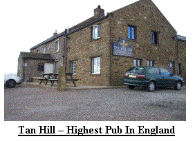 Bridge,a natural stone bridge where again I attended to my knee.
As I pressed onto Sleightholme Moor I got my
first view of England’s Highest Pub, made more famous by Ted Moult with his
double glazing adverts. Tan Hill is on the boundary between County Durham and North Yorkshire which in the past
Bridge,a natural stone bridge where again I attended to my knee.
As I pressed onto Sleightholme Moor I got my
first view of England’s Highest Pub, made more famous by Ted Moult with his
double glazing adverts. Tan Hill is on the boundary between County Durham and North Yorkshire which in the past
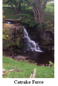 worked in it’s favour regarding opening times.
Today was a rare occasion, it was closed so I passed it and plodded on
to Keld, a small hamlet at the head of Swaledale, one of my favourite places in
Britain. After crossing the river near
Catrake Force I climbed into Keld and joined Rite, Nigel and my Parents for a
cup of tea and a sticky bun, it was 3pm and time for tea!
worked in it’s favour regarding opening times.
Today was a rare occasion, it was closed so I passed it and plodded on
to Keld, a small hamlet at the head of Swaledale, one of my favourite places in
Britain. After crossing the river near
Catrake Force I climbed into Keld and joined Rite, Nigel and my Parents for a
cup of tea and a sticky bun, it was 3pm and time for tea!
Day 37 (Mon 7th Oct) was to be a real treat. We
rose at 6:45am and packed the tents, again the skies were bright and clear and
stayed that way until well after I left Keld at 8:20am. The delay in starting
was due to waiting for Broadland to ring for my weekly slot.
The views round to Muker and Thwaite were
spectacular. As I rounded Kisdon hill I
got my first view of Great Shunner Fell today’s highpoint at 716m (2300ft). I
passed through Thwaite having shaken off some very curious sheep who must have
thought I looked very desirable! By 11am I was at the summit and for once I
could see for miles. Having taken a rest I set off down into Wensleydale and
the town of Hawes. Much of the Pennine
Way has been so over walked that it has been necessary to take action to
prevent further erosion. The most
common solution is to lay slabs of stone along the path.
Once the vegetation has recovered these
paths are almost invisible to all but those actually on them and they are
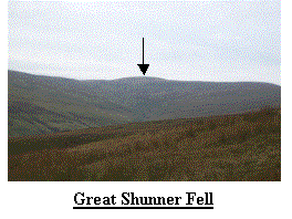 excellent for rapid progress. Great Shunner has such a path but in places it can be seen
disappearing into the distance, great to ease navigation but, as I had found
near Cross Fell, treacherous when wet.
After meeting another Pennine Way walker on the descent I entered Hawes
and headed straight for our campsite, just in time to get a fly past by the Red
Arrows, a dozen Tornados, Hawks, Tucanos and a couple of Seaking Helicopters –
What a peaceful place! I arrived at the
campsite at 1pm just behind our good friend, Eric who was joining us for the
week. We settled down to a cup of tea and piece of cake, mail from home and
lots of talking. We finished the
evening with a B-B-Q as we watched the sun settle behind the hills.
excellent for rapid progress. Great Shunner has such a path but in places it can be seen
disappearing into the distance, great to ease navigation but, as I had found
near Cross Fell, treacherous when wet.
After meeting another Pennine Way walker on the descent I entered Hawes
and headed straight for our campsite, just in time to get a fly past by the Red
Arrows, a dozen Tornados, Hawks, Tucanos and a couple of Seaking Helicopters –
What a peaceful place! I arrived at the
campsite at 1pm just behind our good friend, Eric who was joining us for the
week. We settled down to a cup of tea and piece of cake, mail from home and
lots of talking. We finished the
evening with a B-B-Q as we watched the sun settle behind the hills.
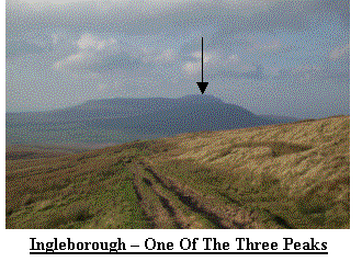 Day 38 (Tue 8th Oct) was another planned rest day and I took Rite
and Eric on a tour of the Dales. We met
up with my parents at Aysgarth; the low falls here were where Robin Hood met
Little John when he tried to cross the river!
After a cup of tea and a sticky bun we crossed from Wensleydale back
into Swaledale and the village of Reeth, famous for James Herriott the
Yorkshire vet. After lunch and a short stroll we said farewell to my parents
and continued our journey back to Hawes and another B-B-Q despite the now
deteriorating weather.
Day 38 (Tue 8th Oct) was another planned rest day and I took Rite
and Eric on a tour of the Dales. We met
up with my parents at Aysgarth; the low falls here were where Robin Hood met
Little John when he tried to cross the river!
After a cup of tea and a sticky bun we crossed from Wensleydale back
into Swaledale and the village of Reeth, famous for James Herriott the
Yorkshire vet. After lunch and a short stroll we said farewell to my parents
and continued our journey back to Hawes and another B-B-Q despite the now
deteriorating weather.
 Day 39 (Wed 9th Oct) was very windy and cold, but still the rain was
holding off. I crawled out of the tent
at 6:45 and noticed how dark it was. By
7:35 I was walking out of the campsite and set off on the journey to Horton in
Ribblesdale, the start and finish point of the famous Yorkshire Three Peaks
walk. No sooner had I left the campsite
as I found myself in a typical country traffic jam and surrounded by cows and
muck – Yep, the cows had been milked and were heading back to the fields for
breakfast! I waited for about 5 minutes
as pushing on would have been a bit too literal and, more importantly, dirty
and smelly! Eventually I broke free of
the herd and found myself following the ridge from Hawes where I got my first
sighting of one of the 3 Three Peaks, Ingleborough, a distinctive, high and
flat topped peak. As I rounded a corner I saw the Ribblehead Viaduct, a famous
point on the Settle to Carlisle railway route, popular with many for it’s
spectacular scenery. Behind the Viaduct was Whernside, a second of the Three
Peaks. I was now into serious Limestone country with caves and sink holes all
around. I stopped by Calf Holes (GR SD803775), an impressive hole where a large stream disappears into the ground.
After a short break I continued to Horton where I met Rite and Eric in the
Horton In Ribblesdale Café, famous with walkers, for a cup of tea and sticky
bun. Despite the extreme wind I proceeded to climb the third of the Three
Peaks, Pen-Y-Ghent. This long flat peak
is just as distinctive as Ingleborough but not quite as high. I soon reached the 694m (2300ft) summit but
Day 39 (Wed 9th Oct) was very windy and cold, but still the rain was
holding off. I crawled out of the tent
at 6:45 and noticed how dark it was. By
7:35 I was walking out of the campsite and set off on the journey to Horton in
Ribblesdale, the start and finish point of the famous Yorkshire Three Peaks
walk. No sooner had I left the campsite
as I found myself in a typical country traffic jam and surrounded by cows and
muck – Yep, the cows had been milked and were heading back to the fields for
breakfast! I waited for about 5 minutes
as pushing on would have been a bit too literal and, more importantly, dirty
and smelly! Eventually I broke free of
the herd and found myself following the ridge from Hawes where I got my first
sighting of one of the 3 Three Peaks, Ingleborough, a distinctive, high and
flat topped peak. As I rounded a corner I saw the Ribblehead Viaduct, a famous
point on the Settle to Carlisle railway route, popular with many for it’s
spectacular scenery. Behind the Viaduct was Whernside, a second of the Three
Peaks. I was now into serious Limestone country with caves and sink holes all
around. I stopped by Calf Holes (GR SD803775), an impressive hole where a large stream disappears into the ground.
After a short break I continued to Horton where I met Rite and Eric in the
Horton In Ribblesdale Café, famous with walkers, for a cup of tea and sticky
bun. Despite the extreme wind I proceeded to climb the third of the Three
Peaks, Pen-Y-Ghent. This long flat peak
is just as distinctive as Ingleborough but not quite as high. I soon reached the 694m (2300ft) summit but
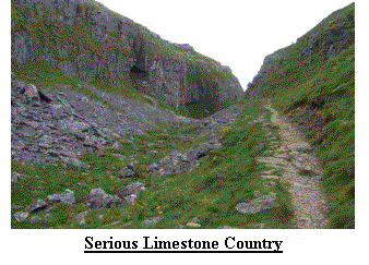
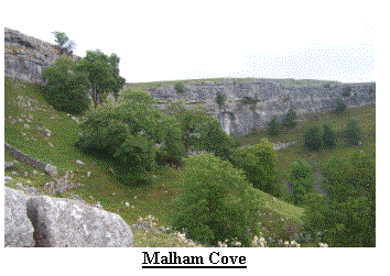 did not hang around for long as the wind was now gusting with extreme force.
So strong in fact that I regularly had to hold on for fear of taking off. I descended as quickly as I could safely do, meeting
a small group going up who again added to my sponsorship total. I arrived at the car at 2:45pm
Once I caught my breath we drove to Kettlewell where we tried out the fayre of one of the coffee shops, before
returning to Hawes to see if the tents were still in place. We were joined in the evening by my parents
and brother whilst we sampled the menu of a local hostelry.
did not hang around for long as the wind was now gusting with extreme force.
So strong in fact that I regularly had to hold on for fear of taking off. I descended as quickly as I could safely do, meeting
a small group going up who again added to my sponsorship total. I arrived at the car at 2:45pm
Once I caught my breath we drove to Kettlewell where we tried out the fayre of one of the coffee shops, before
returning to Hawes to see if the tents were still in place. We were joined in the evening by my parents
and brother whilst we sampled the menu of a local hostelry.
Day 40 (Thu 10thOct). We rose at 6:55am and packed the car before setting off to my drop point. We now had a planned 45 days left before we reached Lands End so were not quite halfway but, and I did not know it at the time, when I reached Malham
Tarn I would be passing the halfway point at a little over 560miles. For anyone who has not been to Malham, the scenery is exhilarating, especially Malham Cove, an enormous limestone cliff. I set out at 7:55am climbing Fountains Fellbefore arriving at Malham Tarn. From here I dropped into Malham village and again met Rite and Eric for a tea and
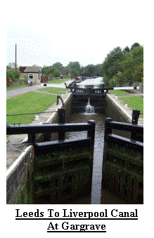 sticky bun. Despite the exquisite scenery I was not feeling as enthusiastic as I appeared and can only conclude I
was suffering from the mid way blues! From Malham I followed the river Aire to Gargrave from where I continued
to Thornton in Craven, today’s finish point. With no teashops I got to the car at 3:55pm and headed for Skipton for
fuel and money, before returning to Gargrave and our new campsite – in a coal
yard! With the weather now at its worst
for several weeks, both cold and windy although still dry, we searched out a
local hostelry and sampled its fayre.
sticky bun. Despite the exquisite scenery I was not feeling as enthusiastic as I appeared and can only conclude I
was suffering from the mid way blues! From Malham I followed the river Aire to Gargrave from where I continued
to Thornton in Craven, today’s finish point. With no teashops I got to the car at 3:55pm and headed for Skipton for
fuel and money, before returning to Gargrave and our new campsite – in a coal
yard! With the weather now at its worst
for several weeks, both cold and windy although still dry, we searched out a
local hostelry and sampled its fayre.
Day 41 (Fri 11th Oct) for us started at 6:45am with dull and overcast skies. By 7:55am I was
walking out of Thornton and heading for the rolling hills of West
Yorkshire. Each climb was followed by a
descent and another climb, this went on for about 6 miles before, eventually,
the terrain decided to finish on the up!
After climbing into and out of Lothersdale, then
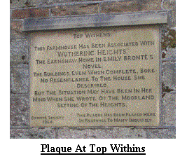 Cowling I met up with 2 lads heading for Haworth.
I made 2 mistakes today, the first ignoring my own advice; Don’t follow
others. The second ‘not paying
attention to the map and terrain’. The
result was walking 1˝ miles Northbound along the PW!
After giving myself a good talking to I set out in the right
direction and was soon descending to the Pondon reservoir near Haworth.
The parts round about are covered in
signposts, often in Japanese directing visitors to Bronte this or Bronte that,
but today it was too cold and most sensible people were at home making the most
of their central heating. After climbing over Withins Heights I returned to the
ups and downs as I approached Calderdale with it’s river, road, canal and
railway crowded into the valley bottom.
I couldn’t see Stoodley Pike, built high on the opposite hill to commemorate
the battle of Waterloo because the cloud providing the rain was too low.
With Eric now returning home it was back to
just Rite and I and I was relieved to find her and the car by the road, it was
3:55pm.
Cowling I met up with 2 lads heading for Haworth.
I made 2 mistakes today, the first ignoring my own advice; Don’t follow
others. The second ‘not paying
attention to the map and terrain’. The
result was walking 1˝ miles Northbound along the PW!
After giving myself a good talking to I set out in the right
direction and was soon descending to the Pondon reservoir near Haworth.
The parts round about are covered in
signposts, often in Japanese directing visitors to Bronte this or Bronte that,
but today it was too cold and most sensible people were at home making the most
of their central heating. After climbing over Withins Heights I returned to the
ups and downs as I approached Calderdale with it’s river, road, canal and
railway crowded into the valley bottom.
I couldn’t see Stoodley Pike, built high on the opposite hill to commemorate
the battle of Waterloo because the cloud providing the rain was too low.
With Eric now returning home it was back to
just Rite and I and I was relieved to find her and the car by the road, it was
3:55pm.
 Day 42 (Sat 12th Oct) had rain pounding on the outer skin of the
tent. Reluctantly we rose at 6:40am to find the campsite in total darkness, the
lights went off at 6:30am! Despite the
rain we had the car packed and ready to go by 7:30am and set out to
Calderdale. The plan was that after I
started Rite would meet up with my Parents and Nigel for a little moral support
whilst waiting on Saddleworth Moor for me to finish.
It turned out that they had had a better journey than expected
and met us just after Keighley. At 8:25am I stepped out of the car into the
pouring rain. The early part of the day had me climbing to about 400m (1300ft)
but with the cloud base at about 250m (800ft) I was soon into thick fog.
I knew I was approaching Stoodley Pike, but
even at 200m away it was only just visible, normally you can see it for miles
Day 42 (Sat 12th Oct) had rain pounding on the outer skin of the
tent. Reluctantly we rose at 6:40am to find the campsite in total darkness, the
lights went off at 6:30am! Despite the
rain we had the car packed and ready to go by 7:30am and set out to
Calderdale. The plan was that after I
started Rite would meet up with my Parents and Nigel for a little moral support
whilst waiting on Saddleworth Moor for me to finish.
It turned out that they had had a better journey than expected
and met us just after Keighley. At 8:25am I stepped out of the car into the
pouring rain. The early part of the day had me climbing to about 400m (1300ft)
but with the cloud base at about 250m (800ft) I was soon into thick fog.
I knew I was approaching Stoodley Pike, but
even at 200m away it was only just visible, normally you can see it for miles
 and it never seems to get any closer, this was not a problem today.
It was with some relief that I found it, at
least I knew I was going the right way.
The rest of the day was spent trudging over open moor on well defined
paths knowing that on a clear day there are great views across Rochdale and
Oldham. At about 12pm I crossed another
big milestone, the M62. From high above
it looked like a continuous stream of traffic in both directions which, of
course, it was. I was now joining the
route of the ‘Derbyshire Masters’. A 45 mile, 1 day,
circular route around the Derbyshire Dark Peak, undertaken by
fools like myself in November each year.
I was going to be taking a more leisurely approach.
I left Standedge to cross Black Moss and
White Moss, the latter being about a mile of liquid mud.
Once again the path protection people had
been out and, providing you could get to it without drowning in mud, a stone
path was available. I arrived at the
pick up point at 2:15. At least the
rain had stopped but for the first time on my walk my pickup was not waiting
for me. I settled down to eat my
lunch. As frostbite set in my support
team arrived, they had been visiting Holmfirth and apparently it was very
good. For the first time in 4 weeks we
were moving into a cottage for accommodation, courtesy of our friends Jacquie
and Philip. They would join us tomorrow.
and it never seems to get any closer, this was not a problem today.
It was with some relief that I found it, at
least I knew I was going the right way.
The rest of the day was spent trudging over open moor on well defined
paths knowing that on a clear day there are great views across Rochdale and
Oldham. At about 12pm I crossed another
big milestone, the M62. From high above
it looked like a continuous stream of traffic in both directions which, of
course, it was. I was now joining the
route of the ‘Derbyshire Masters’. A 45 mile, 1 day,
circular route around the Derbyshire Dark Peak, undertaken by
fools like myself in November each year.
I was going to be taking a more leisurely approach.
I left Standedge to cross Black Moss and
White Moss, the latter being about a mile of liquid mud.
Once again the path protection people had
been out and, providing you could get to it without drowning in mud, a stone
path was available. I arrived at the
pick up point at 2:15. At least the
rain had stopped but for the first time on my walk my pickup was not waiting
for me. I settled down to eat my
lunch. As frostbite set in my support
team arrived, they had been visiting Holmfirth and apparently it was very
good. For the first time in 4 weeks we
were moving into a cottage for accommodation, courtesy of our friends Jacquie
and Philip. They would join us tomorrow.
Day 43 to Day 50 (Sun 13th Oct to Sun 20th Oct)
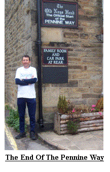 Day 43 (Sun 13th Oct) greeted us with clear skies and a light frost
at 6:40am. We were soon in the car
Day 43 (Sun 13th Oct) greeted us with clear skies and a light frost
at 6:40am. We were soon in the car
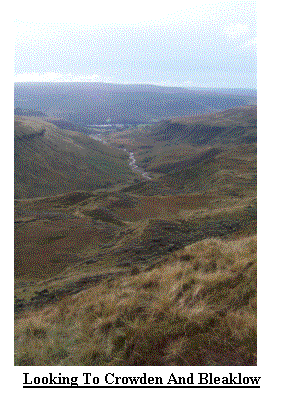 and leaving our new home, the pretty village of Tideswell.
By 8:35am I was striding out towards Black
Hill, a huge mound of Peat some 582m (1900ft) in height. Then without warning I
was up to my knee in mud and water.
There is a finite time, just shorter than that required to remove ones
leg from the bog, that water takes to penetrate any protective shield such as
gaiters and socks. And so it was that I
found myself wringing out my sock and preparing to spend the next 5 hrs with a
soggy left boot. I reached the summit at 9:30am and, to our mutual surprise, met
another person who kindly donated to my causes.
I realised it was Sunday which with decent weather meant a good
fundraising prospect! After Black Hill came Bleaklow, another large plateau of
peat, this time only 633m (2100ft) in height. By now I concluded that my
planned finish time of 2:30pm was un-realistic so I phoned Rite – No answer, so
I left a message. I left Bleaklow and climbed Mill Hill, I tried Rite, no
answer, so I left a message. By now it
was approaching 2:45pm and I was only now climbing onto Kinder Scout, yet
another plateau of thick black peat and 631m (2100ft) in height. I reached
Kinder Downfall, a spectacular waterfall that often blows back up onto Kinder
Scout. I was now worried that Rite
might raise the alarm and have the emergency services out looking for me, it
was well past 3pm and still I was unable to contact her so I left another
message. Soon after leaving the
Downfall I met a Park Ranger, he was able to radio ahead to the ranger station
in case Rite raised the alarm, I felt very relieved.
For anyone who has not visited Kinder, it is a large flat, black,
boggy and wet plateau with ‘Groughs’, deep channels cut into the peat by water
and people, some as deep as 30 or 40 feet.
As a general rule they tend to run to the edges of the plateau.
As I progressed across Kinder I received a
message from Rite, I tried to ring her back but still she did not answer.
Shortly after I received a call from
Jacquie, I told her that I was running late.
I was again using the GPS to save time and effort and it was not long
before I was closing in on the Southern Edge of the plateau.
As I climbed out from a particularly narrow
and deep grough I noticed a couple who appeared to wave, thinking they were not
waving at me I ignored them and disappeared down another grough.
Out I climbed again and there they were,
yomping across the bog after me and waving.
I was now curious. Just as an aside; my pace is quick, compared with
many I run, but for these two they must have thought I was racing them!
As I drew to a halt, the young lad, who I
later discovered answered to the name of Scott, asked me if I was heading for
Edale. I said I was.
He then admitted they were hopelessly lost
and could they follow me, I said they could.
It turned out that they thought I may be a ranger as I had a flag
sticking out of my rucksack (this was just to advertise my challenge in the
hope that people might sponsor me, it worked several times) hence, they raced
across the peat to catch me. As we
headed for the edge of the plateau and the path down to Edale I explained what
I was doing. I also told them that I
had spent many hours on Kinder, learning to navigate and teaching those skills
to others, particularly scouts, blah, blah blah…
It was then that I recognised Grindsbrook Clough, but it had
moved! Or at least it appeared to have. I checked my GPS.
Angela, Scott’s companion told me they had climbed
up over Grindsbrook Knoll, a summit just above Grindsbrook
Clough, I acknowledged this and pointed out the summits and confirmed I
recognised Grindsbrook Clough, but it was in the wrong place.
I checked my GPS.
It was about now I realised something was wrong, had there been a
major earthquake, I think not. My GPS
was obviously leading me to the wrong point.
After some hasty apologies I asked if they fancied a little scramble and
checked that they were confident enough to try it.
We turned round and headed off down a little gully that
intercepts Grindsbrook Clough further down, it is an ‘interesting’ route with
lots of boulders and a small stream. We
reached the path to Edale. I explained
to Scott and Angela that I was running very late and my wife would be
worried. I also advised that if they
continued down this well defined path they would eventually reach Edale about 2
miles away. We said our farewells and
they made a donation, before I jogged off toward Edale, kicking and swearing at
myself for missing my intended descent.
Later that night I discovered that I had entered the wrong Grid Ref into
my GPS, it was taking me to a point exactly 1km East of where I wanted to
be! I arrived in Edale at 4:30pm to
meet a worried and very relieved Wife!
It turned out she had spoken to Jackie after I had spoken to her, just
before she was going to ring the emergency services.
I had now completed the Pennine Way.
As we left Edale I called into the Information centre to advise I
had landed safely and all was well.
and leaving our new home, the pretty village of Tideswell.
By 8:35am I was striding out towards Black
Hill, a huge mound of Peat some 582m (1900ft) in height. Then without warning I
was up to my knee in mud and water.
There is a finite time, just shorter than that required to remove ones
leg from the bog, that water takes to penetrate any protective shield such as
gaiters and socks. And so it was that I
found myself wringing out my sock and preparing to spend the next 5 hrs with a
soggy left boot. I reached the summit at 9:30am and, to our mutual surprise, met
another person who kindly donated to my causes.
I realised it was Sunday which with decent weather meant a good
fundraising prospect! After Black Hill came Bleaklow, another large plateau of
peat, this time only 633m (2100ft) in height. By now I concluded that my
planned finish time of 2:30pm was un-realistic so I phoned Rite – No answer, so
I left a message. I left Bleaklow and climbed Mill Hill, I tried Rite, no
answer, so I left a message. By now it
was approaching 2:45pm and I was only now climbing onto Kinder Scout, yet
another plateau of thick black peat and 631m (2100ft) in height. I reached
Kinder Downfall, a spectacular waterfall that often blows back up onto Kinder
Scout. I was now worried that Rite
might raise the alarm and have the emergency services out looking for me, it
was well past 3pm and still I was unable to contact her so I left another
message. Soon after leaving the
Downfall I met a Park Ranger, he was able to radio ahead to the ranger station
in case Rite raised the alarm, I felt very relieved.
For anyone who has not visited Kinder, it is a large flat, black,
boggy and wet plateau with ‘Groughs’, deep channels cut into the peat by water
and people, some as deep as 30 or 40 feet.
As a general rule they tend to run to the edges of the plateau.
As I progressed across Kinder I received a
message from Rite, I tried to ring her back but still she did not answer.
Shortly after I received a call from
Jacquie, I told her that I was running late.
I was again using the GPS to save time and effort and it was not long
before I was closing in on the Southern Edge of the plateau.
As I climbed out from a particularly narrow
and deep grough I noticed a couple who appeared to wave, thinking they were not
waving at me I ignored them and disappeared down another grough.
Out I climbed again and there they were,
yomping across the bog after me and waving.
I was now curious. Just as an aside; my pace is quick, compared with
many I run, but for these two they must have thought I was racing them!
As I drew to a halt, the young lad, who I
later discovered answered to the name of Scott, asked me if I was heading for
Edale. I said I was.
He then admitted they were hopelessly lost
and could they follow me, I said they could.
It turned out that they thought I may be a ranger as I had a flag
sticking out of my rucksack (this was just to advertise my challenge in the
hope that people might sponsor me, it worked several times) hence, they raced
across the peat to catch me. As we
headed for the edge of the plateau and the path down to Edale I explained what
I was doing. I also told them that I
had spent many hours on Kinder, learning to navigate and teaching those skills
to others, particularly scouts, blah, blah blah…
It was then that I recognised Grindsbrook Clough, but it had
moved! Or at least it appeared to have. I checked my GPS.
Angela, Scott’s companion told me they had climbed
up over Grindsbrook Knoll, a summit just above Grindsbrook
Clough, I acknowledged this and pointed out the summits and confirmed I
recognised Grindsbrook Clough, but it was in the wrong place.
I checked my GPS.
It was about now I realised something was wrong, had there been a
major earthquake, I think not. My GPS
was obviously leading me to the wrong point.
After some hasty apologies I asked if they fancied a little scramble and
checked that they were confident enough to try it.
We turned round and headed off down a little gully that
intercepts Grindsbrook Clough further down, it is an ‘interesting’ route with
lots of boulders and a small stream. We
reached the path to Edale. I explained
to Scott and Angela that I was running very late and my wife would be
worried. I also advised that if they
continued down this well defined path they would eventually reach Edale about 2
miles away. We said our farewells and
they made a donation, before I jogged off toward Edale, kicking and swearing at
myself for missing my intended descent.
Later that night I discovered that I had entered the wrong Grid Ref into
my GPS, it was taking me to a point exactly 1km East of where I wanted to
be! I arrived in Edale at 4:30pm to
meet a worried and very relieved Wife!
It turned out she had spoken to Jackie after I had spoken to her, just
before she was going to ring the emergency services.
I had now completed the Pennine Way.
As we left Edale I called into the Information centre to advise I
had landed safely and all was well.
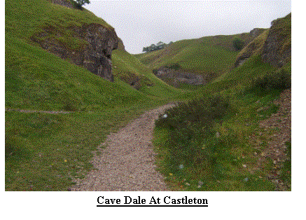 Day 44 (Mon 14th Oct). After
the worries of yesterday we had another rest day which was very welcome, Rite
had now recovered and the escapade became a story to remember the walk
for! Needless to say I recited it to
the listeners of Radio Broadland when they contacted me for the usual Monday
morning slot. I spent much of the day
sorting out accommodation for the final 7 weeks.
Day 44 (Mon 14th Oct). After
the worries of yesterday we had another rest day which was very welcome, Rite
had now recovered and the escapade became a story to remember the walk
for! Needless to say I recited it to
the listeners of Radio Broadland when they contacted me for the usual Monday
morning slot. I spent much of the day
sorting out accommodation for the final 7 weeks.
Day 45 (Tue 15th Oct) and a 6:40am alarm greeted me with overcast skies.
Rite took the opportunity to have a lie in
whilst Jacquie transported me back to Edale. I set out at 7:54am and quickly
climbed over Hollins Cross to reach the pretty village of Castleton.
From here I started the Limestone Way, my
next long distance route. As I climbed
out through Cave Dale the weather was already showing signs of
deterioration. Apart from meeting a
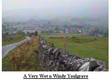 chap walking the Limestone way in the opposite direction nothing of note happened
until I reached Moneyash. For the first
time on my route I encountered a footpath diversion, forcing me to take a 1˝
mile detour to avoid ‘storm damage’.
Despite the extra distance the detour provided some respite from the,
now strengthening wind. As I drew
closer to Youlgrave, today’s finish point, the weather grew steadily wilder
until it reached the point where standing in a swimming baths would have been dryer!
I got into the car at 2:55 feeling windswept
and damp, but at least the waterproofs had done their job.
We retuned to the cottage for a cup of tea
and a sticky bun.
chap walking the Limestone way in the opposite direction nothing of note happened
until I reached Moneyash. For the first
time on my route I encountered a footpath diversion, forcing me to take a 1˝
mile detour to avoid ‘storm damage’.
Despite the extra distance the detour provided some respite from the,
now strengthening wind. As I drew
closer to Youlgrave, today’s finish point, the weather grew steadily wilder
until it reached the point where standing in a swimming baths would have been dryer!
I got into the car at 2:55 feeling windswept
and damp, but at least the waterproofs had done their job.
We retuned to the cottage for a cup of tea
and a sticky bun.
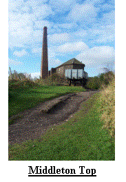 Day 46 (Wed 16th Oct) proved much calmer as the alarm brought me to
consciousness at 6:30am. Indeed, leaving Youlgrave
at 7:52am was very pleasant. The day was spent walking through
rolling countryside and looking for missing footpaths as I moved from the
Limestone way to the Mid Shires Way. I
eventually landed on the High Peak Trail, a disused railway line now used for
the sole benefit of walkers, cyclists and horses.
There are several places of interest along this route not least
of which is Middleton Top. Apparently
in order to get the trains over the high peak a series of ‘inclines’ was
created which literally dragged the trains up the hill using a chains and
pulleys linked to huge fixed steam engines.
After some very pleasant walking including views to Matlock Bath and
Belper at 2:30pm I arrived in Duffield, a few miles north of Derby.
We called into a supermarket on the way back
to the cottage so that we could have a sticky bun with our cup of tea.
Day 46 (Wed 16th Oct) proved much calmer as the alarm brought me to
consciousness at 6:30am. Indeed, leaving Youlgrave
at 7:52am was very pleasant. The day was spent walking through
rolling countryside and looking for missing footpaths as I moved from the
Limestone way to the Mid Shires Way. I
eventually landed on the High Peak Trail, a disused railway line now used for
the sole benefit of walkers, cyclists and horses.
There are several places of interest along this route not least
of which is Middleton Top. Apparently
in order to get the trains over the high peak a series of ‘inclines’ was
created which literally dragged the trains up the hill using a chains and
pulleys linked to huge fixed steam engines.
After some very pleasant walking including views to Matlock Bath and
Belper at 2:30pm I arrived in Duffield, a few miles north of Derby.
We called into a supermarket on the way back
to the cottage so that we could have a sticky bun with our cup of tea.
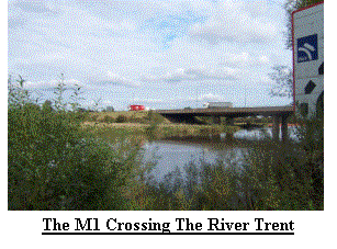 Day 47 (Thu 17th Oct) would see me pass the 600mile point.
We awoke at 6:25am and by 8:30am I was
heading out into the bright and frosty morning.
The day was spent skirting around the countryside between Derby
and Nottingham on the Mid Shires Way.
Just after lunch I encountered by second footpath closure.
This one stated ‘Alternative route:
None’. I now had a dilemma, apparently
a bridge was out, the bridge I planned to use to cross the River Trent, so
wading or swimming were out of the question!
I quickly consulted the map it appeared the shortest diversion was about
7 miles, I looked at the map again! I
identified a route that was only about 1 mile further but involved some road
walking so off I went. I eventually
reached the bridge that was closed, I could see why, it looked virtually
derelict. I now headed along the Trent,
passing under the M1, before turning South and proceeding to Kegworth.
By 2:35 I had finished and awaited my
pickup. I now started a 3 day break
from the walking and, being so close, headed home for a short rest, I had 616miles
under my belt and only 545 remaining.
Day 47 (Thu 17th Oct) would see me pass the 600mile point.
We awoke at 6:25am and by 8:30am I was
heading out into the bright and frosty morning.
The day was spent skirting around the countryside between Derby
and Nottingham on the Mid Shires Way.
Just after lunch I encountered by second footpath closure.
This one stated ‘Alternative route:
None’. I now had a dilemma, apparently
a bridge was out, the bridge I planned to use to cross the River Trent, so
wading or swimming were out of the question!
I quickly consulted the map it appeared the shortest diversion was about
7 miles, I looked at the map again! I
identified a route that was only about 1 mile further but involved some road
walking so off I went. I eventually
reached the bridge that was closed, I could see why, it looked virtually
derelict. I now headed along the Trent,
passing under the M1, before turning South and proceeding to Kegworth.
By 2:35 I had finished and awaited my
pickup. I now started a 3 day break
from the walking and, being so close, headed home for a short rest, I had 616miles
under my belt and only 545 remaining.
Day 48 to day 50 (Fri 18th Oct to Sun 20th Oct) were spent at home getting rid of unwanted
camping equipment, unpacking unwanted clothes, correcting the IT and generally
taking it easy.
Day 51 to Day 49 (Mon 21st Oct to Sat 26th Oct)
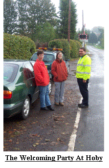 Day 51 (Mon 21st Oct) greeted us with an early 6am start, we had to
get back to Nottingham. It was still dark! We called by our Friends Trish and Derek to collect Justy, their granddaughter and our surrogate daughter.
Somewhere near Kings Lynn I spoke to Broadland on my weekly slot, before continuing to Nottingham. By the time I
started walking at 10:20am the heavens had opened and I needed full waterproofs. In several places the Mid
Shires Way takes different routes. I later learned that this is because there is a bridle route for horses and bikes
and another for those on foot like myself. However, with so much rain and the time of year most of the footpaths
crossing fields were like mud baths so I opted for the cleaner bridle route. By lunchtime I had crossed into
Leicestershire and stopped to eat lunch. It was now that one of my main sponsors rang and after giving him a
progress report we bid our farewells and I set off again into ever improving weather conditions. By 2pm I had
arrived at my planned finish point so chose to press on. As I crossed the busy A6006 a car pulled up
into a driveway, I realised at once that the car was familiar – It was my good friend Joe Dickinson from Oakham in Rutland.
After exchanging pleasantries, he arranged to meet Rite and Justy and take them to Hoby my revised finish point. After a few miles I reached Hoby and
finished for the day at 3:50pm. We then made arrangements to meet up with Joe on Friday, my next rest day, but for now
we returned to our accommodation, Cranford Hall near Kettering.
Day 51 (Mon 21st Oct) greeted us with an early 6am start, we had to
get back to Nottingham. It was still dark! We called by our Friends Trish and Derek to collect Justy, their granddaughter and our surrogate daughter.
Somewhere near Kings Lynn I spoke to Broadland on my weekly slot, before continuing to Nottingham. By the time I
started walking at 10:20am the heavens had opened and I needed full waterproofs. In several places the Mid
Shires Way takes different routes. I later learned that this is because there is a bridle route for horses and bikes
and another for those on foot like myself. However, with so much rain and the time of year most of the footpaths
crossing fields were like mud baths so I opted for the cleaner bridle route. By lunchtime I had crossed into
Leicestershire and stopped to eat lunch. It was now that one of my main sponsors rang and after giving him a
progress report we bid our farewells and I set off again into ever improving weather conditions. By 2pm I had
arrived at my planned finish point so chose to press on. As I crossed the busy A6006 a car pulled up
into a driveway, I realised at once that the car was familiar – It was my good friend Joe Dickinson from Oakham in Rutland.
After exchanging pleasantries, he arranged to meet Rite and Justy and take them to Hoby my revised finish point. After a few miles I reached Hoby and
finished for the day at 3:50pm. We then made arrangements to meet up with Joe on Friday, my next rest day, but for now
we returned to our accommodation, Cranford Hall near Kettering.
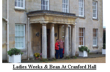 Day 52 (Tue 22nd Oct) and we arose at 6:30am but the mornings were
now very dark, but at least the rain had gone.
We arrived at my start point at about 8:15am and were greeted by Joe and
a local Guide Leader, Maureen, who it turned out, was the footpath inspector
for North Leicestershire. Now it seems
pertinent at this point to discuss the quality, or not, of different Counties
footpaths. After sampling footpaths
through most counties I can say with some authority that high level paths are
generally easier to find and follow than low level paths.
Some counties make no effort at all to mark
paths, some indicate them from roads and tracks but that is all.
Leicestershire, on the other hand, seems to take great pride in marking its
paths. Not only are they generally
clearly indicated from the road or track, tall yellow posts also indicate exit
points from fields or other fenced areas.
Only where farmers seemed determined to obliterate indications of rights
of way did I have any difficulties, but even here path finding did not prove
too arduous. So it was that I was able
to congratulate Maureen, and the rest of Leicestershire on their path marking,
a few other counties were equal but none were better.
As I set out at 8:30am to walk through Maureen’s patch the rain
returned, but at least I could find my way!
Leicestershire is not the most exiting of counties to walk through and
after trudging through ploughed fields for much of the day it was with relief
that I found some minor roads and tracks before I descended some low hills into
the village of Cranoe, having missed my intended path to Slawston!!!
I opted to extend my finish point to Weston
by Welland, which lies about a ˝ mile into Northamptonshire. I had now joined
my next main route south, the Macmillan Way and reached my most Easterly point
since John O' Groats. Rite and Justy met
me at 2:45 and we returned to Cranford Hall for tea and a sticky bun before we
were joined by Trish and Derek.
Day 52 (Tue 22nd Oct) and we arose at 6:30am but the mornings were
now very dark, but at least the rain had gone.
We arrived at my start point at about 8:15am and were greeted by Joe and
a local Guide Leader, Maureen, who it turned out, was the footpath inspector
for North Leicestershire. Now it seems
pertinent at this point to discuss the quality, or not, of different Counties
footpaths. After sampling footpaths
through most counties I can say with some authority that high level paths are
generally easier to find and follow than low level paths.
Some counties make no effort at all to mark
paths, some indicate them from roads and tracks but that is all.
Leicestershire, on the other hand, seems to take great pride in marking its
paths. Not only are they generally
clearly indicated from the road or track, tall yellow posts also indicate exit
points from fields or other fenced areas.
Only where farmers seemed determined to obliterate indications of rights
of way did I have any difficulties, but even here path finding did not prove
too arduous. So it was that I was able
to congratulate Maureen, and the rest of Leicestershire on their path marking,
a few other counties were equal but none were better.
As I set out at 8:30am to walk through Maureen’s patch the rain
returned, but at least I could find my way!
Leicestershire is not the most exiting of counties to walk through and
after trudging through ploughed fields for much of the day it was with relief
that I found some minor roads and tracks before I descended some low hills into
the village of Cranoe, having missed my intended path to Slawston!!!
I opted to extend my finish point to Weston
by Welland, which lies about a ˝ mile into Northamptonshire. I had now joined
my next main route south, the Macmillan Way and reached my most Easterly point
since John O' Groats. Rite and Justy met
me at 2:45 and we returned to Cranford Hall for tea and a sticky bun before we
were joined by Trish and Derek.
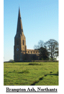 Day 53 (Wed 23rd Oct) greeted me with a 6:30am alarm call and dark, cloudy skies, but no
rain. Derek ran me to my start point and I set out from Weston at 7:37am,
quickly climbing the low hills into the bright, crisp autumn morning sunshine.
The Northants countryside is not my favourite walking area, but it was quite
pretty, especially with such a nice day and it did bring back memories of the
last time I walked the Macmillan way, 2 weeks after I married Rite in 1999.
Before too long I passed Cottesbrooke Hall and reached my destination of Teeton
at 1:35pm where I ate lunch whilst I awaited my carriage.
Day 53 (Wed 23rd Oct) greeted me with a 6:30am alarm call and dark, cloudy skies, but no
rain. Derek ran me to my start point and I set out from Weston at 7:37am,
quickly climbing the low hills into the bright, crisp autumn morning sunshine.
The Northants countryside is not my favourite walking area, but it was quite
pretty, especially with such a nice day and it did bring back memories of the
last time I walked the Macmillan way, 2 weeks after I married Rite in 1999.
Before too long I passed Cottesbrooke Hall and reached my destination of Teeton
at 1:35pm where I ate lunch whilst I awaited my carriage.
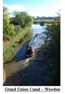 Day 54 (Thu 24th Oct) and I was now getting more distant from my
drop off points so another 6:30am rise to be greeted with dark skies and light
frost. I reached the start point at
7:50am and was soon approaching Althrop Park, home of the Spencers and Princess
Diana’s final resting place. Once again
I reached the M1, but this would be the last.
After Flore I crossed the busy A5, the Grand Union Canal and busy
mainline railway close to Weeden Bec, before climbing to the village of Church Stowe.
After several miles of rolling countryside I
passed the pretty, but closed, Cannons Ashby House.
From here it was muddy paths to reach my destination of Eydon,
which I reached at 1:45.
Day 54 (Thu 24th Oct) and I was now getting more distant from my
drop off points so another 6:30am rise to be greeted with dark skies and light
frost. I reached the start point at
7:50am and was soon approaching Althrop Park, home of the Spencers and Princess
Diana’s final resting place. Once again
I reached the M1, but this would be the last.
After Flore I crossed the busy A5, the Grand Union Canal and busy
mainline railway close to Weeden Bec, before climbing to the village of Church Stowe.
After several miles of rolling countryside I
passed the pretty, but closed, Cannons Ashby House.
From here it was muddy paths to reach my destination of Eydon,
which I reached at 1:45.
Day 55 (Fri 25th Oct) welcomed me with a 6:30am alarm and dark, overcast skies. I started
the day in Northamptonshire at 8:20am and spent the day avoiding the town of
Banbury, crossing more rolling countryside, another motorway, the M42, another
canal, the Oxford Canal, another County, Oxfordshire and just to round off
another map, oh and I was nearly 800miles down!
I also met a gentleman who that morning had lost a close relative
to cancer after being looked after by Macmillan.
The gentleman later pledged a donation to my causes.
The weather also could not decide what to
do, it blew, it rained and it shined.
To cap it all I’d left Northamptonshire, visited Oxfordshire and passed
through Warwickshire, where I finished is anybodies guess, but I think it was
Oxfordshire. I was pleased and relieved to reach my destination Alkerton at
1:45, we all retired for a sticky bun and cup of tea.
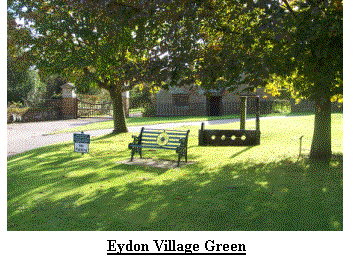 Day 56 (Sat 26th Oct) was my latest rest day. After
a lie in, we packed our kit and headed for the city of Warwick.
After a couple of hours we bid farewell to
Trish, Derek and Justy and headed south for Great Cheveral, near Devizes, a
journey that seemed to take for ever and was not our first choice.
However, it was available and it was warm,
dry and comfortable.
Day 56 (Sat 26th Oct) was my latest rest day. After
a lie in, we packed our kit and headed for the city of Warwick.
After a couple of hours we bid farewell to
Trish, Derek and Justy and headed south for Great Cheveral, near Devizes, a
journey that seemed to take for ever and was not our first choice.
However, it was available and it was warm,
dry and comfortable.
Day 57 to Day 63 (Sun 27th Oct to Sat 2nd Nov)
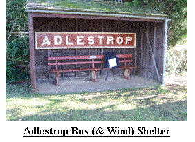 Day 57 (Sun 27th Oct) stands out in my mind for 1 reason, it was
windy, very, very, very windy! After a 6am start because of a long run out,
nearly 2hrs, we arrived at the start point having dodged fallen branches and
millions of fallen leaves. I left the
shelter of the car at 8:40am and spent the next 17miles fighting one of the
strongest gales for a very long time.
Much of the South and East suffered damage from fallen trees, our own
tree in our garden at home succumbed as did a roof tile.
With trepidation I passed hundreds of
trees. I cleared fallen branches from
roads as I passed them, clambered over trees blocking my route and eventually
arrived close to Stow on the Wold at 2:45, just as the wind was starting to
abate. I felt as if I had walked uphill all the way and did
Day 57 (Sun 27th Oct) stands out in my mind for 1 reason, it was
windy, very, very, very windy! After a 6am start because of a long run out,
nearly 2hrs, we arrived at the start point having dodged fallen branches and
millions of fallen leaves. I left the
shelter of the car at 8:40am and spent the next 17miles fighting one of the
strongest gales for a very long time.
Much of the South and East suffered damage from fallen trees, our own
tree in our garden at home succumbed as did a roof tile.
With trepidation I passed hundreds of
trees. I cleared fallen branches from
roads as I passed them, clambered over trees blocking my route and eventually
arrived close to Stow on the Wold at 2:45, just as the wind was starting to
abate. I felt as if I had walked uphill all the way and did
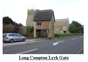 wonder if I had been blown back to JOG. We
returned to our cottage for tea and cake.
wonder if I had been blown back to JOG. We
returned to our cottage for tea and cake.
Day 58 (Mon 28th Oct) presented clear skies and gentle breeze.
Another long run out meant a 6am call, allowing me time to
present myself to Norfolk. This proved
a problem and after waiting ˝ an hour for Broadland to ring, they eventually
contacted me at 7:55am asking if they could speak later, they were busy dealing
with the aftermath of yesterday. I set out at 8:40, paused briefly to speak to
Broadland and then set out across the county of Gloucestershire.
The only places that stood out were Lower
Slaughter, Chedworth Roman Villa, closed, and Rencomb, the latter having a
stable block, now a science block, in the style of a French Chateaux.
I reached Woodmancote, my finish point at
2:20pm. We took the short drive to our cottage and indulged in tea and cake!
 Day 59 (Tue 29th Oct) had me up and about at 6am and although the
run out to the start was fairly short we wanted to avoid as much of the traffic
as possible. By 8:10am I was off and heading around the Northern edge of Cirencester
Great Park, before skirting the Western edge and arriving in the village of
Sapperton where I got reports of a fellow End to End walker about 2 weeks
ahead. I remembered Sapperton from my
Day 59 (Tue 29th Oct) had me up and about at 6am and although the
run out to the start was fairly short we wanted to avoid as much of the traffic
as possible. By 8:10am I was off and heading around the Northern edge of Cirencester
Great Park, before skirting the Western edge and arriving in the village of
Sapperton where I got reports of a fellow End to End walker about 2 weeks
ahead. I remembered Sapperton from my
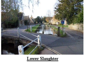 last visit in 99, the one thing that stuck in my mind was some topiary, in this case
a house cut into a hedge, I found it and photographed it before continuing my
journey. I now had a choice of 3 miles
or 1.5miles to get to the same point, guess which way I went!
The shorter route did mean missing a pub and
an impressive canal tunnel near the village of Tarlton.
My route now led me to the Arboretum at
Westonbrit, but reports on the news suggested it was shut due to the damage
caused by Sunday’s gales so I took to the lanes and finished in Sherston where
Rite met me at 2:40pm, once again we returned to our accommodation and indulged
in tea and cake.
last visit in 99, the one thing that stuck in my mind was some topiary, in this case
a house cut into a hedge, I found it and photographed it before continuing my
journey. I now had a choice of 3 miles
or 1.5miles to get to the same point, guess which way I went!
The shorter route did mean missing a pub and
an impressive canal tunnel near the village of Tarlton.
My route now led me to the Arboretum at
Westonbrit, but reports on the news suggested it was shut due to the damage
caused by Sunday’s gales so I took to the lanes and finished in Sherston where
Rite met me at 2:40pm, once again we returned to our accommodation and indulged
in tea and cake.
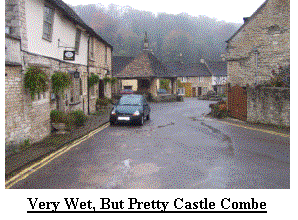 Day 60 (Wed 30th Oct) started as yesterday had finished, wet! After
another 6am rise I commenced walking at 7:44am and paddled away from Sherston
alongside the slowly expanding and very young river Avon.
By mid morning I was passing under my very
last Motorway, the M4 as the traffic hurtled in both directions. In Box I spoke
to a couple of men dismantling a very large and sorry looking Beech tree,
another victim of Sundays gales. I was
now approaching Bradford on Avon, my largest town for sometime.
As is usual on long distance walks, I
entered by a back door and crept through without anyone but my wife noticing
and joined the Kennet and Avon Canal, where I raced a couple of barges and won.
After extending my day by a few miles I reached Iford Manor at 3:20and gladly
got into the car. We retired for tea and a sticky bun!
Day 60 (Wed 30th Oct) started as yesterday had finished, wet! After
another 6am rise I commenced walking at 7:44am and paddled away from Sherston
alongside the slowly expanding and very young river Avon.
By mid morning I was passing under my very
last Motorway, the M4 as the traffic hurtled in both directions. In Box I spoke
to a couple of men dismantling a very large and sorry looking Beech tree,
another victim of Sundays gales. I was
now approaching Bradford on Avon, my largest town for sometime.
As is usual on long distance walks, I
entered by a back door and crept through without anyone but my wife noticing
and joined the Kennet and Avon Canal, where I raced a couple of barges and won.
After extending my day by a few miles I reached Iford Manor at 3:20and gladly
got into the car. We retired for tea and a sticky bun!
Day 61 (Thu 31st Oct). Spookily I took a lie in and
awoke at 7am. At 8am I was off and
following the river Frome. After
briefly leaving Wiltshire for Somerset and returning (more than once) I settled
on Somerset. I now had only 3 counties
more to go. Once again I suffered the
vagaries of Long Distance route planners and instead of a 7 mile route I
covered 9miles. This did have the
advantage of avoiding Frome and the traffic on the busy A361.
The countryside, was also very pleasant, it
is just a pity that the weather did not oblige by showing me how much better it
looks in sunshine instead of from under the hood of a waterproof jacket.
Again I had extended today’s route,
resulting in nearly 10 miles of the tally of the next 2 days.
Why had I done this?
I had done it to reduce the pain a friend of
mine would suffer when he joined me tomorrow for a couple of days ‘walking in
the Somerset countryside’! Nothing
exciting happened today so I just walked until I reached my finish point at
Druly Hill Farm (GR ST756371). Rite and
I returned for more Sticky buns and a cup of tea to wash it down.
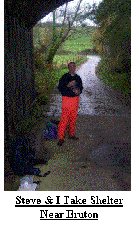 Day 62 (Fri 1st Nov) was wet and Dreary so we spent the day relaxing, drinking tea and
sampling sticky buns in the town of Frome.
We also headed out to a very wet and very busy Street (GR ST4735) and
met Steve, a long time friend, his Wife, Joyce and their children Martyn and
Katie in the Ashcott pub in the village of Ashcott.
We then bid our Farewells to Joyce, Martyn and Katie and the 3 of
us returned to Street for a little shopping. The day was very, very wet.
Day 62 (Fri 1st Nov) was wet and Dreary so we spent the day relaxing, drinking tea and
sampling sticky buns in the town of Frome.
We also headed out to a very wet and very busy Street (GR ST4735) and
met Steve, a long time friend, his Wife, Joyce and their children Martyn and
Katie in the Ashcott pub in the village of Ashcott.
We then bid our Farewells to Joyce, Martyn and Katie and the 3 of
us returned to Street for a little shopping. The day was very, very wet.
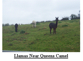 Day 63 (Sat 2nd Nov) greeted us at 6:40am with broken cloud but
dry. Steve and I said goodbye to Rite,
who headed off to meet up with Nigel and my parents before visiting Longleat
safari park, whilst we explored Somerset. As we set out the rain returned and
got heavier and heavier until it would have been less wet fully submerged in a
swimming pool. We sheltered under a
bridge near Bruton for breakfast. We
sheltered in a bus shelter in North Cadbury for lunch and swam the last few miles
to Queen Camel before clambering into an already over packed car at
2:40pm. Just before Queens Camel I
thought my brain had become waterlogged, the sheep round here looked strange.
When Steve and I looked closer we identified
the culprits as Lamas! We welcomed
Nigel then set out to Yeovil for shopping and sticky buns with tea before
heading to our new accommodation where we were welcomed with tea and Cream
Scones. We settled down for the evening
to dry out.
Day 63 (Sat 2nd Nov) greeted us at 6:40am with broken cloud but
dry. Steve and I said goodbye to Rite,
who headed off to meet up with Nigel and my parents before visiting Longleat
safari park, whilst we explored Somerset. As we set out the rain returned and
got heavier and heavier until it would have been less wet fully submerged in a
swimming pool. We sheltered under a
bridge near Bruton for breakfast. We
sheltered in a bus shelter in North Cadbury for lunch and swam the last few miles
to Queen Camel before clambering into an already over packed car at
2:40pm. Just before Queens Camel I
thought my brain had become waterlogged, the sheep round here looked strange.
When Steve and I looked closer we identified
the culprits as Lamas! We welcomed
Nigel then set out to Yeovil for shopping and sticky buns with tea before
heading to our new accommodation where we were welcomed with tea and Cream
Scones. We settled down for the evening
to dry out.
Day 64 to Day 70 (Sun 3rd Nov to Sat 9th Nov)
Day 64 (Sun 3rd Nov) looked promising as I looked out of the cottage window at 6:40am.
When we left Queen Camel at 8:30am it was
glorious, a beautiful clear, crisp winter morning (although technically it was
still Autumn!). The River Yeo was full,
but not quite flooded after the rain of the past few days, which was lucky as
we needed to cross it after we had skirted around RNAS Yeovilton, one of the
largest Naval air stations in the UK., and familiar to
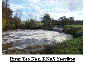 me from my work. By lunchtime we were
passing the fantastic Elizabethan House at Montacute, where Nigel and Rite were
visiting. We joined them for
lunch. I had expected to be at
Montacute around 11am, but Steve found the pace hard going especially
me from my work. By lunchtime we were
passing the fantastic Elizabethan House at Montacute, where Nigel and Rite were
visiting. We joined them for
lunch. I had expected to be at
Montacute around 11am, but Steve found the pace hard going especially
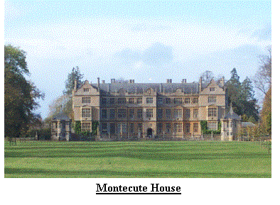 after the 17 miles of yesterday. Today was
also 17 miles and I had expected to reach our destination at about 2:30pm.
I contacted Rite about 2pm to advise a later
finish of about 3pm. As the afternoon
wore on Steve was obviously suffering, but refused to be defeated even if this
meant missing his train, due at 4:20pm.
I contacted Rite again to advise and expected eta of 3:30.
We arrived in Crewkerne at 3:40 with Steve
looking more like someone who had been to war, which he of course had.
We had been fighting hills and vales, styles
and gates, not to mention fallen trees!
With sadness we said farewell to Steve as we left him at Crewkerne
station. We thought of him hobbling
along the platform, seizing up on the train and crawling home from Shrewsbury
station late on a Sunday night, whilst we headed back for cake and tea and a
relaxing evening in front of the telly
after the 17 miles of yesterday. Today was
also 17 miles and I had expected to reach our destination at about 2:30pm.
I contacted Rite about 2pm to advise a later
finish of about 3pm. As the afternoon
wore on Steve was obviously suffering, but refused to be defeated even if this
meant missing his train, due at 4:20pm.
I contacted Rite again to advise and expected eta of 3:30.
We arrived in Crewkerne at 3:40 with Steve
looking more like someone who had been to war, which he of course had.
We had been fighting hills and vales, styles
and gates, not to mention fallen trees!
With sadness we said farewell to Steve as we left him at Crewkerne
station. We thought of him hobbling
along the platform, seizing up on the train and crawling home from Shrewsbury
station late on a Sunday night, whilst we headed back for cake and tea and a
relaxing evening in front of the telly
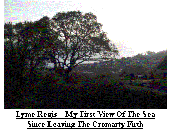 Day 65 (Mon 4th Nov). Being
so close to my drop off allowed a lie in and I awoke at 7am to a dry but cloudy
day. After a brief chat with Broadland,
my mind was elsewhere as I contemplated the need to visit the little boys room,
I set out from Crewkerne at 8:50am. The
weather improved as the day went on, and despite a slight chill from the
November air I was comfortably warm in my T shirt as I crossed into the County
of Dorset. The countryside was restful
and relaxing despite the many hills. A
little before lunch I had a surprise when my phone rang.
It was a lady from Sargent Cancer Care, one
of the charities my fundraising would benefit.
After a pleasant chat, she wished me well and I continued on my
way. Nigel had also contacted me to
advise that the Coast path was closed from Charmouth, my current destination,
and Lyme Regis, today’s finish point. I
revised my route and took a more direct route to Lyme Regis.
This diversion was lucky for a Sheep! The Sheep in question was entangled in a
hedge of brambles, and becoming more so each time it attempted to escape.
I took out my first aid kit, withdrew the scissors (I’d left my penknife at home!) and cut it free.
After thanking me profusely (I wish!) it joined it’s mates and
returned to what Sheep are good at – eating grass. At 2:10pm I reached the second biggest milestone so far, the
South Coast at Lyme Regis. We celebrated with tea and a sticky bun in a little coffee shop.
Day 65 (Mon 4th Nov). Being
so close to my drop off allowed a lie in and I awoke at 7am to a dry but cloudy
day. After a brief chat with Broadland,
my mind was elsewhere as I contemplated the need to visit the little boys room,
I set out from Crewkerne at 8:50am. The
weather improved as the day went on, and despite a slight chill from the
November air I was comfortably warm in my T shirt as I crossed into the County
of Dorset. The countryside was restful
and relaxing despite the many hills. A
little before lunch I had a surprise when my phone rang.
It was a lady from Sargent Cancer Care, one
of the charities my fundraising would benefit.
After a pleasant chat, she wished me well and I continued on my
way. Nigel had also contacted me to
advise that the Coast path was closed from Charmouth, my current destination,
and Lyme Regis, today’s finish point. I
revised my route and took a more direct route to Lyme Regis.
This diversion was lucky for a Sheep! The Sheep in question was entangled in a
hedge of brambles, and becoming more so each time it attempted to escape.
I took out my first aid kit, withdrew the scissors (I’d left my penknife at home!) and cut it free.
After thanking me profusely (I wish!) it joined it’s mates and
returned to what Sheep are good at – eating grass. At 2:10pm I reached the second biggest milestone so far, the
South Coast at Lyme Regis. We celebrated with tea and a sticky bun in a little coffee shop.
Day 66 (Tue 5th Nov) greeted me at 7am with dry but cloudy skies.
It must have been an exciting day my notes say ’07:00 Rise,
cloudy & bright. 08:15 start, light Rain. 14:20 finish’.
That about sums it up for, apart from a walk
through the results of a huge landslip in 1839 the walk was spent climbing and
descending, climbing and descending all up and down steep muddy paths.
I was glad to reach Sidmouth, I’d only done
16miles, it felt more like 30 along the Pennine Way.
I prayed it would get easier as I got into the car at 2:20pm and
set out to find tea and sticky buns.
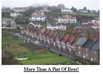 Day 67 (wed 6th Nov) brought rain as I awoke at 7am.
It was still raining at 8:40am when I stepped out of the car.
After a couple of attempts to remove my
waterproofs I gave in and left them on.
Despite the rain the scenery was impressive with views out to sea across
rugged and sometimes steep cliffs. I
arrived at the point of my first ferry, the Starcross ferry which runs between
Starcross and Exmouth. It was
closed! I called on my alternative
ferry and as we drove to Starcross I ate lunch.
Now some may say I cheated, I look at it this way:
If the ferry had been running I would have
used it, I did not have sufficient time to make several 15+mile detours between
here and Lands End. If I had not had
access to the car I would have changed my route in order to avoid the ferries –
so there, if you believe I cheated, tough, I believe I made suitable
arrangements!! Once in Starcross I
walked the 5 miles or so to Dawlish where I finished at 1:50pm in warm winter
sunshine.
Day 67 (wed 6th Nov) brought rain as I awoke at 7am.
It was still raining at 8:40am when I stepped out of the car.
After a couple of attempts to remove my
waterproofs I gave in and left them on.
Despite the rain the scenery was impressive with views out to sea across
rugged and sometimes steep cliffs. I
arrived at the point of my first ferry, the Starcross ferry which runs between
Starcross and Exmouth. It was
closed! I called on my alternative
ferry and as we drove to Starcross I ate lunch.
Now some may say I cheated, I look at it this way:
If the ferry had been running I would have
used it, I did not have sufficient time to make several 15+mile detours between
here and Lands End. If I had not had
access to the car I would have changed my route in order to avoid the ferries –
so there, if you believe I cheated, tough, I believe I made suitable
arrangements!! Once in Starcross I
walked the 5 miles or so to Dawlish where I finished at 1:50pm in warm winter
sunshine.
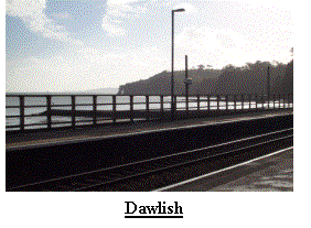 Day 68 (Thu 7th Nov) meant that I had completed another 5 days and could take a days rest
so I met up with my future employers in the little seaside village of
Abbotsbury, one of the official finishes of the Macmillan Way, a route I had
left last Saturday.
Day 68 (Thu 7th Nov) meant that I had completed another 5 days and could take a days rest
so I met up with my future employers in the little seaside village of
Abbotsbury, one of the official finishes of the Macmillan Way, a route I had
left last Saturday.
Day 69 (Fri 8th Nov) once again awoke me to the pitter-patter of heavy rain, oh joy! And it
was only 6:50am We reached Dawlish at 8:40 and I set out fully enclosed in
water resistant material for the seaside town of Teignmouth.
I don’t doubt that this pretty walk is
fantastic in summer when the sun shines, but on a cold wet winter day I was
glad to reach Teignmouth and my second ferry crossing.
Alas the Ferryman had decided to stay in
bed, despite signs to the contrary so I used the alternative again.
I continued along the coast in the pouring
rain, slipping and sliding in the mud as I ascended steep muddy slopes before
descending a few yards further on! With
relief I reached Torbay and as I was already soaked opted to continue to
Broadsands (GR SX8957), where I arrived at 2:10.
We retired to our cottage to pack and indulge in more tea and
sticky buns.
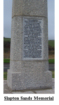
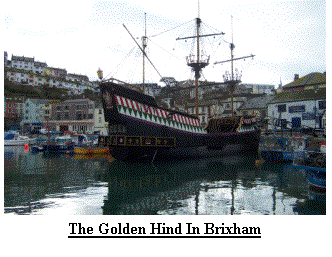 Day 70 (Sat 9th Nov) at least allowed me a lie in, 7:45am, and even
better there was no rain and broken clouds in the sky!
I set out at 8:50am, one of my latest starts
for a long time, but soon I was striding out into Brixham, a quaint little
fishing port and home to the Golden Hind, which did not look out of place.
After Brixham it was back up onto high
cliffs, but with a brisk wind it was proving a little dangerous especially on
the more muddy stretches so I opted for quiet country lanes and headed inland
slightly. I encountered my first ferry
of the day, the Kingswear ferry and, great joy, it was running. I disembarked
in Dartmouth at about the same time as the rain returned, so on came the
waterproofs. My finish point was
Torcross, a little village at the end of Slapton Sands.
Slapton Sands was home to a large number of
American servicemen during WWII as they trained for the Dunkirk landings.
I passed several memorials both to soldiers
and civilians, the latter because they were forced to leave their homes in
order that the soldiers could train. I
didn’t know it at the time but the main Monument was to be unveiled tomorrow,
during the remembrance day service. I
climbed into the car at 2:25pm knowing I had reached another major
milestone. I had broken the 1000mile
barrier. We moved into our new
accommodation in Totnes and celebrated with Tea and sticky buns.
Day 70 (Sat 9th Nov) at least allowed me a lie in, 7:45am, and even
better there was no rain and broken clouds in the sky!
I set out at 8:50am, one of my latest starts
for a long time, but soon I was striding out into Brixham, a quaint little
fishing port and home to the Golden Hind, which did not look out of place.
After Brixham it was back up onto high
cliffs, but with a brisk wind it was proving a little dangerous especially on
the more muddy stretches so I opted for quiet country lanes and headed inland
slightly. I encountered my first ferry
of the day, the Kingswear ferry and, great joy, it was running. I disembarked
in Dartmouth at about the same time as the rain returned, so on came the
waterproofs. My finish point was
Torcross, a little village at the end of Slapton Sands.
Slapton Sands was home to a large number of
American servicemen during WWII as they trained for the Dunkirk landings.
I passed several memorials both to soldiers
and civilians, the latter because they were forced to leave their homes in
order that the soldiers could train. I
didn’t know it at the time but the main Monument was to be unveiled tomorrow,
during the remembrance day service. I
climbed into the car at 2:25pm knowing I had reached another major
milestone. I had broken the 1000mile
barrier. We moved into our new
accommodation in Totnes and celebrated with Tea and sticky buns.
Day 71 to Day 77 (Sun 10th Nov to Sat 16th Nov)
Day 71 (Sun 10th Nov) and I was now within a fortnight of reaching Lands End.
I now knew with certainty that I would reach
the end. Having extended the past few
days by a mile or so at a time I now only had 10 miles to do today so after a
7:30 rise I set out to walk at 8:50am.
By 10:30am I was back into waterproofs, but the weather only emphasised
the ruggedness of the cliffs. Soon the
climbs and descents were behind me and I was approaching Salcome along some of
the best cliff walking so far. It was
nice to finish so early, 12:15pm and I was tempted to head back along the
cliffs, but a short day is nice when you have over a 1000miles under your belt
and an average of over 18miles per day.
So I watched the little ferry cross to Salcome and climbed into the
car. One day I will return. With the
rain outside hammering on the window we sat in our little flat in the heart of
Totnes and
 indulged ourselves with tea and sticky buns.
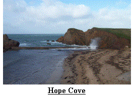 Day 72 (Mon 11th Nov) greeted us with bright clear skies as I
climbed out of bed at 7am. Once again I
was treating myself to an easy day, only 11˝
miles. I was soon climbing out of the pretty town of Salcome having bid
goodbye to Rite and Nigel at 8:40am. I
was soon passing Sharp Tor, Bolt Head, Steeple Cove, Ham Stone, Slippery Point
and Bolt Tail, all names conjuring up visions of tall cliffs and ragged
coastline. I descended into the tiny
hamlets of Inner and Outer Hope, nestled around the pretty Hope Cove.
By 12:10 I had reached the pub in Bantham,
another estuary where a ferry is required to cross.
Again the ferry here was not running, but that did not matter, as
I did not intend to travel further today, so we called into the pub, before
heading back to Totnes.
Day 72 (Mon 11th Nov) greeted us with bright clear skies as I
climbed out of bed at 7am. Once again I
was treating myself to an easy day, only 11˝
miles. I was soon climbing out of the pretty town of Salcome having bid
goodbye to Rite and Nigel at 8:40am. I
was soon passing Sharp Tor, Bolt Head, Steeple Cove, Ham Stone, Slippery Point
and Bolt Tail, all names conjuring up visions of tall cliffs and ragged
coastline. I descended into the tiny
hamlets of Inner and Outer Hope, nestled around the pretty Hope Cove.
By 12:10 I had reached the pub in Bantham,
another estuary where a ferry is required to cross.
Again the ferry here was not running, but that did not matter, as
I did not intend to travel further today, so we called into the pub, before
heading back to Totnes.
Day 73 (Tue 12th Nov) started at 7am and was wet, dark and dingy.
As I progressed along the coast path
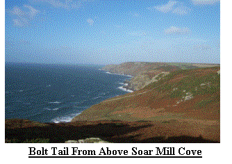 the weather improved, but the wind also increased in ferocity.
For my own self-preservation I took to the
roads and headed inland for a little shelter.
After a combination of footpaths and quiet lanes I
the weather improved, but the wind also increased in ferocity.
For my own self-preservation I took to the
roads and headed inland for a little shelter.
After a combination of footpaths and quiet lanes I
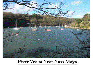 arrived in Noss Mayo, where sheltered from the wind one could have believed it was the
middle of summer. It was in fact the middle of the day, 12:05pm to be precise, and I sat down next to the car for
lunch and watched a Lady and her dog swimming in the River Yealm. Another car
ride back to Totnes and another tea and sticky bun.
arrived in Noss Mayo, where sheltered from the wind one could have believed it was the
middle of summer. It was in fact the middle of the day, 12:05pm to be precise, and I sat down next to the car for
lunch and watched a Lady and her dog swimming in the River Yealm. Another car
ride back to Totnes and another tea and sticky bun.
Day 74 (Wed 13th Nov) and another late rise, oh the hardship! This was another rest day, I
didn’t really need it after the last few short days but I wanted to finish on
the 24th Nov, the eve of my 40th birthday and to do this
I could afford to take things relatively easy.
Day 75 (Thu 14th Nov) and once again I was up at 7am, greeted by dark skies with broken
cloud. At 8:40am I was
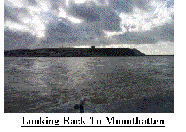 walking and heading toward my final County, but before I got there I had to rely on 2
ferries being operational. The strong
winds of the past few days were still with us and when combined with the recent
wind they were making walking the coastline fairly treacherous, so again I had
opted for inland paths and quiet lanes.
Initially I was heading for Mount Batten point, a former RAF base, in
the hope that I could catch a water taxi to Plymouth.
My luck was in, the boat arrived just as I did and after a few
minutes I was in Plymouth and walking ‘The Hoe’.
On route to the Cremyll ferry, my transport out of Devon and into
Cornwall I spotted the Greenpeace ship the ‘Rainbow Warrior’.
Again my luck was in and I ate my lunch as I
crossed the mouth of the Tamar and entered Cornwall.
With the winds seemingly getting stronger I returned to the
cliffs for the final few miles to Portwrinkle and arrived at 1pm.
The journey back to Totnes was now quite
long, but we rested with a cup of tea and a sticky bun.
walking and heading toward my final County, but before I got there I had to rely on 2
ferries being operational. The strong
winds of the past few days were still with us and when combined with the recent
wind they were making walking the coastline fairly treacherous, so again I had
opted for inland paths and quiet lanes.
Initially I was heading for Mount Batten point, a former RAF base, in
the hope that I could catch a water taxi to Plymouth.
My luck was in, the boat arrived just as I did and after a few
minutes I was in Plymouth and walking ‘The Hoe’.
On route to the Cremyll ferry, my transport out of Devon and into
Cornwall I spotted the Greenpeace ship the ‘Rainbow Warrior’.
Again my luck was in and I ate my lunch as I
crossed the mouth of the Tamar and entered Cornwall.
With the winds seemingly getting stronger I returned to the
cliffs for the final few miles to Portwrinkle and arrived at 1pm.
The journey back to Totnes was now quite
long, but we rested with a cup of tea and a sticky bun.
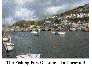 Day 76 (Fri 15th Nov) arrived with light winds and bright skies.
By the time I started walking at 8:30am I was in heaven, although
the going was hard, the views and weather more than
Day 76 (Fri 15th Nov) arrived with light winds and bright skies.
By the time I started walking at 8:30am I was in heaven, although
the going was hard, the views and weather more than
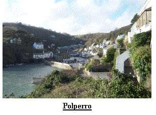 made up for it. I met up with Rite and Nigel
in Looe, where we had a cup of tea and a cake.
The climb out of Looe was long and steep but with over 1050 miles under
my belt I barely noticed it. I quickly
left Looe behind and enjoyed the scenery as I approached Polperro one of
Cornwall’s more popular places, but very quiet and peaceful this late in the
season. I arrived in Polperro at
1:30pm from where we returned to Totnes
for the last time.
made up for it. I met up with Rite and Nigel
in Looe, where we had a cup of tea and a cake.
The climb out of Looe was long and steep but with over 1050 miles under
my belt I barely noticed it. I quickly
left Looe behind and enjoyed the scenery as I approached Polperro one of
Cornwall’s more popular places, but very quiet and peaceful this late in the
season. I arrived in Polperro at
1:30pm from where we returned to Totnes
for the last time.
Day 77 (Sat 16th Nov) and we were up bright and early to get the car packed, so the alarm
sounded at 6:20am. After carrying our
kit from the flat to the car I was wide awake and raring to go.
We reached Polperro at 8:45 and off I
went. After a short stretch on quiet
lanes I
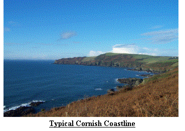 returned to the coast path for the roller coaster route to Fowey via the Polruan ferry.
Again I found the ferry to be running and after a short stretch of the Saints
Way found myself looking across St Austell Bay.
The route from Par Sands to Charlestown, today’s destination, was
pretty ugly and a large portion was spent keeping an eye out for stray golf
balls. Charlestown is a restored dock area with 2 bays and it looked very
atmospheric in the early afternoon drizzle, with its sailing ships and
authentic buildings. I got into the car
at 1:05pm and we set out for Truro and our final cottage.
returned to the coast path for the roller coaster route to Fowey via the Polruan ferry.
Again I found the ferry to be running and after a short stretch of the Saints
Way found myself looking across St Austell Bay.
The route from Par Sands to Charlestown, today’s destination, was
pretty ugly and a large portion was spent keeping an eye out for stray golf
balls. Charlestown is a restored dock area with 2 bays and it looked very
atmospheric in the early afternoon drizzle, with its sailing ships and
authentic buildings. I got into the car
at 1:05pm and we set out for Truro and our final cottage.
Day 78 to Day 85 (Sun 17th Nov to Sun 24th Nov)
Day 78 (Sun 17th Nov) was again a dry, bright welcome when the alarm sounded at 7am.
With a short run out I was off at 8:20 and
soon left St Austell behind. The roller coaster ride continued as I headed to
Mevagissey, a place I had fond memories of from my childhood where I spent many
hours catching Mackerel and watching model trains.
The weather remained kind and as I headed inland once more for
quiet lanes and paths the views ahead and behind looked fantastic.
This is the first time I have attempted much
of the SW coast path, but I am certain I shall return one day, even if it is
not to try the entire 600+mile route. I
finished the day at the tiny hamlet of Portholland, nestled between the surrounding
cliffs and hills, at 1:05pm. We
returned to Truro for yet more sticky buns and tea.
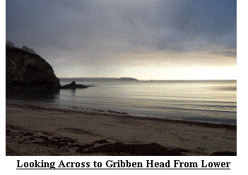
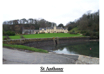 Day 79 (Mon 18th Nov). The
alarm sounded at 7am and after my appointment with Broadland I set out for the
start point. I was walking by 8:35 on
another bright and sunny morning. By now I was beginning to grow tired of this
never ending roller coaster ride. The
views in all directions were awe inspiring and for the first time I knew I
could see Britain’s most Southerly point,
however I would not arrive there for another 2 days.
For now I continued around the coast before arriving at St
Anthony Point at 12:55pm and awaited pick-up.
Way back in Teesdale I had lost my Pedometer, however, our friends Trish
and Derek had presented me with a new one when they had joined us near
Northhampton and I had used it ever since.
I mention this because for the first time since I started using it, it
did not agree with my estimated, or measured distance.
It reckoned I had walked 18 miles, I was
fairly certain I had only done about 13 – I was confused!
We returned to Truro to shop and find Tea
and Sticky buns.
Day 79 (Mon 18th Nov). The
alarm sounded at 7am and after my appointment with Broadland I set out for the
start point. I was walking by 8:35 on
another bright and sunny morning. By now I was beginning to grow tired of this
never ending roller coaster ride. The
views in all directions were awe inspiring and for the first time I knew I
could see Britain’s most Southerly point,
however I would not arrive there for another 2 days.
For now I continued around the coast before arriving at St
Anthony Point at 12:55pm and awaited pick-up.
Way back in Teesdale I had lost my Pedometer, however, our friends Trish
and Derek had presented me with a new one when they had joined us near
Northhampton and I had used it ever since.
I mention this because for the first time since I started using it, it
did not agree with my estimated, or measured distance.
It reckoned I had walked 18 miles, I was
fairly certain I had only done about 13 – I was confused!
We returned to Truro to shop and find Tea
and Sticky buns.
Day 80 (Tues 19th Nov) greeted us with rain. I wasn’t
walking so I didn’t care. We spent the
day visiting The Lost Gardens of Helegan – a visit highly recommended.
We finished the day with tea and sticky buns.
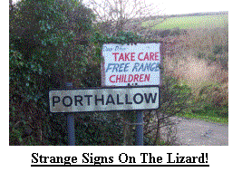 Day 81 (Wed 20th Nov) and the rain had now gone to be replaced by
bright skies with broken cloud. After
another 7am rise I arrived in Falmouth at 8:15am.
I was on the Lizard peninsular.
Now if you are paying attention you will realize I last finished at St
Anthony. If it had been the middle of
summer I would then have boarded a ferry to St Mawes, where I would have
disembarked and climbed onto another ferry to Falmouth.
We were not in the middle of Summer and the
ferries were at best unreliable, but normally non-existent so here I am in
Falmouth, I did a few extra yards to compensate.
I now had only 50 miles left, although I did not know it at the
time and so I set out. After more miles
of cliffs, views and roller coaster I arrived in Helford Passage and another
missing ferry. The Ľ mile hop to the
other side took 40 minutes in the car and about 20miles!
Shortly before Porthoustock I thought I was
seeing things, a field of Ostrich, this was close to a sign advertising ‘free
range children’, it did not indicate the price!
After walking through a working quarry with warning signs
everywhere I enjoyed the final stretch over Lowland Point before I arrived in
Coverack at 1:35pm. We returned for our
fix of tea and sticky buns.
Day 81 (Wed 20th Nov) and the rain had now gone to be replaced by
bright skies with broken cloud. After
another 7am rise I arrived in Falmouth at 8:15am.
I was on the Lizard peninsular.
Now if you are paying attention you will realize I last finished at St
Anthony. If it had been the middle of
summer I would then have boarded a ferry to St Mawes, where I would have
disembarked and climbed onto another ferry to Falmouth.
We were not in the middle of Summer and the
ferries were at best unreliable, but normally non-existent so here I am in
Falmouth, I did a few extra yards to compensate.
I now had only 50 miles left, although I did not know it at the
time and so I set out. After more miles
of cliffs, views and roller coaster I arrived in Helford Passage and another
missing ferry. The Ľ mile hop to the
other side took 40 minutes in the car and about 20miles!
Shortly before Porthoustock I thought I was
seeing things, a field of Ostrich, this was close to a sign advertising ‘free
range children’, it did not indicate the price!
After walking through a working quarry with warning signs
everywhere I enjoyed the final stretch over Lowland Point before I arrived in
Coverack at 1:35pm. We returned for our
fix of tea and sticky buns.
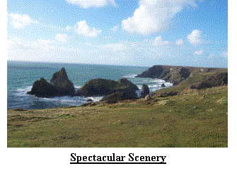 Day 82 (Thu 21st Nov) started bright and dry at 7am. I was on a high
for most of the day, despite
Day 82 (Thu 21st Nov) started bright and dry at 7am. I was on a high
for most of the day, despite
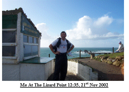 feeling the miles and at 8:40 I left Coverack.
I continued along the coastline, watching waves crashing against the
cliffs and trying to capture the distant Lizard Point Lighthouse with the
camera, I failed every time. It wasn’t
too long before I rounded a corner to find the twee fishing village of
Cadworth, like so many other National Trust places it captured an atmosphere of
years gone by, but as is usually the case at this time of year the café and all
other retail outlets were closed so I pressed on.
I stopped above the ‘Devils Frying Pan’ an impressive place as I
watched the sea crashing into the rocks way below an impressive natural
arch. I arrived at the Lizard Point at
12:35 in bright sun and strong winds.
After badgering a passer by to take a photo I moved away from the bustle
of all the tourists, I was surprised at how many were here, and took sanctuary
on the cliffs a little further round. I
was slightly disappointed not to find Nigel and Rite at the Lizard, but as I
found out later, they had been and as they could not contact me they assumed I
had already gone through. I had now
completed the North to South Trek, leaving only the most South Westerly point
to do and , for the first time since I set out I could see it, or at least see
where it is, but my route now took me North and West, as to go due West would
require me to sprout wings or swim over 20miles!
The rain of the past few days had turned the cliff tops into
shallow rivers so I paddled my way to Predannack Wollas (GR SW669161), getting
wet where the wind blew the water back up and over the cliff.
I also had to find a way of crossing swollen
streams, especially near soap rock.
Having admired such features as Asparagus Island, Pigeon Ogo, The Horse
and Gull Rock I landed at my finish point at 2:15pm.
We returned to Truro for refreshments.
feeling the miles and at 8:40 I left Coverack.
I continued along the coastline, watching waves crashing against the
cliffs and trying to capture the distant Lizard Point Lighthouse with the
camera, I failed every time. It wasn’t
too long before I rounded a corner to find the twee fishing village of
Cadworth, like so many other National Trust places it captured an atmosphere of
years gone by, but as is usually the case at this time of year the café and all
other retail outlets were closed so I pressed on.
I stopped above the ‘Devils Frying Pan’ an impressive place as I
watched the sea crashing into the rocks way below an impressive natural
arch. I arrived at the Lizard Point at
12:35 in bright sun and strong winds.
After badgering a passer by to take a photo I moved away from the bustle
of all the tourists, I was surprised at how many were here, and took sanctuary
on the cliffs a little further round. I
was slightly disappointed not to find Nigel and Rite at the Lizard, but as I
found out later, they had been and as they could not contact me they assumed I
had already gone through. I had now
completed the North to South Trek, leaving only the most South Westerly point
to do and , for the first time since I set out I could see it, or at least see
where it is, but my route now took me North and West, as to go due West would
require me to sprout wings or swim over 20miles!
The rain of the past few days had turned the cliff tops into
shallow rivers so I paddled my way to Predannack Wollas (GR SW669161), getting
wet where the wind blew the water back up and over the cliff.
I also had to find a way of crossing swollen
streams, especially near soap rock.
Having admired such features as Asparagus Island, Pigeon Ogo, The Horse
and Gull Rock I landed at my finish point at 2:15pm.
We returned to Truro for refreshments.
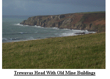 Day 83 (Fri 22nd Nov) welcomed us at 7am with more rain, and it was
still very dark. I got to the start
point at 8:40am and set out along some very wet roads and after a short while
entered the village of Mullion. I was
now well into my journey around Mounts Bay, but once
Day 83 (Fri 22nd Nov) welcomed us at 7am with more rain, and it was
still very dark. I got to the start
point at 8:40am and set out along some very wet roads and after a short while
entered the village of Mullion. I was
now well into my journey around Mounts Bay, but once
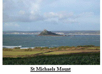 more the wind was my biggest enemy. Where I could I avoided the cliff path and headed instead for more sheltered paths and
lanes. Despite this the walking was very pleasant and before too long I was sitting in Porthleven eating breakfast,
with the wind full on my face. Every so often black clouds would race in from the sea and, on occasion, dump their
contents. It wasn’t until I reached my destination, Praa Sands, that one actually caught me, but by then it was too
late I was already in the car and it was only 12:20pm. I should also mention the derelict mine
workings on the cliff’s edge near Trewavas Head, they looked like they were defying gravity, as I passed I tried to imagine what it must have been like
working here in the middle of Winter during a storm. I left my thoughts behind and headed back to Truro for Tea and
another sticky bun. Tonight would be our last night in self catering, tomorrow we would be in a Hotel in Penzance,
we celebrated by going out for a meal.
more the wind was my biggest enemy. Where I could I avoided the cliff path and headed instead for more sheltered paths and
lanes. Despite this the walking was very pleasant and before too long I was sitting in Porthleven eating breakfast,
with the wind full on my face. Every so often black clouds would race in from the sea and, on occasion, dump their
contents. It wasn’t until I reached my destination, Praa Sands, that one actually caught me, but by then it was too
late I was already in the car and it was only 12:20pm. I should also mention the derelict mine
workings on the cliff’s edge near Trewavas Head, they looked like they were defying gravity, as I passed I tried to imagine what it must have been like
working here in the middle of Winter during a storm. I left my thoughts behind and headed back to Truro for Tea and
another sticky bun. Tonight would be our last night in self catering, tomorrow we would be in a Hotel in Penzance,
we celebrated by going out for a meal.
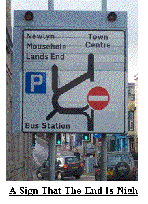 Day 84 (Sat 23rd Nov) started with more rain and a 6:55am alarm
call. We quickly packed and I left Praa
Sands at 8:35. Soon after setting out I
watched a heavy shower track across Mounts Bay from Lands End direction and
quickly donned waterproofs in anticipation of the dousing that was sure to
come. I couldn’t believe it missed
me! Despite the wind I opted to stay on
the coast path which, for much of the way, provided some shelter.
I was still on a roller coaster, but it was
obviously mid way as the climbs and descents were now much smaller.
I soon had my first view of St Michaels
Mount, a little Island that looks very like it’s cousin in France.
I spent a few minutes in Marazion looking
across the beach at the Mount whilst I ate breakfast.
The wind was now determined to blow me to the North Cornish
coast, but I resisted and progressed to the town of Penzanace, I soon recognised
the signs of civilisation, Tesco’s, Safeway, railway line, heliport…. I did consider jumping onboard a nearby helicopter and visiting the Isles
of Scilly, but this would be silly! I had an appointment to keep and needed to press on.
After meeting up with 2 suspicious characters in Penzance, one being my Wife, the other my Brother, I left Penzance behind and entered
Newlyn. Did you know Newlyn is the official point of Sea
Day 84 (Sat 23rd Nov) started with more rain and a 6:55am alarm
call. We quickly packed and I left Praa
Sands at 8:35. Soon after setting out I
watched a heavy shower track across Mounts Bay from Lands End direction and
quickly donned waterproofs in anticipation of the dousing that was sure to
come. I couldn’t believe it missed
me! Despite the wind I opted to stay on
the coast path which, for much of the way, provided some shelter.
I was still on a roller coaster, but it was
obviously mid way as the climbs and descents were now much smaller.
I soon had my first view of St Michaels
Mount, a little Island that looks very like it’s cousin in France.
I spent a few minutes in Marazion looking
across the beach at the Mount whilst I ate breakfast.
The wind was now determined to blow me to the North Cornish
coast, but I resisted and progressed to the town of Penzanace, I soon recognised
the signs of civilisation, Tesco’s, Safeway, railway line, heliport…. I did consider jumping onboard a nearby helicopter and visiting the Isles
of Scilly, but this would be silly! I had an appointment to keep and needed to press on.
After meeting up with 2 suspicious characters in Penzance, one being my Wife, the other my Brother, I left Penzance behind and entered
Newlyn. Did you know Newlyn is the official point of Sea
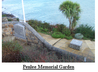 Level for all OS maps? Shortly before Mousehole, I found myself looking into a small garden.
The garden and memorial stone to the Penlee Lifeboat men who lost there lives more than 20 years ago on the 19th
December 1981. Soon I was climbing the steep road out of Mousehole and heading along the cliffs towards the
picturesque Lamorna Cove. I was now on the same side of Mounts Bay as Lands End, a mere 14 miles away.
It was now 1:15pm and I had finished for the day so we stepped into the café and sampled the tea and sticky buns, before
returning to Penzance and finding our hotel.
Level for all OS maps? Shortly before Mousehole, I found myself looking into a small garden.
The garden and memorial stone to the Penlee Lifeboat men who lost there lives more than 20 years ago on the 19th
December 1981. Soon I was climbing the steep road out of Mousehole and heading along the cliffs towards the
picturesque Lamorna Cove. I was now on the same side of Mounts Bay as Lands End, a mere 14 miles away.
It was now 1:15pm and I had finished for the day so we stepped into the café and sampled the tea and sticky buns, before
returning to Penzance and finding our hotel.
Day 85 (Sun 24th Nov), my final day. I was in no
rush to start but still rose at 7:15am before going down for breakfast – how
civilised! After a light breakfast we
set out to Lamorna Cove,
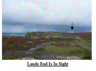 where I started from at 9:15am. I was soon back onto the cliff tops and heading for my destination.
Today took me through a collection of fishing cottages known as Penberth and on to Porthcurno, home of the famous
open air Minnack Theatre, often shown on the BBC advertisements. I wanted to tell the world I was nearly at
the end of an 85 day adventure, but no-one cared. I did meet one lady who blocked my path with her entourage of
dogs, I told her what I had done, she replied, “That’s nice”! The cliffs
where I started from at 9:15am. I was soon back onto the cliff tops and heading for my destination.
Today took me through a collection of fishing cottages known as Penberth and on to Porthcurno, home of the famous
open air Minnack Theatre, often shown on the BBC advertisements. I wanted to tell the world I was nearly at
the end of an 85 day adventure, but no-one cared. I did meet one lady who blocked my path with her entourage of
dogs, I told her what I had done, she replied, “That’s nice”! The cliffs
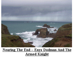 were becoming even more rugged, and beginning to increase in height, I found small
islands, Coves, Stacks and Arches, all battered by an unrelenting sea.
The sea was also showing off as it pounded
against the rocks and cliffs. I was
reluctant to complete my journey, for 85 days I had been heading in a generally
South Westerly direction and today that would cease.
A lifetime ambition was drawing to a close and the weather and
terrain appeared to have sensed it.
Soon after rounding Gwennap Head I got my first sighting of the complex
on mainland Britain’s most South Westerly tip.
I continued round to Pordenack Point where I sat and contemplated what
lay ahead, tomorrow I would be 40 and from midnight I would be without work for
the first time in my life. On the
bright side I would be drawing my military pension, I had a month to do as I
wished and I had my gratuity to spend!
I looked out across the sea to the Longships Lighthouse, silhouetted
against the backdrop of dark clouds, did this represent my future? I hoped not.
I decided it was time to finish and took the
long route up to the Lands End complex.
Over the past few days my suspicions had been aroused that something was
afoot, but I didn’t pry, well not too much!
I approached the Lands End signpost.
There with balloons and banners were Rite and Nigel, as I took in what I
had accomplished with their support I recognised another small group, it was my
Mum and Dad, backed up with my Sister and her husband, also my Uncle, all
sporting balloons and banners, they had travelled over 500 miles to be here. I
was speechless, an unusual occurrence for me!
I welcomed them all and now became aware of some activity behind me, and
there at the most South Westerly point on the British Mainland was a group of
our friends from Norfolk, Trish, Derek, Justy, Will, Jacquie and Philip.
I couldn’t believe they had also made the
400+ mile journey just to witness me complete an ambition I had spoken about
for many years. I think the next few
minutes were a mix of every possible emotion.
I was elated to have finished, overwhelmed by the support I had been
given, relieved it was over, disappointed that I had reached the end.
After several pose’s for photo’s I set out
along the last few hundred yards to the actual headland, I had started at the
extreme North Easterly point 85 days ago and now I wanted to reach the most
South Westerly point, I arrived at 1:19pm and 33seconds, that was it, it was
finished. Now was the time to
contemplate my achievement but not before some celebrations.
were becoming even more rugged, and beginning to increase in height, I found small
islands, Coves, Stacks and Arches, all battered by an unrelenting sea.
The sea was also showing off as it pounded
against the rocks and cliffs. I was
reluctant to complete my journey, for 85 days I had been heading in a generally
South Westerly direction and today that would cease.
A lifetime ambition was drawing to a close and the weather and
terrain appeared to have sensed it.
Soon after rounding Gwennap Head I got my first sighting of the complex
on mainland Britain’s most South Westerly tip.
I continued round to Pordenack Point where I sat and contemplated what
lay ahead, tomorrow I would be 40 and from midnight I would be without work for
the first time in my life. On the
bright side I would be drawing my military pension, I had a month to do as I
wished and I had my gratuity to spend!
I looked out across the sea to the Longships Lighthouse, silhouetted
against the backdrop of dark clouds, did this represent my future? I hoped not.
I decided it was time to finish and took the
long route up to the Lands End complex.
Over the past few days my suspicions had been aroused that something was
afoot, but I didn’t pry, well not too much!
I approached the Lands End signpost.
There with balloons and banners were Rite and Nigel, as I took in what I
had accomplished with their support I recognised another small group, it was my
Mum and Dad, backed up with my Sister and her husband, also my Uncle, all
sporting balloons and banners, they had travelled over 500 miles to be here. I
was speechless, an unusual occurrence for me!
I welcomed them all and now became aware of some activity behind me, and
there at the most South Westerly point on the British Mainland was a group of
our friends from Norfolk, Trish, Derek, Justy, Will, Jacquie and Philip.
I couldn’t believe they had also made the
400+ mile journey just to witness me complete an ambition I had spoken about
for many years. I think the next few
minutes were a mix of every possible emotion.
I was elated to have finished, overwhelmed by the support I had been
given, relieved it was over, disappointed that I had reached the end.
After several pose’s for photo’s I set out
along the last few hundred yards to the actual headland, I had started at the
extreme North Easterly point 85 days ago and now I wanted to reach the most
South Westerly point, I arrived at 1:19pm and 33seconds, that was it, it was
finished. Now was the time to
contemplate my achievement but not before some celebrations.
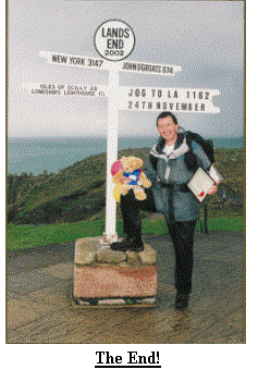
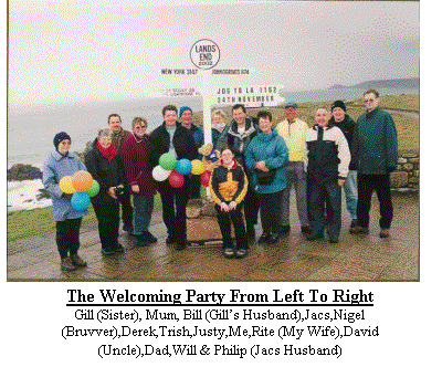 After finishing we returned to our friends cottage and sampled champagne and cake, I
was inundated with cards and messages of congratulations and surrounded by
family and friends, what more could one ask for?
In the evening our friends joined us at our hotel for a meal and
more celebrating. I awoke the next morning, being unemployed didn’t seem so
bad, I opened my presents. Yesterday I
had been employed and only 39, today I was 40.
It is often said that life starts at 40, is it true, mine would
certainly never be the same. At 9am
Trish, Derek, Will and Justy called by to wish me a happy birthday and say
farewell as they had to make the return journey to Norfolk.
Rite, Nigel and I spent the day with Jacquie
and Philip at the Eden Project, rather apt really as Eden represents the
beginning! The evening was spent with
Jacquie, Philip and my family again celebrating my birthday and
achievement. Tuesday saw us saying
goodbye to all as we set out for home, the first time in more than 5 weeks.
We arrived home to be greeted with banners
and more messages of support. Even now,
over a month after finishing I can feel many of the emotions I experienced when
I reached the end and realised I had achieved what I set out to do.
After finishing we returned to our friends cottage and sampled champagne and cake, I
was inundated with cards and messages of congratulations and surrounded by
family and friends, what more could one ask for?
In the evening our friends joined us at our hotel for a meal and
more celebrating. I awoke the next morning, being unemployed didn’t seem so
bad, I opened my presents. Yesterday I
had been employed and only 39, today I was 40.
It is often said that life starts at 40, is it true, mine would
certainly never be the same. At 9am
Trish, Derek, Will and Justy called by to wish me a happy birthday and say
farewell as they had to make the return journey to Norfolk.
Rite, Nigel and I spent the day with Jacquie
and Philip at the Eden Project, rather apt really as Eden represents the
beginning! The evening was spent with
Jacquie, Philip and my family again celebrating my birthday and
achievement. Tuesday saw us saying
goodbye to all as we set out for home, the first time in more than 5 weeks.
We arrived home to be greeted with banners
and more messages of support. Even now,
over a month after finishing I can feel many of the emotions I experienced when
I reached the end and realised I had achieved what I set out to do.
As is always the case I could not have done this on my own and I sincerely thank everyone who sponsored me,
before, during and after the event my total sum raised is Ł3718.68 and I know it will be put to good use by the charities.
I must thank personally my Mum and Dad for running all around the country after me (literally) and offering me support in
many forms. Trish, Derek, Justy, Jacquie, Philip and Eric for being great friends and providing support to Rite and I.
Kay & Peter, Eric, Gil & Anne, and my Mum & Dad for looking after our house, cat
and fish during our absence from home. To my Brother who gave up 2 months from work
to follow me around the country and offer moral support to Rite. And finally to Rite, my Wife, who gave up
work for 4 months to follow me around the country, suffered endless stress as she navigated to my pick up points and was there to listen to my pains, stories
and difficulties when I needed her.
So that is my story, I hope it inspired you, I’m now
planning my next expedition, a holiday to Canada – my wife is following the
plans closely! I have also suggested I
try round Britain, about 3000miles, Rite is not keen!!!!
The Finalised Route